File:CIA map Central America & Caribbean.png
Spring til navigation
Spring til søgning

Størrelse af denne forhåndsvisning: 798 × 599 pixels. Andre opløsninger: 320 × 240 pixels | 639 × 480 pixels | 1.023 × 768 pixels | 1.280 × 961 pixels | 1.390 × 1.044 pixels.
Oprindelig fil (1.390 × 1.044 billedpunkter, filstørrelse: 1,6 MB, MIME-type: image/png)
Captions
Captions
Tilføj en kort forklaring på en enkelt linje om hvad filen viser
Beskrivelse
[redigér]| Beskrivelse |
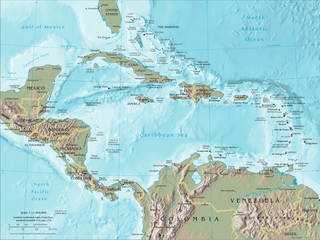
English: Map of Central America and the Caribbean by the CIA World Factbook Español: Mapa de Centroamérica y el Caribe en el CIA World Factbook |
| Kilde | Transferred from en.wikipedia to Commons. Original source is/was CIA The World Factbook |
| Forfatter | U.S. Central Intelligence Agency (CIA) |
| Andre versioner |


Licensering
[redigér]
This image is in the public domain because it contains materials that originally came from the United States Central Intelligence Agency's World Factbook.
|
 |
Oprindelig oplægningslog
[redigér]
The original description page was here. All following user names refer to en.wikipedia.
- 2007-09-20 19:45 Brianski 1392×1066×8 (1720810 bytes) == Summary == Map of [[Central America]], see https://www.cia.gov/library/publications/the-world-factbook/docs/refmaps.html. == License == {{PD-USGov-CIA-WF}}
Filhistorik
Klik på en dato/tid for at se filen som den så ud på det tidspunkt.
| Dato/tid | Miniaturebillede | Dimensioner | Bruger | Kommentar | |
|---|---|---|---|---|---|
| nuværende | 10. jun. 2010, 22:22 | | 1.390 × 1.044 (1,6 MB) | Jahoe (diskussion | bidrag) | better compression (no visible alterations) |
| 26. aug. 2008, 08:45 |  | 1.390 × 1.044 (2,3 MB) | Bowlhover (diskussion | bidrag) | Cropped title. | |
| 25. sep. 2007, 22:01 |  | 1.392 × 1.066 (1,64 MB) | Paintman (diskussion | bidrag) | {{Information |Description=Map of en:Central America, see https://www.cia.gov/library/publications/the-world-factbook/docs/refmaps.html. |Source=Originally from [http://en.wikipedia.org en.wikipedia]; description page is/was [http://en.wikipedia.org |
Du kan ikke overskrive denne fil.
Filanvendelse
De følgende 5 sider bruger denne fil:
.png&redirect=no)
Global filanvendelse
Følgende andre wikier anvender denne fil:
- Anvendelser på als.wikipedia.org
- Anvendelser på an.wikipedia.org
- Anvendelser på ar.wikipedia.org
- Anvendelser på ast.wikipedia.org
- Anvendelser på bat-smg.wikipedia.org
- Anvendelser på ba.wikipedia.org
- Anvendelser på bm.wikipedia.org
- Anvendelser på bn.wikipedia.org
- Anvendelser på bo.wikipedia.org
- Anvendelser på br.wikipedia.org
- Anvendelser på bs.wikipedia.org
- Anvendelser på co.wikipedia.org
- Anvendelser på cs.wikipedia.org
- Anvendelser på da.wikipedia.org
- Anvendelser på de.wikipedia.org
- Anvendelser på de.wiktionary.org
- Anvendelser på el.wikipedia.org
- Anvendelser på en.wikipedia.org
- Piracy in the Caribbean
- Portal:Latin America/Portals
- Wikipedia:WikiProject Caribbean
- Portal:Piracy/Selected article
- User:Saaristo
- Portal:Piracy/Selected article/10
- User:Zero Gravity/Proposal
- Ocean fisheries
- Wikipedia:Graphics Lab/Image workshop/Archive/Sep 2008
- File talk:Central america (cia).png
- Portal:Bolivia
- Portal:Bolivia/Related portals
- User:StAnMc18/sandbox
- User:Benjamin Trovato/sandbox
- File talk:CIA map Central America & Caribbean.png
- Anvendelser på en.wikibooks.org
- Anvendelser på eo.wikipedia.org
- Anvendelser på es.wikipedia.org
- Anvendelser på eu.wikipedia.org
- Anvendelser på ext.wikipedia.org
.png)
Vis flere globale anvendelser af denne fil.
Kategorier:
- Maps of the Caribbean
- Maps of Central America
- Topographic maps of Nicaragua
- Topographic maps of Venezuela
- Topographic maps of Colombia
- Topographic maps of Panama
- Topographic maps of Costa Rica
- Topographic maps of El Salvador
- Topographic maps of Honduras
- Topographic maps of Guatemala
- Topographic maps of Belize
- Topographic maps of Mexico
- Topographic maps of Cuba
- Topographic maps of Jamaica
- Topographic maps of Haiti
- Topographic maps of the Dominican Republic
- Topographic maps of Puerto Rico