File:Caldey Island Map.png
Zur Navigation springen
Zur Suche springen

Größe dieser Vorschau: 800 × 462 Pixel. Weitere Auflösungen: 320 × 185 Pixel | 640 × 370 Pixel | 862 × 498 Pixel.
Originaldatei (862 × 498 Pixel, Dateigröße: 105 KB, MIME-Typ: image/png)
Bildtexte
Kurzbeschreibungen
Ergänze eine einzeilige Erklärung, was diese Datei darstellt.
Beschreibung[Bearbeiten]
| Beschreibung |
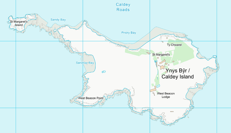
English: Map of the Caldey Island in Wales produced by Ordnance Survey. Scale indicated by 1km grid lines. |
| Datum | Uploaded 2017 |
| Quelle | https://www.ordnancesurvey.co.uk/opendata/viewer/index.html |
| Urheber | UK Ordnance Survey |
| Genehmigung (Weiternutzung dieser Datei) |
Open Government Licence (OGL) version 3.0 |
| Kameraposition | | Dieses und weitere Bilder auf OpenStreetMap |
|---|
Lizenz[Bearbeiten]
.svg)
|
This file is licensed under the United Kingdom Open Government Licence v3.0. |
See also: Meta for information on usage on Wikimedia wikis.
|
Dateiversionen
Klicke auf einen Zeitpunkt, um diese Version zu laden.
| Version vom | Vorschaubild | Maße | Benutzer | Kommentar | |
|---|---|---|---|---|---|
| aktuell | 18:55, 26. Mai 2017 | | 862 × 498 (105 KB) | Verbcatcher (Diskussion | Beiträge) | User created page with UploadWizard |
Du kannst diese Datei nicht überschreiben.
Dateiverwendung
Keine Seiten verwenden diese Datei.
Globale Dateiverwendung
Die nachfolgenden anderen Wikis verwenden diese Datei:
- Verwendung auf de.wikipedia.org
- Verwendung auf en.wikipedia.org