File:California 78.svg
Zur Navigation springen
Zur Suche springen

Größe der PNG-Vorschau dieser SVG-Datei: 385 × 401 Pixel. Weitere Auflösungen: 230 × 240 Pixel | 461 × 480 Pixel | 737 × 768 Pixel | 983 × 1.024 Pixel | 1.966 × 2.048 Pixel.
Originaldatei (SVG-Datei, Basisgröße: 385 × 401 Pixel, Dateigröße: 13 KB)
Bildtexte
Kurzbeschreibungen
Ergänze eine einzeilige Erklärung, was diese Datei darstellt.
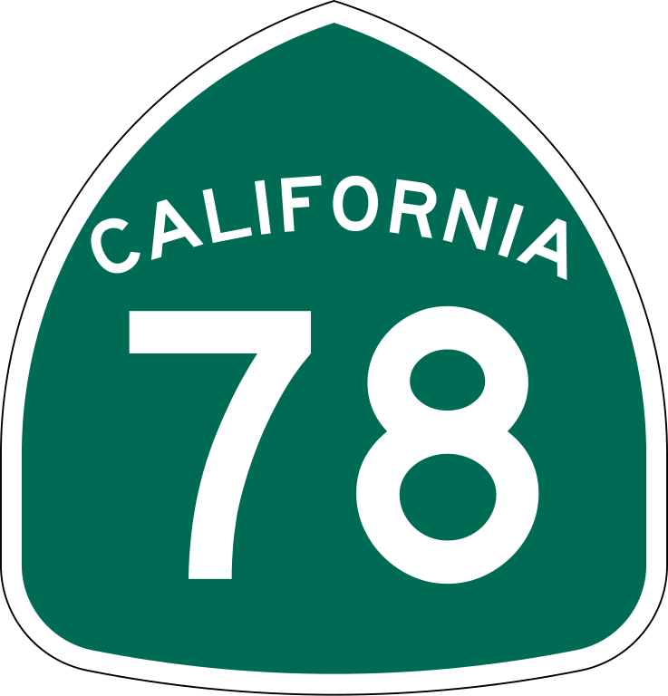
| Beschreibung | Vector image of a 24 in by 25 in (600 mm by 635 mm) California State Route shield. Colors are from [1] (Pantone Green 342), converted to RGB by [2]. The outside border has a width of 1 (1/16 in) and a color of black so it shows up; in reality, signs have no outside border. |
| Datum | |
| Quelle | Made to the specifications of the 1971 Caltrans sign drawing (still in use). Uses the Roadgeek 2005 fonts. (United States law does not permit the copyrighting of typeface designs, and the fonts are meant to be copies of a U.S. Government-produced work anyway.) |
| Urheber | SPUI |
| Andere Versionen |
Diese Datei enthält Elemente, die von folgender Datei entnommen oder adaptiert wurden: |
| SVG‑Erstellung | Dieses Logo wurde mit Adobe Illustrator erstellt. |
This file is in the public domain because it comes from the California Manual on Uniform Traffic Control Devices, sign number G28-2 (CA), which states specifically in its introduction, on page 44 that:
|
Dateiversionen
Klicke auf einen Zeitpunkt, um diese Version zu laden.
| Version vom | Vorschaubild | Maße | Benutzer | Kommentar | |
|---|---|---|---|---|---|
| aktuell | 16:33, 20. Mär. 2006 | | 385 × 401 (13 KB) | SPUI~commonswiki (Diskussion | Beiträge) | |
| 13:57, 20. Mär. 2006 |  | 385 × 401 (13 KB) | SPUI~commonswiki (Diskussion | Beiträge) | ||
| 13:32, 20. Mär. 2006 | 570 × 2.910 (24 KB) | SPUI~commonswiki (Diskussion | Beiträge) | {{spuiother}} 24 in by 25 in (600 mm by 635 mm) California State Route shield, made to the specifications of the [http://www.dot.ca.gov/hq/traffops/signtech/signdel/specs/G28-2.pdf 1971 Caltrans sign drawing] (still in use). Uses the [http://www.triskele. |
Du kannst diese Datei nicht überschreiben.
Dateiverwendung
Die folgenden 4 Seiten verwenden diese Datei:
Globale Dateiverwendung
Die nachfolgenden anderen Wikis verwenden diese Datei:
- Verwendung auf ast.wikipedia.org
- Verwendung auf ca.wikipedia.org
- Verwendung auf de.wikipedia.org
- Verwendung auf en.wikipedia.org
- Imperial County, California
- Vista, California
- User:Branddobbe
- User:Branddobbe/Temporary
- Imperial Valley
- California State Route 86
- California State Route 111
- California State Route 67
- Southern California freeways
- California State Route 78
- Eastern California
- California State Route 79
- Wikipedia:WikiProject U.S. Roads/Redirects/California
- San Diego River
- California State Route 185
- California State Route 115
- Imperial Highway
- Sprinter (rail service)
- Portal:U.S. roads/Selected article
- Interstate 10 in California
- List of highways numbered 78
- Interstate 15 in California
- Wikipedia talk:WikiProject U.S. Roads/California/Archive 4
- Interstate 5 in California
- List of state highways in California
- Template:Sprinter (rail service)
- Business routes of Interstate 10
- Portal:U.S. roads/Selected article/February 2009
- United States Border Patrol interior checkpoints
- User:DeFaultRyan/Travels
- Transportation in San Diego
- Transportation in the Inland Empire
- User:House1090/Sandbox/San Diego Metropolitan Area
- California county routes in zone S
- Escondido Subdivision
- Riverside County, California
- San Diego County, California
- User:08OceanBeach SD/Sandbox 3
- Transportation in San Diego–Tijuana
- User talk:MatthewAnderson707/sandbox
- User:Ejells2/sandbox
- User:Tv's emory/Sandbox/List of state highways in California
Weitere globale Verwendungen dieser Datei anschauen.