File:Canada.A2002160.1920.721.250m.jpg
Pāriet uz navigāciju
Pāriet uz meklēšanu
Šī priekšskata izmērs: 712 × 600 pikseļi. Citi izmēri: 285 × 240 pikseļi | 570 × 480 pikseļi | 912 × 768 pikseļi | 1 216 × 1 024 pikseļi | 2 432 × 2 048 pikseļi | 2 914 × 2 454 pikseļi.
Sākotnējais fails (2 914 × 2 454 pikseļi, faila izmērs: 1,82 MB, MIME tips: image/jpeg)
Captions
Captions
Pievieno vienas rindiņas aprakstu, ko šis fails attēlo
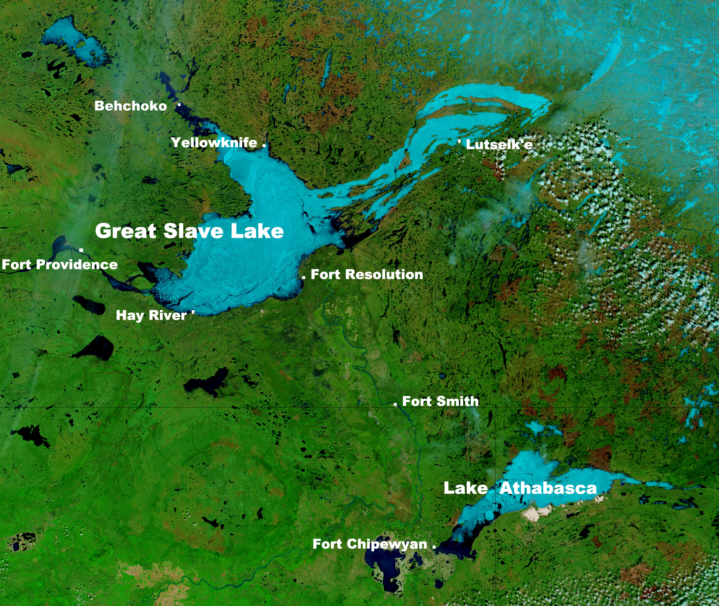
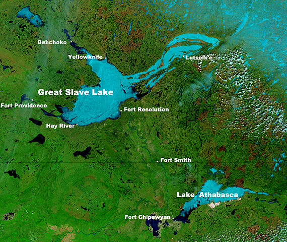
Great Slave Lake in Canada's Northwest Territories
Kopsavilkums[labot šo sadaļu]
| Apraksts |
English: These true- and false-color images of central Canada show the Great Slave Lake in the Northwest Territories (top) and Lake Athabasca to the southeast. Lake Athabasca straddles the border between Alberta (west) and Saskatchewan (east). A fire (red dot) is burning in Alberta, and the snow capped Rocky Mountains cut through southwest Alberta at bottom left. In the false-color image, vegetation is green, water is dark blue, and ice (or snow) is light blue.
(Captions added by Kayoty) |
| Datums | |
| Avots | Nasa (Visible Earth) |
| Autors | Jacques Descloitres, MODIS Land Rapid Response Team, NASA/GSFC |
Licence[labot šo sadaļu]
| This file is in the public domain in the United States because it was solely created by NASA. NASA copyright policy states that "NASA material is not protected by copyright unless noted". (See Template:PD-USGov, NASA copyright policy page or JPL Image Use Policy.) | ||
 |
Warnings:
|
Faila hronoloģija
Uzklikšķini uz datums/laiks kolonnā esošās saites, lai apskatītos, kā šis fails izskatījās tad.
| Datums/Laiks | Attēls | Izmēri | Dalībnieks | Komentārs | |
|---|---|---|---|---|---|
| tagadējais | 2014. gada 16. septembris, plkst. 10.17 | | 2 914 × 2 454 (1,82 MB) | Kayoty (diskusija | devums) | added Behchoko to map |
| 2014. gada 16. septembris, plkst. 09.33 |  | 2 914 × 2 454 (1,82 MB) | Kayoty (diskusija | devums) | User created page with UploadWizard |
Šo failu nevar pārrakstīt.
Faila lietojums
Šo failu izmanto šajā 1 lapā:
Globālais faila lietojums
Šīs Vikipēdijas izmanto šo failu:
- Izmantojums af.wikipedia.org
- Izmantojums bs.wikipedia.org
- Izmantojums en.wikipedia.org
- Izmantojums fa.wikipedia.org
- Izmantojums fr.wikipedia.org
- Izmantojums he.wikipedia.org
- Izmantojums id.wikipedia.org
- Izmantojums is.wikipedia.org
- Izmantojums kn.wikipedia.org
- Izmantojums la.wikipedia.org
- Izmantojums lv.wikipedia.org
- Izmantojums ml.wikipedia.org
- Izmantojums sl.wikipedia.org
- Izmantojums th.wikipedia.org
- Izmantojums vi.wikipedia.org
- Izmantojums vls.wikipedia.org
- Izmantojums xmf.wikipedia.org
- Izmantojums zh.wikipedia.org