File:Canada.A2002160.1920.721.250m.jpg
跳转到导航
跳转到搜索
本预览的尺寸:712 × 600像素。 其他分辨率:285 × 240像素 | 570 × 480像素 | 912 × 768像素 | 1,216 × 1,024像素 | 2,432 × 2,048像素 | 2,914 × 2,454像素。
原始文件 (2,914 × 2,454像素,文件大小:1.82 MB,MIME类型:image/jpeg)
说明
说明
添加一行文字以描述该文件所表现的内容
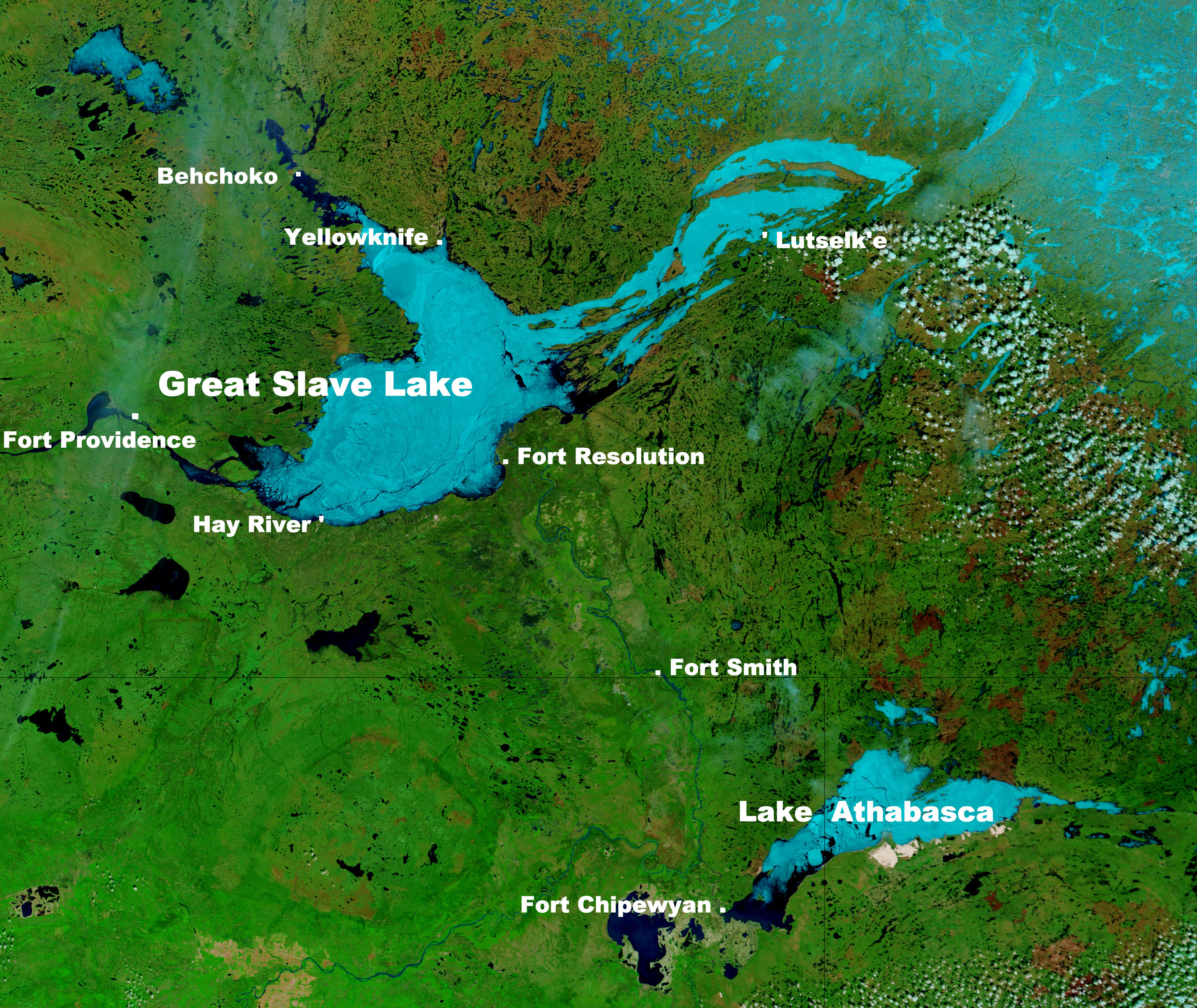
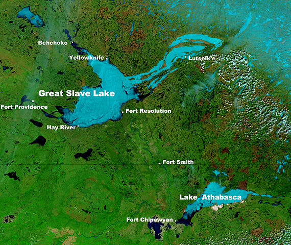
Great Slave Lake in Canada's Northwest Territories
摘要[编辑]
| 描述 |
English: These true- and false-color images of central Canada show the Great Slave Lake in the Northwest Territories (top) and Lake Athabasca to the southeast. Lake Athabasca straddles the border between Alberta (west) and Saskatchewan (east). A fire (red dot) is burning in Alberta, and the snow capped Rocky Mountains cut through southwest Alberta at bottom left. In the false-color image, vegetation is green, water is dark blue, and ice (or snow) is light blue.
(Captions added by Kayoty) |
| 日期 | |
| 来源 | Nasa (Visible Earth) |
| 作者 | Jacques Descloitres, MODIS Land Rapid Response Team, NASA/GSFC |
许可协议[编辑]
| 本文件完全由NASA创作,在美国属于公有领域。根据NASA的版权方针,NASA的材料除非另有声明否则不受版权保护。(参见Template:PD-USGov/zh、NASA版权方针页面或JPL图片使用方针。) | ||
 |
警告:
|
文件历史
点击某个日期/时间查看对应时刻的文件。
| 日期/时间 | 缩略图 | 大小 | 用户 | 备注 | |
|---|---|---|---|---|---|
| 当前 | 2014年9月16日 (二) 10:17 | | 2,914 × 2,454(1.82 MB) | Kayoty(留言 | 贡献) | added Behchoko to map |
| 2014年9月16日 (二) 09:33 |  | 2,914 × 2,454(1.82 MB) | Kayoty(留言 | 贡献) | User created page with UploadWizard |
您不可以覆盖此文件。
文件用途
以下页面使用本文件:
全域文件用途
以下其他wiki使用此文件:
- af.wikipedia.org上的用途
- bs.wikipedia.org上的用途
- en.wikipedia.org上的用途
- fa.wikipedia.org上的用途
- fr.wikipedia.org上的用途
- he.wikipedia.org上的用途
- id.wikipedia.org上的用途
- is.wikipedia.org上的用途
- kn.wikipedia.org上的用途
- la.wikipedia.org上的用途
- lv.wikipedia.org上的用途
- ml.wikipedia.org上的用途
- sl.wikipedia.org上的用途
- th.wikipedia.org上的用途
- vi.wikipedia.org上的用途
- vls.wikipedia.org上的用途
- xmf.wikipedia.org上的用途
- zh.wikipedia.org上的用途