File:Canada.A2002160.1920.721.250m.jpg
跳至導覽
跳至搜尋
預覽大小:712 × 600 像素。 其他解析度:285 × 240 像素 | 570 × 480 像素 | 912 × 768 像素 | 1,216 × 1,024 像素 | 2,432 × 2,048 像素 | 2,914 × 2,454 像素。
原始檔案 (2,914 × 2,454 像素,檔案大小:1.82 MB,MIME 類型:image/jpeg)
說明
說明
添加單行說明來描述出檔案所代表的內容
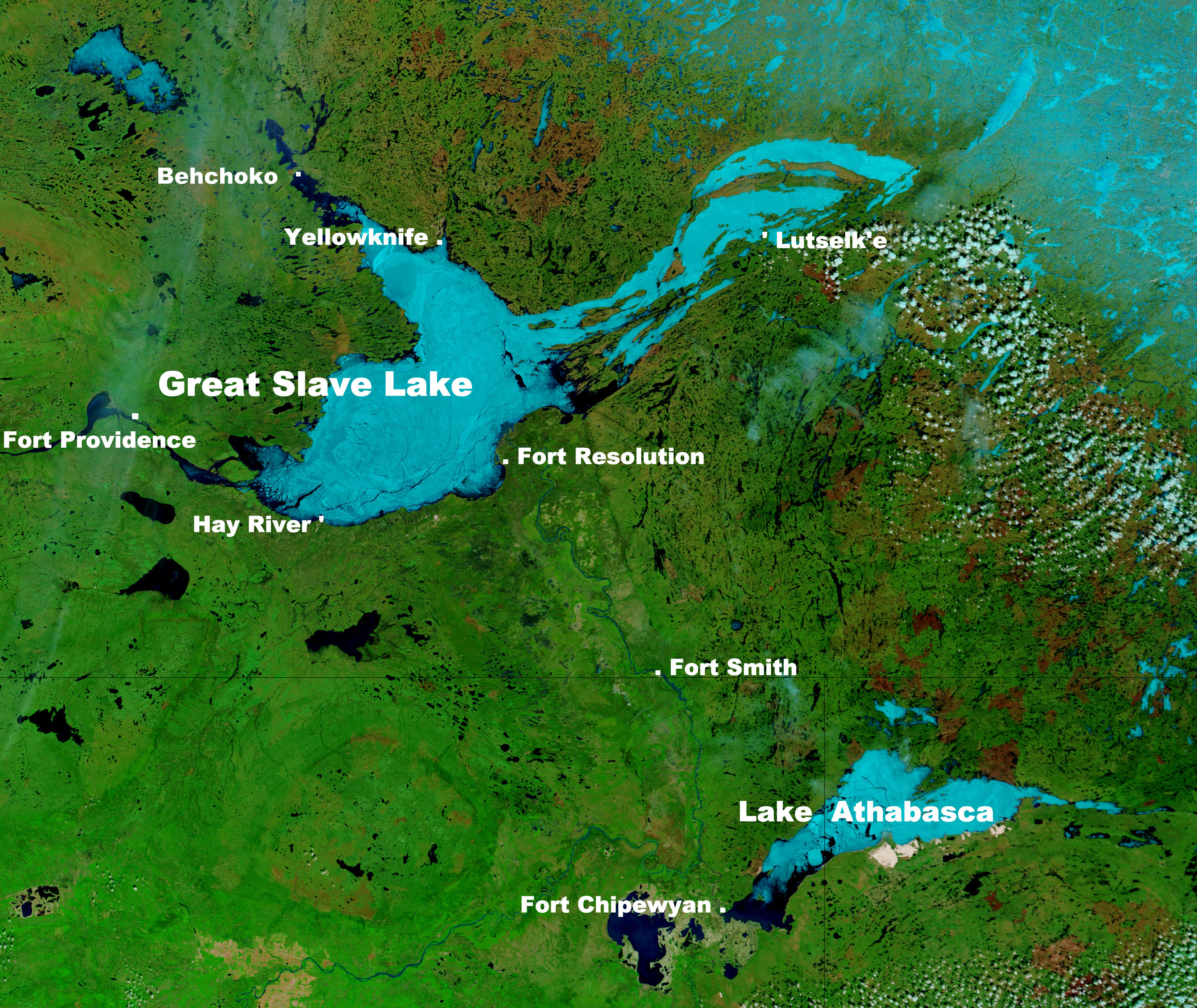
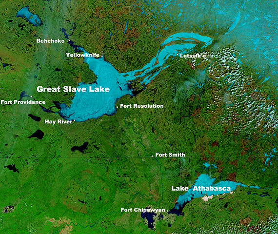
Great Slave Lake in Canada's Northwest Territories
摘要
[編輯]
| 描述 |
English: These true- and false-color images of central Canada show the Great Slave Lake in the Northwest Territories (top) and Lake Athabasca to the southeast. Lake Athabasca straddles the border between Alberta (west) and Saskatchewan (east). A fire (red dot) is burning in Alberta, and the snow capped Rocky Mountains cut through southwest Alberta at bottom left. In the false-color image, vegetation is green, water is dark blue, and ice (or snow) is light blue.
(Captions added by Kayoty) |
| 日期 | |
| 來源 | Nasa (Visible Earth) |
| 作者 | Jacques Descloitres, MODIS Land Rapid Response Team, NASA/GSFC |
授權條款
[編輯]
| 本作品由NASA創作,屬於公有領域。根據NASA的版權政策:“NASA的創作除非另有聲明否則不受版權保護。”(參見:Template:PD-USGov/zh,NASA版權政策或JPL圖像使用政策) | ||
 |
警告:
|
檔案歷史
點選日期/時間以檢視該時間的檔案版本。
| 日期/時間 | 縮圖 | 尺寸 | 用戶 | 備註 | |
|---|---|---|---|---|---|
| 目前 | 2014年9月16日 (二) 10:17 | | 2,914 × 2,454(1.82 MB) | Kayoty(對話 | 貢獻) | added Behchoko to map |
| 2014年9月16日 (二) 09:33 |  | 2,914 × 2,454(1.82 MB) | Kayoty(對話 | 貢獻) | User created page with UploadWizard |
無法覆蓋此檔案。
檔案用途
下列頁面有用到此檔案:
全域檔案使用狀況
以下其他 wiki 使用了這個檔案:
- af.wikipedia.org 的使用狀況
- bs.wikipedia.org 的使用狀況
- en.wikipedia.org 的使用狀況
- fa.wikipedia.org 的使用狀況
- fr.wikipedia.org 的使用狀況
- he.wikipedia.org 的使用狀況
- id.wikipedia.org 的使用狀況
- is.wikipedia.org 的使用狀況
- kn.wikipedia.org 的使用狀況
- la.wikipedia.org 的使用狀況
- lv.wikipedia.org 的使用狀況
- ml.wikipedia.org 的使用狀況
- sl.wikipedia.org 的使用狀況
- th.wikipedia.org 的使用狀況
- vi.wikipedia.org 的使用狀況
- vls.wikipedia.org 的使用狀況
- xmf.wikipedia.org 的使用狀況
- zh.wikipedia.org 的使用狀況