File:Canada provinces 1949-1999.png
跳转到导航
跳转到搜索
本预览的尺寸:694 × 600像素。 其他分辨率:278 × 240像素 | 556 × 480像素 | 1,000 × 864像素。
原始文件 (1,000 × 864像素,文件大小:59 KB,MIME类型:image/png)
说明
说明
添加一行文字以描述该文件所表现的内容
摘要
[编辑]
| 描述 |
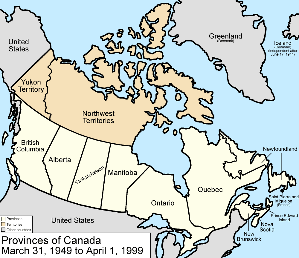
Map of the provinces and territories of Canada as they were between 1949 and 1999. On March 31 1949, Newfoundland joined Canada. On April 1 1999, Nunavut was split from Northwest Territories, giving us the map we have today. Made by User:Golbez. |
| 日期 | 2006年2月13日 (原始上传日期) |
| 来源 | No machine-readable source provided. Own work assumed (based on copyright claims). |
| 作者 | No machine-readable author provided. Golbez assumed (based on copyright claims). |
许可协议
[编辑]
我,本作品著作权人,特此采用以下许可协议发表本作品:

|
已授权您依据自由软件基金会发行的无固定段落及封面封底文字(Invariant Sections, Front-Cover Texts, and Back-Cover Texts)的GNU自由文件许可协议1.2版或任意后续版本的条款,复制、传播和/或修改本文件。该协议的副本请见“GNU Free Documentation License”。 |
| 本文件采用知识共享署名-相同方式共享 3.0 未本地化版本许可协议授权。 | ||
| ||
| 本许可协议标签作为GFDL许可协议更新的组成部分被添加至本文件。 |
您可以选择您需要的许可协议。
文件历史
点击某个日期/时间查看对应时刻的文件。
| 日期/时间 | 缩略图 | 大小 | 用户 | 备注 | |
|---|---|---|---|---|---|
| 当前 | 2009年7月14日 (二) 17:36 | | 1,000 × 864(59 KB) | Golbez(留言 | 贡献) | minor fix |
| 2009年7月14日 (二) 17:22 |  | 1,000 × 864(59 KB) | Golbez(留言 | 贡献) | New color scheme, other borders | |
| 2006年8月7日 (一) 09:59 |  | 1,000 × 864(45 KB) | Golbez(留言 | 贡献) | with legend | |
| 2006年2月18日 (六) 02:24 |  | 1,000 × 864(44 KB) | Golbez(留言 | 贡献) | Better version | |
| 2006年2月13日 (一) 23:49 |  | 1,000 × 864(44 KB) | Golbez(留言 | 贡献) | better colors | |
| 2006年2月13日 (一) 06:14 |  | 1,000 × 864(44 KB) | Golbez(留言 | 贡献) | Map of the provinces and territories of Canada as they were between 1949 and 1999. On March 31 1949, Newfoundland joined Canada. On April 1 1999, Nunavut was split from Northwest Territories, giving us the map we have today. Made by User:Golbez. [[C |
您不可以覆盖此文件。
文件用途
全域文件用途
以下其他wiki使用此文件:
- de.wikipedia.org上的用途
- en.wikipedia.org上的用途
- User:Tompw/sandbox3
- Electoral history of Louis St. Laurent
- Electoral history of John Diefenbaker
- Electoral history of Lester B. Pearson
- Electoral history of Pierre Trudeau
- Electoral history of Joe Clark
- Electoral history of John Turner
- Electoral history of Brian Mulroney
- Electoral history of Kim Campbell
- Electoral history of Jean Chrétien
- User:Falcaorib/Canada, United States and Mexico
- es.wikipedia.org上的用途
- fr.wikipedia.org上的用途
- fy.wikipedia.org上的用途
- it.wikipedia.org上的用途
- no.wikipedia.org上的用途
- pt.wikipedia.org上的用途
- ru.wikipedia.org上的用途
- sv.wikipedia.org上的用途
- uk.wikipedia.org上的用途
- vi.wikipedia.org上的用途
- zh.wikipedia.org上的用途