File:Cape breton island.png
跳转到导航
跳转到搜索
没有更高的分辨率。
Cape_breton_island.png (514 × 562像素,文件大小:16 KB,MIME类型:image/png)
说明
说明
添加一行文字以描述该文件所表现的内容
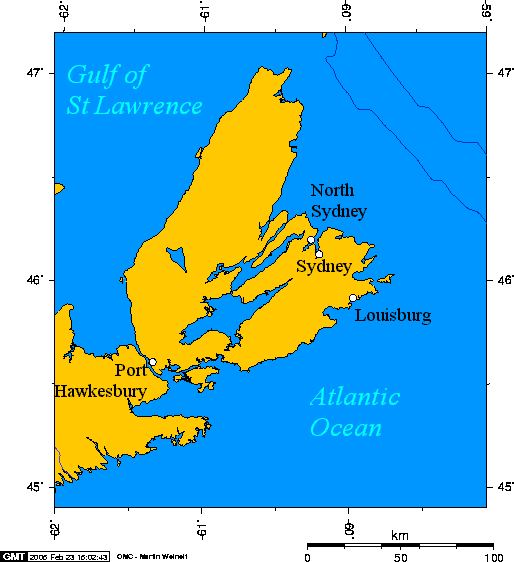
Cape Breton Island, Nova Scotia, Canada

|
已授权您依据自由软件基金会发行的无固定段落及封面封底文字(Invariant Sections, Front-Cover Texts, and Back-Cover Texts)的GNU自由文件许可协议1.2版或任意后续版本的条款,复制、传播和/或修改本文件。该协议的副本请见“GNU Free Documentation License”。 |
| 本文件采用知识共享署名-相同方式共享 3.0 未本地化版本许可协议授权。 | ||
| ||
| 本许可协议标签作为GFDL许可协议更新的组成部分被添加至本文件。 |
en:User:Geo Swan used this online map creation tool archive copy at the Wayback Machine to generate this map. en:User:Geo Swan used the following longitude and latitude to the tool to specify the locations of the cities:
- -60.2524,46.2065,North Sydney
- -60.1955,46.1365,Sydney
- -59.9643,45.9235,Louisburg
- -61.3452,45.6119,Port Hawkesbury
Originally uploaded on 23 February 2005.
文件历史
点击某个日期/时间查看对应时刻的文件。
| 日期/时间 | 缩略图 | 大小 | 用户 | 备注 | |
|---|---|---|---|---|---|
| 当前 | 2005年6月16日 (四) 14:00 | | 514 × 562(16 KB) | Peregrine981(留言 | 贡献) | Cape Breton Island, Nova Scotia, Canada {{GFDL}} en:User:Geo Swan used this [http://www.aquarius.geomar.de/omc/ online map creation tool] to generate this map. en:User:Geo Swan used the following longitude and latitude to the tool to specify t |
您不可以覆盖此文件。
文件用途
没有页面使用本文件。
全域文件用途
以下其他wiki使用此文件:
- af.wikipedia.org上的用途
- da.wikipedia.org上的用途
- de.wikipedia.org上的用途
- en.wikipedia.org上的用途
- eo.wikipedia.org上的用途
- es.wikipedia.org上的用途
- fa.wikipedia.org上的用途
- fr.wikipedia.org上的用途
- he.wikipedia.org上的用途
- it.wikipedia.org上的用途
- ja.wikipedia.org上的用途
- nl.wikipedia.org上的用途
- no.wikipedia.org上的用途
- pl.wikipedia.org上的用途
- pt.wikipedia.org上的用途
- sr.wikipedia.org上的用途
- uk.wikipedia.org上的用途
- zh-min-nan.wikipedia.org上的用途
- zh.wikipedia.org上的用途