File:Capital Beltway Map Color.svg
跳转到导航
跳转到搜索

此SVG文件的PNG预览的大小:564 × 489像素。 其他分辨率:277 × 240像素 | 554 × 480像素 | 886 × 768像素 | 1,181 × 1,024像素 | 2,362 × 2,048像素。
原始文件 (SVG文件,尺寸为564 × 489像素,文件大小:279 KB)
说明
说明
添加一行文字以描述该文件所表现的内容
摘要
[编辑]
| 描述 |
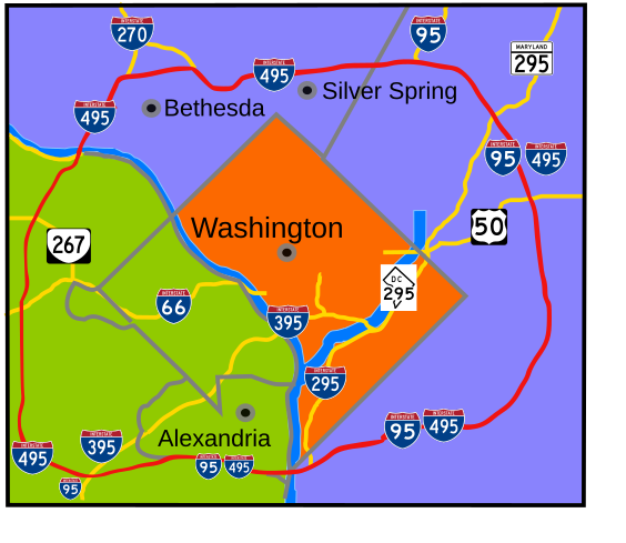
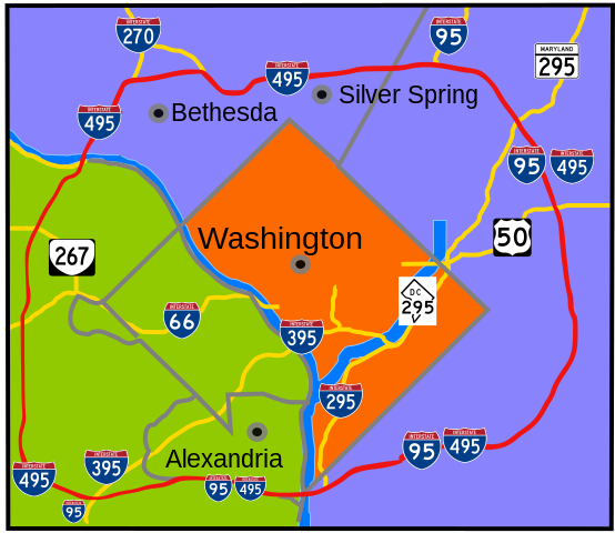
English: Interstate 495 in the state of Maryland and Commonwealth of Virginia in red surrounds the District of Columbia like a "belt", hence the name. |
| 日期 | |
| 来源 | 自己的作品 |
| 作者 | based on Image:Capital Beltway Map Color.png by Squiggygfm |
许可协议
[编辑]
| 我,本作品著作权人,释出本作品至公有领域。这适用于全世界。 在一些国家这可能不合法;如果是这样的话,那么: 我无条件地授予任何人以任何目的使用本作品的权利,除非这些条件是法律规定所必需的。 |
文件历史
点击某个日期/时间查看对应时刻的文件。
| 日期/时间 | 缩略图 | 大小 | 用户 | 备注 | |
|---|---|---|---|---|---|
| 当前 | 2008年3月23日 (日) 20:49 | | 564 × 489(279 KB) | RTCNCA(留言 | 贡献) | Adjust interstate shields to mark I-95 south of beltway, portion of beltway between 95 and Woodrow Wilson bridge, mark 395 more clearly |
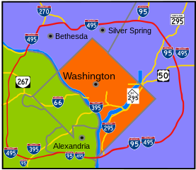
| 2007年11月30日 (五) 21:44 |  | 564 × 489(241 KB) | Rfc1394(留言 | 贡献) | Fix more minor format and placement errors either I should have seen before or didn't notice until after uploaded | |
| 2007年11月30日 (五) 21:35 |  | 564 × 489(243 KB) | Rfc1394(留言 | 贡献) | Slight adjustment to move label "Silver Spring" above the dividing line | |
| 2007年11月30日 (五) 21:33 |  | 564 × 489(241 KB) | Rfc1394(留言 | 贡献) | == Summary == {{Information |Description= Interstate 495 in the state of Maryland and Commonwealth of Virgina in red surrounds the District of Columbia like a "belt", hence the name. |Source=own work |Date= April 26, 2007 |Author= based on [[:Image:Capi |
您不可以覆盖此文件。
文件用途
全域文件用途
以下其他wiki使用此文件:
- da.wikipedia.org上的用途
- de.wikipedia.org上的用途
- en.wikipedia.org上的用途
- en.wikibooks.org上的用途
- es.wikipedia.org上的用途
- fr.wikipedia.org上的用途
- ja.wikipedia.org上的用途
- sv.wikipedia.org上的用途
- www.wikidata.org上的用途
- zh.wikipedia.org上的用途