File:Carlos 2003 rainfall.png
跳至導覽
跳至搜尋

預覽大小:800 × 559 像素。 其他解析度:320 × 224 像素 | 640 × 447 像素 | 1,024 × 715 像素 | 1,174 × 820 像素。
原始檔案 (1,174 × 820 像素,檔案大小:21 KB,MIME 類型:image/png)
說明
說明
添加單行說明來描述出檔案所代表的內容
摘要
| 描述 |
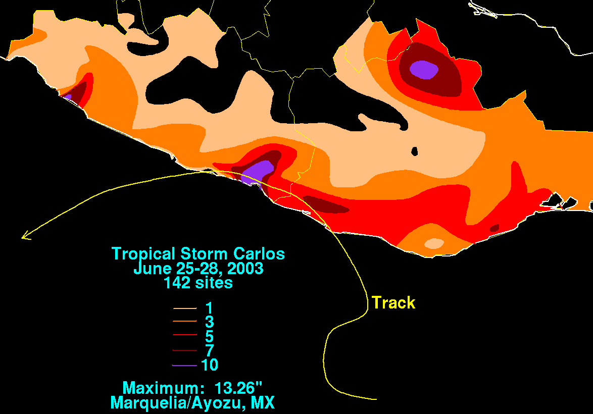
English: Storm total rainfall map of Tropical Storm Carlos during June 2003. |
|||
| 日期 | ||||
| 來源 | WPC tropical cyclone rainfall data | |||
| 作者 | David Roth, Weather Prediction Center, Camp Springs, Maryland | |||
| 授權許可 (重用此檔案) |
|
原始上傳日誌[編輯]
| 日期/時間 | 尺寸 | 使用者 | 備註 |
|---|---|---|---|
| 2008年11月30日, 19:14:31 | 1174 × 820 (21687 bytes) | Miss Madeline (留言 · 貢獻) | {{Information |Description=Rainfall map of [[W:Tropical Storm Carlos (2003)|2003's Tropical Storm Carlos]] |Source=[http://www.hpc.ncep.noaa.gov/tropical/rain/carlos2003filledrainblk.gif Hydrometeorological Prediction Center] |Date=unknown |Author=[[W:Dav |
檔案歷史
點選日期/時間以檢視該時間的檔案版本。
| 日期/時間 | 縮圖 | 尺寸 | 使用者 | 備註 | |
|---|---|---|---|---|---|
| 目前 | 2014年8月29日 (五) 22:41 | | 1,174 × 820(21 KB) | GifTagger(留言 | 貢獻) | Bot: Converting file to superior PNG file. (Source: Carlos_2003_rainfall.gif). This GIF was problematic due to non-greyscale color table. |
無法覆蓋此檔案。
檔案用途
下列2個頁面有用到此檔案:
- File:Carlos2003filledrainblk.gif (檔案重新導向)
- File:Carlos 2003 rainfall.gif (檔案重新導向)
全域檔案使用狀況
以下其他 wiki 使用了這個檔案:
- en.wikipedia.org 的使用狀況
- zh.wikipedia.org 的使用狀況