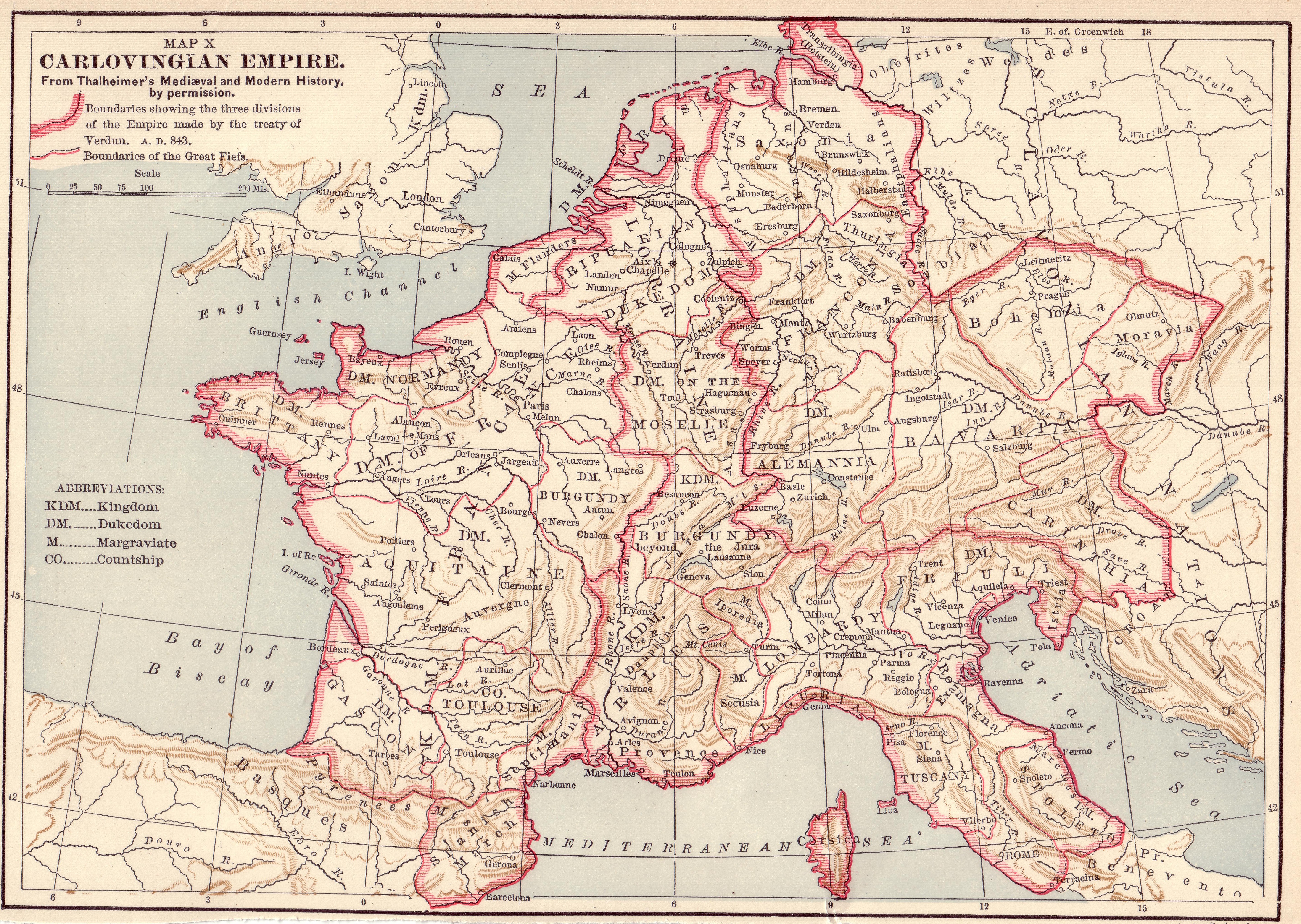
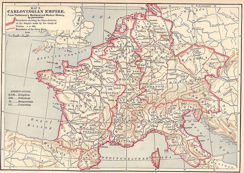
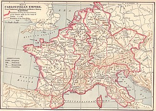
File:Carolingian Empire map 1895.jpg
Pradinė rinkmena (5 697 × 4 050 taškų, rinkmenos dydis: 7,84 MiB, MIME tipas: image/jpeg)
Captions
Captions
Aprašymas[keisti]

|
This map has been uploaded by Electionworld from en.wikipedia.org to enable the |
Licencija[keisti]
|
Šis failas yra viešo naudojimo tose šalyse, kuriose autorių teisės galiojimo netenka po 70 metų nuo autoriaus mirties.
| |
| This file has been identified as being free of known restrictions under copyright law, including all related and neighboring rights. | |
Source: Scanned by Stbalbach from Ridpath's Universal History, Copyright 1895, Section XII, Page 512.
Rinkmenos istorija
Paspauskite ant datos/laiko, kad pamatytumėte rinkmeną tokią, kokia ji buvo tuo metu.
| Data/Laikas | Miniatiūra | Matmenys | Naudotojas | Paaiškinimas | |
|---|---|---|---|---|---|
| dabartinis | 19:52, 20 gruodžio 2006 | | 5 697 × 4 050 (7,84 MiB) | Electionworld (aptarimas | indėlis) | {{ew|en|}} {{PD-old}} Source: Scanned by Stbalbach from {{link|Ridpath's Universal History}}, Copyright 1895, Section XII, Page 512. |
Jūs negalite perrašyti šios rinkmenos.
Rinkmenos naudojimas
Šie puslapiai naudoja šią rinkmeną:
Visuotinis rinkmenos naudojimas
Ši rinkmena naudojama šiose viki svetainėse:
- Naudojama ar.wikipedia.org
- Naudojama arz.wikipedia.org
- Naudojama ast.wikipedia.org
- Naudojama azb.wikipedia.org
- Naudojama az.wikipedia.org
- Naudojama be.wikipedia.org
- Naudojama bs.wikipedia.org
- Naudojama cs.wikipedia.org
- Naudojama de.wikipedia.org
- Naudojama de.wikibooks.org
- Naudojama en.wikipedia.org
- Naudojama es.wikipedia.org
- Naudojama et.wikipedia.org
- Naudojama fi.wikipedia.org
- Naudojama fr.wikipedia.org
- Naudojama he.wikipedia.org
- Naudojama hr.wikipedia.org
- Naudojama hy.wikipedia.org
- Naudojama io.wikipedia.org
- Naudojama it.wikipedia.org
- Naudojama ja.wikipedia.org
- Naudojama ko.wikipedia.org
- Naudojama lmo.wikipedia.org
- Naudojama lt.wikipedia.org
- Naudojama mk.wikipedia.org
- Naudojama ms.wikipedia.org
- Naudojama nl.wikipedia.org
Žiūrėti visuotinį šios rinkmenos naudojimą.
Metaduomenys
- Old maps of the history of Austria
- Old maps of Luxembourg
- Maps of the history of Slovenia in the Middle Ages
- 1890s maps of Switzerland
- Atlas of Europe
- Old maps of the Carolingian Empire
- Treaty of Verdun
- Maps of the partitions of the Carolingian Empire
- Maps of the history of Czechia
- Administrative history of France
- 19th-century maps of France