File:Carte aerienne du robert ShockymapServer.jpg
跳至導覽
跳至搜尋
無更高解析度可提供。
Carte_aerienne_du_robert_ShockymapServer.jpg (587 × 587 像素,檔案大小:83 KB,MIME 類型:image/jpeg)
說明
說明
添加單行說明來描述出檔案所代表的內容
摘要
[編輯]
| 描述 |
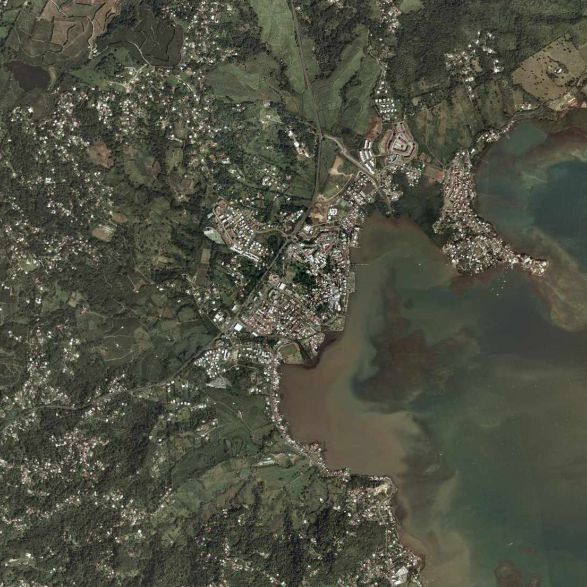
Français : la commune du Le Robert (97231) en Martinique (France). |
| 來源 | page jaune |
| 作者 | satellite |
授權條款
[編輯]
Hi, this image isn't property of Nasa but IGN (Institut National Géographique et Forestière). This image has been acquired by airplaine and this image was captured from www.pagesjaunes.fr through InterAtlas Shockymap Application, please contact IGN to have the permission to use it.
Regards.
| 本作品由NASA創作,屬於公有領域。根據NASA的版權政策:“NASA的創作除非另有聲明否則不受版權保護。”(參見:Template:PD-USGov/zh,NASA版權政策或JPL圖像使用政策) | ||
 |
警告:
|
檔案歷史
點選日期/時間以檢視該時間的檔案版本。
| 日期/時間 | 縮圖 | 尺寸 | 用戶 | 備註 | |
|---|---|---|---|---|---|
| 目前 | 2009年3月9日 (一) 11:14 | | 587 × 587(83 KB) | Lavermeil(對話 | 貢獻) | {{Information |Description={{fr|1=la commune du robert 97231}} |Source=page jaune |Author=satellite |Date= |Permission= |other_versions= }} <!--{{ImageUpload|full}}--> |
無法覆蓋此檔案。
檔案用途
下列2個頁面有用到此檔案:
全域檔案使用狀況
以下其他 wiki 使用了這個檔案:
- azb.wikipedia.org 的使用狀況
- ca.wikipedia.org 的使用狀況
- ceb.wikipedia.org 的使用狀況
- ce.wikipedia.org 的使用狀況
- el.wikipedia.org 的使用狀況
- en.wikipedia.org 的使用狀況
- es.wikipedia.org 的使用狀況
- eu.wikipedia.org 的使用狀況
- fr.wikipedia.org 的使用狀況
- fr.wikivoyage.org 的使用狀況
- he.wikipedia.org 的使用狀況
- it.wikipedia.org 的使用狀況
- mzn.wikipedia.org 的使用狀況
- nl.wikipedia.org 的使用狀況
- no.wikipedia.org 的使用狀況
- oc.wikipedia.org 的使用狀況
- pl.wikipedia.org 的使用狀況
- pt.wikipedia.org 的使用狀況
- sh.wikipedia.org 的使用狀況
- simple.wikipedia.org 的使用狀況
- sk.wikipedia.org 的使用狀況
- sr.wikipedia.org 的使用狀況
- sv.wikipedia.org 的使用狀況
- sw.wikipedia.org 的使用狀況
- uk.wikipedia.org 的使用狀況
- www.wikidata.org 的使用狀況
- zh.wikipedia.org 的使用狀況