File:Cassilis historical area.jpg

Originaldatei (2.000 × 849 Pixel, Dateigröße: 942 KB, MIME-Typ: image/jpeg)
Bildtexte
Kurzbeschreibungen
Beschreibung
[Bearbeiten]| Beschreibung |
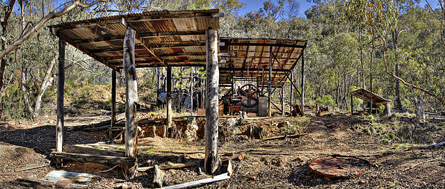
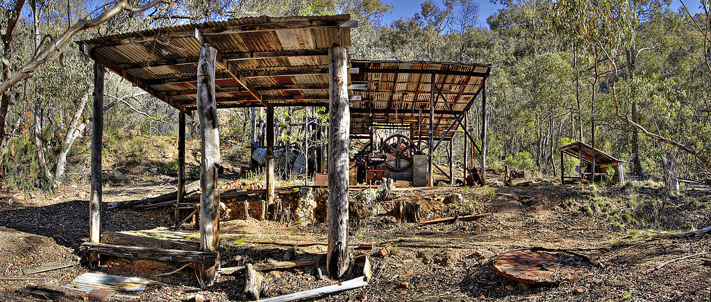
English: Cassilis Historical Park. Cassilis was once the largest gold mining town in Victoria, it is now a ghost town. |
|||||||||
| Quelle | Eigenes Werk | |||||||||
| Urheber |
|
|||||||||
| Genehmigung (Weiternutzung dieser Datei) |
|
|||||||||


Lizenz
[Bearbeiten]
| ||||||||

|
Es ist erlaubt, die Datei unter den Bedingungen der GNU-Lizenz für freie Dokumentation, Version 1.2, veröffentlicht von der Free Software Foundation, zu kopieren, zu verbreiten und/oder zu modifizieren; es gibt keine unveränderlichen Abschnitte, keinen vorderen und keinen hinteren Umschlagtext.
Der vollständige Text der Lizenz ist im Kapitel GNU-Lizenz für freie Dokumentation verfügbar. |
nur 1.2 |
Diese Datei wird unter folgender Creative Commons-Lizenz veröffentlicht:
Attribution NonCommercial Unported 3.0 |
| Kameraposition | | Dieses und weitere Bilder auf OpenStreetMap |
|---|
Dateiversionen
Klicke auf einen Zeitpunkt, um diese Version zu laden.
| Version vom | Vorschaubild | Maße | Benutzer | Kommentar | |
|---|---|---|---|---|---|
| aktuell | 05:48, 3. Sep. 2006 | | 2.000 × 849 (942 KB) | Fir0002 (Diskussion | Beiträge) | Cassilis Historical Park. Cassilis was once the largest gold mining town in Victoria, it is now a ghost town. {{Fir0002 17}} |
Du kannst diese Datei nicht überschreiben.
Dateiverwendung
Die folgenden 3 Seiten verwenden diese Datei:
Globale Dateiverwendung
Die nachfolgenden anderen Wikis verwenden diese Datei:
- Verwendung auf arz.wikipedia.org
- Verwendung auf de.wikipedia.org
- Verwendung auf en.wikipedia.org
- Verwendung auf en.wikibooks.org
- Verwendung auf es.wikipedia.org
- Verwendung auf ja.wikipedia.org
- Verwendung auf ko.wikipedia.org
- Verwendung auf ms.wikipedia.org
- Verwendung auf www.wikidata.org