File:Centrale prefectures.png
跳转到导航
跳转到搜索

本预览的尺寸:776 × 600像素。 其他分辨率:311 × 240像素 | 621 × 480像素 | 994 × 768像素 | 1,056 × 816像素。
原始文件 (1,056 × 816像素,文件大小:25 KB,MIME类型:image/png)
说明
说明
添加一行文字以描述该文件所表现的内容
摘要
[编辑]
| 描述 |
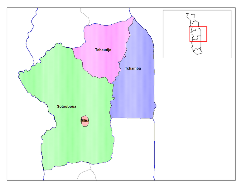
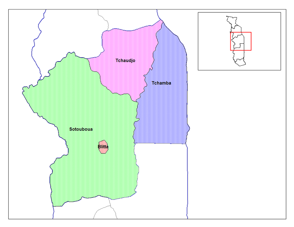
English: Map of the prefectures of the Centrale region of Togo. |
| 日期 | 2006年3月5日 (原始上传日期) |
| 来源 |
|
| 作者 | 英语维基百科的Rarelibra |
许可协议
[编辑]
| 本作品已被作者英语维基百科的Rarelibra释出到公有领域。这适用于全世界。 在一些国家这可能不合法;如果是这样的话,那么: Rarelibra无条件地授予任何人以任何目的使用本作品的权利,除非这些条件是法律规定所必需的。 |
原始上传日志
[编辑]
The original description page was here. All following user names refer to en.wikipedia.
- 2006-03-05 06:12 Rarelibra 1056×816× (25457 bytes) Map of the prefectures of the Centrale region of Togo. Created by Rarelibra for public domain use. Created using MapInfo Professional v7.5 and various mapping resources.
文件历史
点击某个日期/时间查看对应时刻的文件。
| 日期/时间 | 缩略图 | 大小 | 用户 | 备注 | |
|---|---|---|---|---|---|
| 当前 | 2012年9月9日 (日) 22:49 | | 1,056 × 816(25 KB) | OgreBot(留言 | 贡献) | (BOT): Uploading old version of file from en.wikipedia; originally uploaded on 2006-03-05 06:12:13 by Rarelibra |
| 2007年2月17日 (六) 18:23 |  | 776 × 600(125 KB) | Reyos(留言 | 贡献) | from http://en.wikipedia.org/wiki/Image:Centrale_prefectures.png |
您不可以覆盖此文件。
文件用途
以下页面使用本文件:
全域文件用途
以下其他wiki使用此文件:
- ar.wikipedia.org上的用途
- ca.wikipedia.org上的用途
- da.wikipedia.org上的用途
- ee.wikipedia.org上的用途
- el.wikipedia.org上的用途
- en.wikipedia.org上的用途
- es.wikipedia.org上的用途
- fi.wikipedia.org上的用途
- it.wikipedia.org上的用途
- ja.wikipedia.org上的用途
- ko.wikipedia.org上的用途
- lt.wikipedia.org上的用途
- nl.wikipedia.org上的用途
- pt.wikipedia.org上的用途
- ro.wikipedia.org上的用途
- ru.wikipedia.org上的用途
- simple.wikipedia.org上的用途
- si.wikipedia.org上的用途
- smn.wikipedia.org上的用途
- sv.wikipedia.org上的用途
- sw.wikipedia.org上的用途
- tr.wikipedia.org上的用途
- vi.wikipedia.org上的用途
- zh.wikipedia.org上的用途