File:Ceram tpc 1967.jpg

Πρωτότυπο αρχείο (2.374 × 1.185 εικονοστοιχεία, μέγεθος αρχείου: 364 KB, τύπος MIME: image/jpeg)
Λεζάντες
Λεζάντες
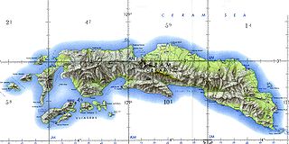
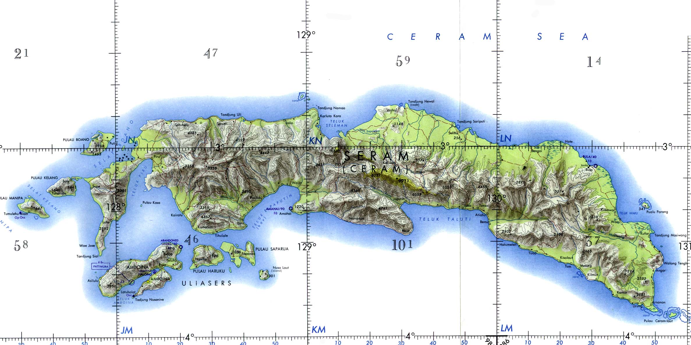
Ceram and Ambon Islands (Operational Navigation Chart) original scale 1:1,000,000. Portion of Defense Mapping Agency ONC M-12 1967 (372K) Not for navigational use
nb: Seram; formerly Ceram, also called Seran or Serang.
Courtesy of the University of Texas Libraries, The University of Texas at Austin.
From the Perry-Castañeda Library Map Collection:
http://www.lib.utexas.edu/maps/middle_east_and_asia/ceram_tpc_1967.jpg
Library Web Material Usage Statement at:
http://www.lib.utexas.edu/usage_statement.html
This work is in the public domain in the United States because it is a work prepared by an officer or employee of the United States Government as part of that person’s official duties under the terms of Title 17, Chapter 1, Section 105 of the US Code.
Note: This only applies to original works of the Federal Government and not to the work of any individual U.S. state, territory, commonwealth, county, municipality, or any other subdivision. This template also does not apply to postage stamp designs published by the United States Postal Service since 1978. (See § 313.6(C)(1) of Compendium of U.S. Copyright Office Practices). It also does not apply to certain US coins; see The US Mint Terms of Use.
|
 | |
| Αυτό το αρχείο έχει χαρακτηριστεί ως απαλλαγμένο από γνωστούς περιορισμούς βάσει της νομοθεσίας περί πνευματικής ιδιοκτησίας, περιλαμβανομένων όλων των συναφών και συγγενικών δικαιωμάτων. | ||
nb: Originally uploaded by me, Jack Merridew, as w:User:Davenbelle, on en:wp:
Ιστορικό αρχείου
Πατήστε σε μια ημερομηνία/ώρα για να δείτε το αρχείο όπως εμφανιζόταν εκείνη την χρονική στιγμή.
| Ημερομηνία/Ώρα | Μικρογραφία | Διαστάσεις | Χρήστης | Σχόλιο | |
|---|---|---|---|---|---|
| τρέχον | 10:47, 25 Ιανουαρίου 2005 | | 2.374 × 1.185 (364 KB) | Dionysos~commonswiki (συζήτηση | Συνεισφορά) | Ceram |
Δεν μπορείτε να αντικαταστήσετε αυτό το αρχείο.
Χρήση αρχείου
Δεν υπάρχουν σελίδες που χρησιμοποιούν αυτό το αρχείο.
Καθολική χρήση αρχείου
Τα ακόλουθα άλλα wiki χρησιμοποιούν αυτό το αρχείο:
- Χρήση σε en.wikipedia.org
- Χρήση σε es.wikipedia.org