File:Chalcidice.jpg
出典:ウィキメディア・コモンズ (Wikimedia Commons)
ナビゲーションに移動
検索に移動

このプレビューのサイズ: 800 × 475 ピクセル。 その他の解像度: 320 × 190 ピクセル | 640 × 380 ピクセル | 854 × 507 ピクセル。
元のファイル (854 × 507 ピクセル、ファイルサイズ: 209キロバイト、MIME タイプ: image/jpeg)
ファイル情報
構造化データ
キャプション
キャプション
このファイルの内容を1行で記述してください
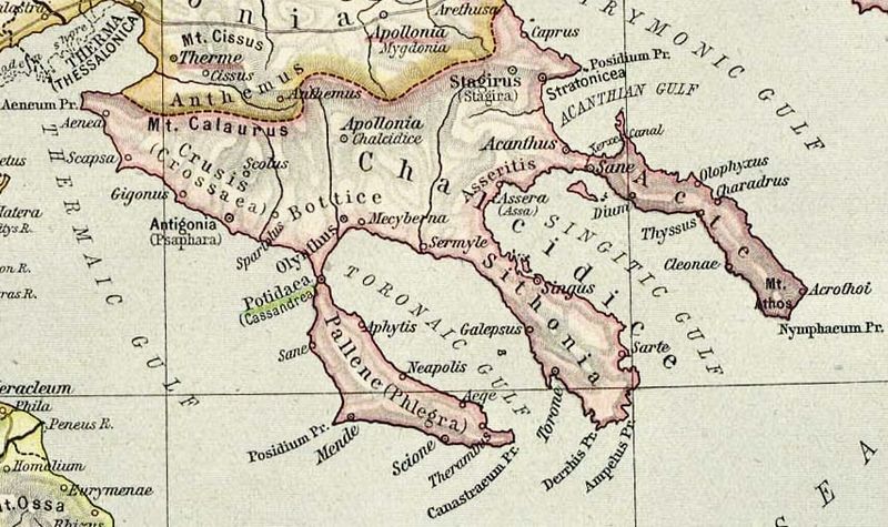
Map of Chalcidice
概要[編集]
| 解説Chalcidice.jpg |
English: Map of Chalcidice, cropped from old public domain map of Greece, from the Perry-Castañeda Library Map Collection, Historical Atlas by William R. Shepherd. Note that the location shown for Stagirus (Stagira) is the site of the modern village. Ancient Stagira is located on the coast north of that at the position labeled "Caprus", the name of the island off the coast of Stagira. north, south |
||
| 日付 | |||
| 原典 |
|
||
| 作者 | William Robert Shepherd |
ライセンス[編集]
| Public domainPublic domainfalsefalse |
|
この著作物は、著作権の保護期間が著作者の死後75年以下である国・地域においてパブリックドメインの状態にあります。
| |
| このファイルは著作権法の既知の制約(隣接権や関連する権利を含む)から自由であると特定されています。 | |
https://creativecommons.org/publicdomain/mark/1.0/PDMCreative Commons Public Domain Mark 1.0falsefalse
ファイルの履歴
過去の版のファイルを表示するには、その版の日時をクリックしてください。
| 日付と時刻 | サムネイル | 寸法 | 利用者 | コメント | |
|---|---|---|---|---|---|
| 現在の版 | 2013年4月19日 (金) 19:49 |  | 854 × 507 (209キロバイト) | Jbarta (トーク | 投稿記録) | lighten |
| 2006年12月12日 (火) 08:27 |  | 854 × 507 (135キロバイト) | Roke~commonswiki (トーク | 投稿記録) | Map of Chalcidice, cropped from old public domain map of Greece, from the Perry-Castañeda Library Map Collection, Historical Atlas by William R. Shepherd [http://www.lib.utexas.edu/maps/historical/shepherd/greece_ancient_n_ref_1926.jpg north], [http://ww |
このファイルは上書きできません。
ファイルの使用状況
以下の 2 ページがこのファイルを使用しています:
グローバルなファイル使用状況
以下に挙げる他のウィキがこの画像を使っています:
- bg.wikipedia.org での使用状況
- ca.wikipedia.org での使用状況
- da.wikipedia.org での使用状況
- de.wikipedia.org での使用状況
- el.wikipedia.org での使用状況
- en.wikipedia.org での使用状況
- eo.wikipedia.org での使用状況
- es.wikipedia.org での使用状況
このファイルのグローバル使用状況を表示する。