File:Chan-hom 2009-05-04 0930Z.jpg
跳至導覽
跳至搜尋
預覽大小:600 × 600 像素。 其他解析度:240 × 240 像素 | 480 × 480 像素 | 768 × 768 像素 | 1,024 × 1,024 像素。
原始檔案 (1,024 × 1,024 像素,檔案大小:142 KB,MIME 類型:image/jpeg)
說明
說明
添加單行說明來描述出檔案所代表的內容
摘要
[編輯]
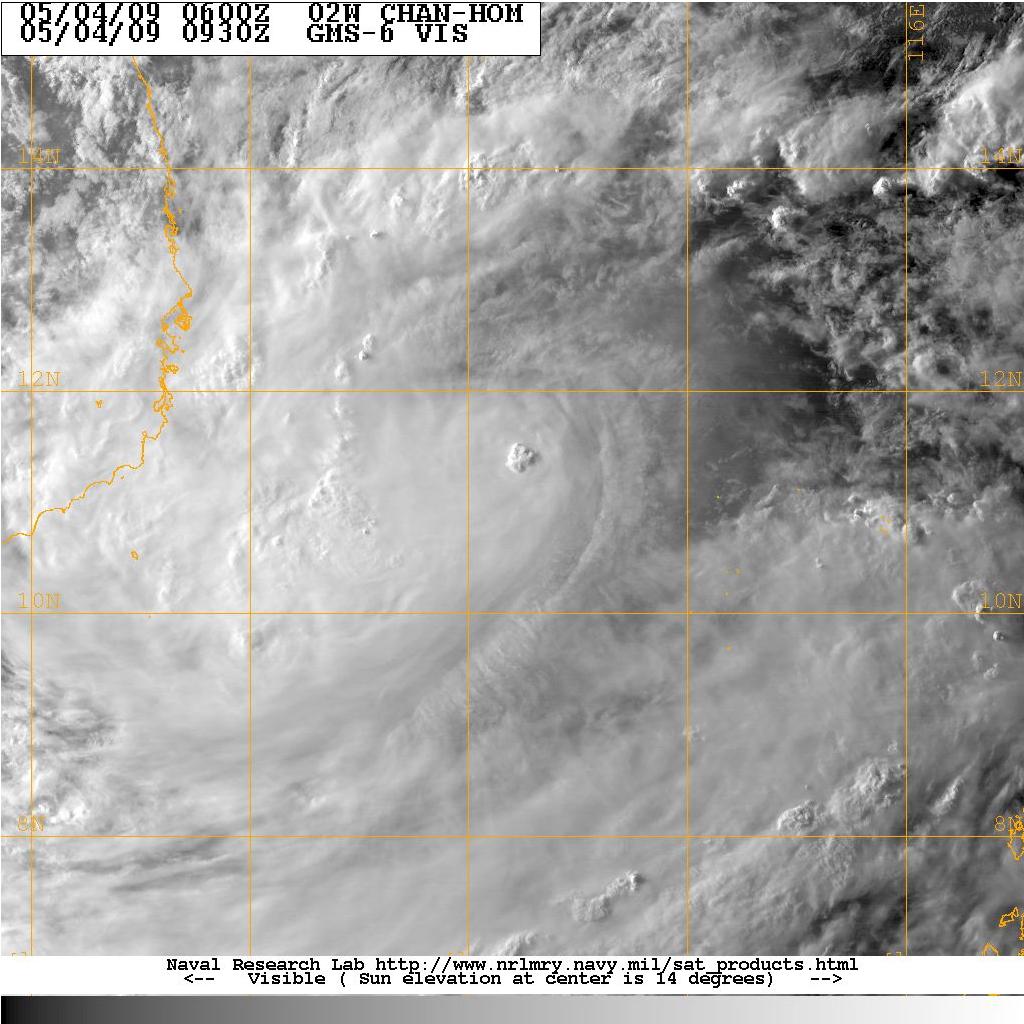
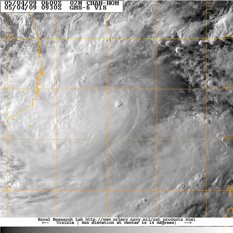
| 描述 | On May 2, an area of covection cloudiness associated with an area of disturbed weather formed southeast of Nha Trang, Vietnam and associated with remnant of Tropical depression Crising. JTWC monitored the low as "Fair" for developing due to low vertical wind shear and an upper level anticyclone to the east of the system. Later on the JMA designated the low pressure as a minor tropical depression reporting the outlook track as southwestward. The JTWC issued a TCFA on the system once the convection increased and became better organized although with an exposed LLC east of its convection. Early morning of May 3, the JMA begun issuing tropical cyclone advisories on the system forecasting it to become a tropical storm later in the afternoon as it tracks eastwards. On May 3, the JTWC desingated disturbance as Tropical Depression 02W as the JMA named the storm Chan-hom. As the storm moved into PAGASA's area of responsibility, they gave it the name "Emong". |
| 日期 | |
| 來源 | http://199.9.2.143/tc-bin/tc_home2.cgi?ACTIVES=09-SHEM-05S.BILLY,09-SHEM-94S.INVEST,09-WPAC-99W.INVEST&SIZE=Thumb&PHOT=yes&NAV=tc&YR=09&ATCF_BASIN=wp&ATCF_YR=1&YEAR=2009&ATCF_FILE=1/&CURRENT=20090103.1457.gms6.x.ir1km_bw.99WINVEST.15kts-1008mb-89N-1271E.100pc.jpg&AGE=Latest&ATCF_NAME=wp991&ATCF_DIR=1&ARCHIVE=active&MO=MAY&BASIN=WPAC&STORM_NAME=02W.CHAN-HOM&STYLE=tables&AREA=atlantic/tropics&AID_DIR=/data/www/pacific/western/tropics/microvap/dmsp&DIR=/TC/tc09/WPAC/02W.CHAN-HOM/vis/geo/1km_zoom&TYPE=geo&PROD=vis&SUB_PROD=1km_zoom |
| 作者 | NRL/Navy |
授權條款
[編輯]
 | ||
| 此作品無已知的著作權限制,亦不受所有相關和鄰接的權利限制。 | ||
檔案歷史
點選日期/時間以檢視該時間的檔案版本。
| 日期/時間 | 縮圖 | 尺寸 | 用戶 | 備註 | |
|---|---|---|---|---|---|
| 目前 | 2009年5月4日 (一) 14:47 | | 1,024 × 1,024(142 KB) | Jpuligan 12(對話 | 貢獻) | {{Information |Description=On May 2, an area of covection cloudiness associated with an area of disturbed weather formed southeast of Nha Trang, Vietnam and associated with remnant of Tropical depression Crising. JTWC monitored the low as "Fair" for devel |
無法覆蓋此檔案。
檔案用途
下列頁面有用到此檔案:
- File:TYPHOON CHAN-HOM.jpg (檔案重新導向)
全域檔案使用狀況
以下其他 wiki 使用了這個檔案:
- zh.wikipedia.org 的使用狀況