File:Chesapeake and Delaware Canal eastern entrance.jpg
Aller à la navigation
Aller à la recherche

Taille de cet aperçu : 800 × 527 pixels. Autres résolutions : 320 × 211 pixels | 640 × 422 pixels | 1 024 × 674 pixels | 1 500 × 988 pixels.
Fichier d’origine (1 500 × 988 pixels, taille du fichier : 527 kio, type MIME : image/jpeg)
Légendes
Légendes
Ajoutez en une ligne la description de ce que représente ce fichier
| Description |
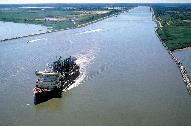
English: The eastern entrance to the Chesapeake & Delaware Canal at Reedy Point, Delaware. Fort Dupont State park is at the right. The Reedy Point Bridge, carrying Delaware State Route 9, is visible in the distance. The U.S. Army Corps of Engineers hopper dredge McFarland is exiting the channel. View is to the east. The channel entrance is located on the Delaware River in New Castle County, Delaware, USA.
|
|||
| Date | not specified or unknown | |||
| Source |
U.S. Army Corps of Engineers Digital Visual Library Image page Image description page Digital Visual Library home page |
|||
| Auteur | Anthony Bley, U.S. Army Corps of Engineers | |||
| Autorisation (Réutilisation de ce fichier) |
|
|||
| Lieu | Delaware River, New Castle County, Delaware, USA |
| Lieu de la prise de vue | | Voir cet endroit et d’autres images sur : OpenStreetMap |
|---|
Historique du fichier
Cliquer sur une date et heure pour voir le fichier tel qu'il était à ce moment-là.
| Date et heure | Vignette | Dimensions | Utilisateur | Commentaire | |
|---|---|---|---|---|---|
| actuel | 8 avril 2007 à 02:46 | | 1 500 × 988 (527 kio) | DanMS (d | contributions) | {{Information | Description = {{en|The eastern entrance to the Chesapeake & Delaware Canal at Reedy Point, Delaware. Fort Dupont State park is at the right. The Reedy Point Bridge, carrying Delaware State Route 9, is visible in the distance. The U. |
Vous ne pouvez pas remplacer ce fichier.
Utilisations locales du fichier
Les 2 pages suivantes utilisent ce fichier :
Utilisations du fichier sur d’autres wikis
Les autres wikis suivants utilisent ce fichier :
- Utilisation sur de.wikipedia.org
- Utilisation sur en.wikipedia.org
- Utilisation sur es.wikipedia.org
- Utilisation sur fr.wikipedia.org
- Utilisation sur no.wikipedia.org
- Utilisation sur vi.wikipedia.org
- Utilisation sur www.wikidata.org
- Utilisation sur zh.wikipedia.org