File:China-Guangdong.png
ナビゲーションに移動
検索に移動
高解像度版はありません。
China-Guangdong.png (268 × 218 ピクセル、ファイルサイズ: 31キロバイト、MIME タイプ: image/png)
キャプション
キャプション
このファイルの内容を1行で記述してください
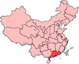
en: Location of Guangdong Province in the People's Republic of China. See Locator maps of province-level divisions of the People's Republic of China for more information.
zh: 廣東省在中華人民共和國的位置。另見Locator maps of province-level divisions of the People's Republic of China。

|
この文書は、フリーソフトウェア財団発行のGNUフリー文書利用許諾書 (GNU Free Documentation License) 1.2またはそれ以降のバージョンの規約に基づき、複製や再配布、改変が許可されます。不可変更部分、表紙、背表紙はありません。このライセンスの複製は、GNUフリー文書利用許諾書という章に含まれています。 |
| このファイルはクリエイティブ・コモンズ 表示-継承 3.0 非移植ライセンスのもとに利用を許諾されています。 | ||
| ||
| このライセンスのテンプレートは、GFDLのライセンス・アップデートによりこのファイルに追加されたものです。 |

|
このファイルのベクター画像 (SVG) が利用できます。 使う目的に対し、元画像よりもSVGがより優れている場合、SVG画像を使用して下さい。
File:China-Guangdong.png → File:Map of PRC Guangdong.svg
|
 |
ファイルの履歴
過去の版のファイルを表示するには、その版の日時をクリックしてください。
| 日付と時刻 | サムネイル | 寸法 | 利用者 | コメント | |
|---|---|---|---|---|---|
| 現在の版 | 2007年10月28日 (日) 14:03 | | 268 × 218 (31キロバイト) | Croquant (トーク | 投稿記録) | transparent background |
| 2005年6月4日 (土) 22:35 |  | 268 × 218 (9キロバイト) | Ran (トーク | 投稿記録) | '''en''': Location of Guangdong Province in the People's Republic of China. See Category:Locator maps of province-level divisions of the People's Republic of China for more information. '''zh''': 廣東省在中華人民共和國的位置。另見[[ |
このファイルは上書きできません。
ファイルの使用状況
以下のページがこのファイルを使用しています:
グローバルなファイル使用状況
以下に挙げる他のウィキがこの画像を使っています:
- da.wikipedia.org での使用状況
- en.wikipedia.org での使用状況
- Dong River (China)
- Bei River
- Meixian, Meizhou
- Xingning, Guangdong
- Sihui
- Leizhou
- Longgang, Shenzhen
- Wangniudun
- Xingning Air Base
- Wikipedia:WikiProject Chinese provinces/Locator maps
- Chashan
- Ning River
- Shenguang Mountain
- Yingde
- Shiwanzhen Subdistrict
- Xinjiao Town
- Guanghai
- Haiyan, Guangdong
- Xingning Basin
- Qiongzhou Strait
- Chang'an, Dongguan
- Yingdehong tea
- Haifeng County
- Taishi, Guangzhou
- Zhongshan Island
- Baisha, Taishan
- Sanhe, Taishan
- Dongzhou, Guangdong
- Liannan Yao Autonomous County
- Jiaoling County
- Nanhai, Foshan
- Chaoyang, Shantou
- Jianying Memorial Bridge
- Xinyi, Guangdong
- Fengshun County
- Template:Guangdong-geo-stub
- Dabu County
- Meizhou Meixian Airport
- Shantou Waisha Airport
- Zhanjiang Airport
- Changping, Guangdong
- Huilai County
- Shuibu
- Huacheng
- Zhaoqing railway station
- Egongling River
- Longhua Subdistrict, Shenzhen
- Longjiang, Foshan
このファイルのグローバル使用状況を表示する。