File:China-Inner-Mongolia.png
China-Inner-Mongolia.png (268 × 218 billedpunkter, filstørrelse: 15 KB, MIME-type: image/png)
Captions
Captions
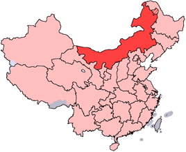
en: Location of Inner Mongolia Autonomous Region in the People's Republic of China. See Locator maps of province-level divisions of the People's Republic of China for more information. The striped area is nominally part of Inner Mongolia, but it is administered by Daxing'anling Prefecture of Heilongjiang Province.
zh: 内蒙古自治區在中華人民共和國的位置。另見Locator maps of province-level divisions of the People's Republic of China。加斜杠的地區由黑龍江省大興安嶺地區所管轄,僅在名義上為内蒙古的一部分。

|
Tilladelse er givet til at kopiere, distribuere og/eller ændre dette dokument under betingelserne i GNU Free Documentation License', Version 1.2 eller enhver senere version udgivet af Free Software Foundation; uden et invariant afsnit, ingen forsidetekster, og ingen bagsidetekst. En kopi af licensen er inkluderet i afsnittet GNU Free Documentation License. |
| Denne fil er udgivet under Creative Commons Kreditering-Del på samme vilkår 3.0 Ikke-porteret-licensen. | ||
| ||
| Denne licens blev tilføjet som en del af GFDL-licensopdateringen. |
Filhistorik
Klik på en dato/tid for at se filen som den så ud på det tidspunkt.
| Dato/tid | Miniaturebillede | Dimensioner | Bruger | Kommentar | |
|---|---|---|---|---|---|
| nuværende | 15. jul. 2005, 14:44 | | 268 × 218 (15 KB) | Schaengel89~commonswiki (diskussion | bidrag) | transparent background |
| 4. jun. 2005, 21:42 |  | 268 × 218 (9 KB) | Ran (diskussion | bidrag) | '''en''': Location of Inner Mongolia in the People's Republic of China. See Category:Locator maps of province-level divisions of the People's Republic of China for more information. '''zh''': 内蒙古自治區在中華人民共和國的位置。另 |
Du kan ikke overskrive denne fil.
Filanvendelse
Den følgende side bruger denne fil:
Global filanvendelse
Følgende andre wikier anvender denne fil:
- Anvendelser på da.wikipedia.org
- Anvendelser på de.wikipedia.org
- Anvendelser på en.wikipedia.org
- Wikipedia:WikiProject Chinese provinces/Locator maps
- Fengzhen
- Yin Mountains
- Hanggai (village)
- Tengger Desert
- Liaobei
- Dolon Nor
- Oroqen Autonomous Banner
- Solun, Horqin Right Front Banner
- Khalkhin Gol
- Bailingmiao
- Dongsheng District
- Chifeng Yulong Airport
- Hulunbuir Hailar Airport
- Tongliao Airport
- Xilinhot Airport
- Template:InnerMongolia-geo-stub
- Lang Mountains
- Tsondol
- Xar Moron River
- Honggor Sum, Siziwang Banner
- Baochang, Taibus Banner
- Hobor
- Honggor Sum, Sonid Left Banner
- Hongort
- Shangdu County
- Xuejiawan, Jungar Banner
- Dashuigou Formation
- Bayin-Gobi Formation
- Jalaid Banner
- Hexigten Banner
- Horinger County
- Xincheng, Hohhot
- Wuyuan County, Inner Mongolia
Vis flere globale anvendelser af denne fil.