File:Coat of Arms of Yamal Nenetsia.svg

Fitxer original (fitxer SVG, nominalment 252 × 342 píxels, mida del fitxer: 120 Ko)
Llegendes
Llegendes
Resum
[modifica]| Descripció |
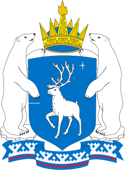
Русский: Ямало-Ненецкий автономный округ, герб. English: Yamalo-Nenets Autonomous Okrug, coat of arms. Esperanto: Jamalo-Neneca aŭtonoma distrikto, la blazono. |
||||||
| Data | |||||||
| Font | Treball propi | ||||||
| Autor | Cian Akril | ||||||
| Permís (Com reutilitzar aquest fitxer) |
|
||||||
| Altres versions |
 |


Llicència
[modifica]
| L'ús d'aquest fitxer és regulat sota les condicions de Creative Commons de CC0 1.0 lliurament al domini públic universal. | |
| La persona que ha associat un treball amb aquest document ha dedicat l'obra domini públic, renunciant en tot el món a tots els seus drets de d'autor i a tots els drets legals relacionats que tenia en l'obra, en la mesura permesa per la llei. Podeu copiar, modificar, distribuir i modificar l'obra, fins i tot amb fins comercials, tot sense demanar permís.
|
Historial del fitxer
Cliqueu una data/hora per veure el fitxer tal com era aleshores.
| Data/hora | Miniatura | Dimensions | Usuari/a | Comentari | |
|---|---|---|---|---|---|
| actual | 16:07, 3 des 2012 | | 252 × 342 (120 Ko) | Cian Akril (discussió | contribucions) | User created page with UploadWizard |
No podeu sobreescriure aquest fitxer.
Ús del fitxer
Les 17 pàgines següents utilitzen aquest fitxer:
- Гербы субъектов Российской Федерации
- Commons:Graphic Lab/Illustration workshop/Archive/2012
- File:Coat of Arms of Yamal Nenetsia.png
- File:Заксобрание ЯНАО (2020).jpg
- Template:Yanao.ru
- Template:Yanao.ru/layout
- Template:Yanao.ru/ru
- Category:Airports in Yamalo-Nenets Autonomous Okrug
- Category:Economy of Yamalo-Nenets Autonomous Okrug
- Category:Geography of Yamalo-Nenets Autonomous Okrug
- Category:Maps of Yamalo-Nenets Autonomous Okrug
- Category:People of Yamalo-Nenets Autonomous Okrug
- Category:Rivers of Yamalo-Nenets Autonomous Okrug
- Category:Train stations in Yamalo-Nenets Autonomous Okrug
- Category:Transport in Yamalo-Nenets Autonomous Okrug
- Category:Visitor attractions in Yamalo-Nenets Autonomous Okrug
- Category:Yamalo-Nenets Autonomous Okrug
.jpg)
Ús global del fitxer
Utilització d'aquest fitxer en altres wikis:
- Utilització a af.wikipedia.org
- Utilització a an.wikipedia.org
- Utilització a ar.wikipedia.org
- Utilització a arz.wikipedia.org
- Utilització a ast.wikipedia.org
- Utilització a azb.wikipedia.org
- Utilització a az.wikipedia.org
- Utilització a ba.wikipedia.org
- Utilització a be-tarask.wikipedia.org
- Utilització a be.wikipedia.org
- Лабытнангі
- Ямала-Ненецкая аўтаномная акруга
- Новы Урэнгой
- Надым (горад)
- Мураўленка
- Наябрск
- Тарка-Сале
- Губкінскі
- Салехард
- Урэнгой
- Суб’екты Расійскай Федэрацыі
- Харп
- Шаблон:Ямала-Ненецкая аўтаномная акруга
- Пангады
- Запалярны (Ямала-Ненецкая аўтаномная акруга)
- Аксарка
- Яр-Сале
- Тазаўскі
- Мужы (Ямала-Ненецкая аўтаномная акруга)
- Шурышкарскі раён
- Краснасялькуп
- Краснасялькупскі раён
- Надымскі раён
- Ямальскі раён
Vegeu més usos globals d'aquest fitxer.