File:Collines communes.png
跳转到导航
跳转到搜索
本预览的尺寸:776 × 600像素。 其他分辨率:311 × 240像素 | 621 × 480像素 | 994 × 768像素 | 1,056 × 816像素。
原始文件 (1,056 × 816像素,文件大小:26 KB,MIME类型:image/png)
说明
说明
添加一行文字以描述该文件所表现的内容
摘要[编辑]
| 描述 |
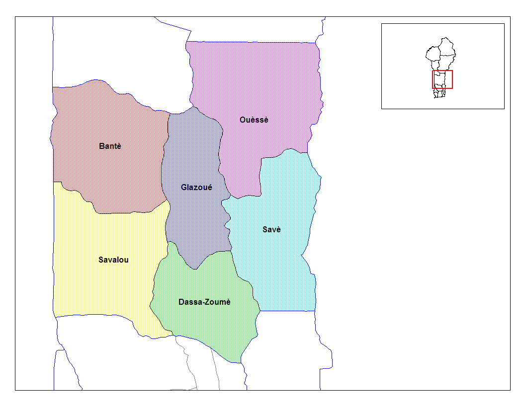
English: Map of the communes of the department of Collines, Benin. Created by Rarelibra for public domain use. Created using MapInfo Professional v7.5 and various mapping resources. |
| 日期 | 2006年3月5日 (原始上传日期) |
| 来源 | 本檔案是從en.wikipedia轉移到維基共享資源。 |
| 作者 | 英语维基百科的Rarelibra |
许可协议[编辑]
| 本作品已被作者英语维基百科的Rarelibra释出到公有领域。这适用于全世界。 在一些国家这可能不合法;如果是这样的话,那么: Rarelibra无条件地授予任何人以任何目的使用本作品的权利,除非这些条件是法律规定所必需的。 |
原始上传日志[编辑]
原始描述頁面位於這裡。下列使用者名稱均來自en.wikipedia。
- 2006-03-05 02:01 Rarelibra 1056×816× (26636 bytes) Map of the communes of the department of Collines, Benin. Created by Rarelibra for public domain use. Created using MapInfo Professional v7.5 and various mapping resources.
- 2006-03-05 01:56 Rarelibra 1056×816× (26543 bytes) Map of the communes of the department of Collines, Benin. Created by Rarelibra for public domain use. Created using MapInfo Professional v7.5 and various mapping resources.
文件历史
点击某个日期/时间查看对应时刻的文件。
| 日期/时间 | 缩略图 | 大小 | 用户 | 备注 | |
|---|---|---|---|---|---|
| 当前 | 2009年3月26日 (四) 07:41 | | 1,056 × 816(26 KB) | Luk(留言 | 贡献) | full version.. |
| 2007年2月17日 (六) 15:15 |  | 776 × 600(125 KB) | Reyos(留言 | 贡献) | from http://en.wikipedia.org/wiki/Image:Collines_communes.png |
您不可以覆盖此文件。
文件用途
没有页面使用本文件。
全域文件用途
以下其他wiki使用此文件:
- ar.wikipedia.org上的用途
- ca.wikipedia.org上的用途
- de.wikipedia.org上的用途
- en.wikipedia.org上的用途
- eo.wikipedia.org上的用途
- es.wikipedia.org上的用途
- fi.wikipedia.org上的用途
- fon.wikipedia.org上的用途
- frr.wikipedia.org上的用途
- fr.wikipedia.org上的用途
- hu.wikipedia.org上的用途
- id.wikipedia.org上的用途
- it.wikipedia.org上的用途
- ja.wikipedia.org上的用途
- lt.wikipedia.org上的用途
- nl.wikipedia.org上的用途
- pt.wikipedia.org上的用途
- sv.wikipedia.org上的用途
- tr.wikipedia.org上的用途
- uk.wikipedia.org上的用途
- vi.wikipedia.org上的用途
- zh.wikipedia.org上的用途