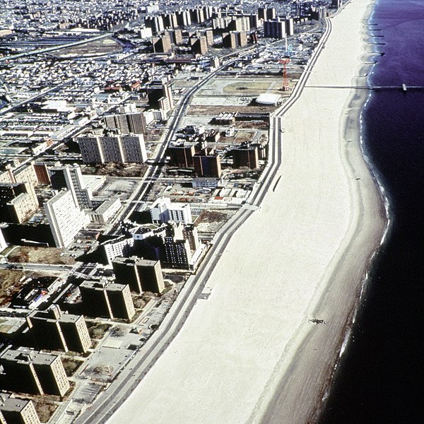
File:Coney Island beach aerial view.jpg
出自Wikimedia Commons
跳至導覽
跳至搜尋

預覽大小:600 × 600 像素。 其他解析度:240 × 240 像素 | 480 × 480 像素 | 769 × 768 像素 | 1,025 × 1,024 像素 | 1,500 × 1,499 像素。
原始檔案 (1,500 × 1,499 像素,檔案大小:862 KB,MIME 類型:image/jpeg)
檔案資訊
結構化資料
說明
說明
添加單行說明來描述出檔案所代表的內容
| 描述Coney Island beach aerial view.jpg |
English: Aerial view of the oceanfront of Coney Island, Brooklyn, New York, USA. The photograph appears to be taken from the vicinity of West 32nd Street, looking east. The view extends a short distance beyond Asser Levy Park. |
||||
| 日期 | (Caution: Dates given on the Corps of Engineers website are often incorrect.) | ||||
| 來源 |
U.S. Army Corps of Engineers Digital Visual Library Image page Image description page Digital Visual Library home page |
||||
| 作者 | Peter Shugert, U.S. Army Corps of Engineers | ||||
| 授權許可 (重用此檔案) |
|
||||
| 圖中地點 InfoField | Brooklyn, New York, USA |
| 目標地點 | 40° 34′ 27.9″ 北, 73° 58′ 43″ 西 | 位於此地的本圖片與其他圖片: OpenStreetMap |
|---|
檔案歷史
點選日期/時間以檢視該時間的檔案版本。
| 日期/時間 | 縮圖 | 尺寸 | 使用者 | 備註 | |
|---|---|---|---|---|---|
| 目前 | 2007年4月8日 (日) 23:00 |  | 1,500 × 1,499(862 KB) | DanMS(留言 | 貢獻) | {{Information | Description = {{en|Aerial view of the oceanfront of Coney Island, Brooklyn, New York, USA. The photograph appears to be taken from the vicinity of West 32nd Street, looking east. The view extends a short distance beyond Asser Levy Park. |
無法覆蓋此檔案。
檔案用途
沒有使用此檔案的頁面。
全域檔案使用狀況
以下其他 wiki 使用了這個檔案:
- af.wikipedia.org 的使用狀況
- ar.wikipedia.org 的使用狀況
- da.wikipedia.org 的使用狀況
- et.wikipedia.org 的使用狀況
- he.wikipedia.org 的使用狀況
- ja.wikipedia.org 的使用狀況
- nl.wikipedia.org 的使用狀況
- sv.wikipedia.org 的使用狀況
- zh.wikipedia.org 的使用狀況
詮釋資料
此檔案中包含其他資訊,這些資訊可能是由數位相機或掃描器在建立或數位化過程中所新增的。若檔案自原始狀態已被修改,一些詳細資料可能無法完整反映出已修改的檔案。
| JPEG 檔案備註 | File written by Adobe Photoshop¨ 5.0 |
|---|
