File:Confluence Kadei and Mambere.jpg
跳转到导航
跳转到搜索
本预览的尺寸:787 × 600像素。 其他分辨率:315 × 240像素 | 630 × 480像素 | 888 × 677像素。
原始文件 (888 × 677像素,文件大小:405 KB,MIME类型:image/jpeg)
说明
说明
添加一行文字以描述该文件所表现的内容
摘要
[编辑]
| 描述 |
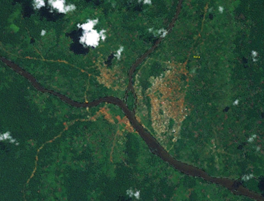
English: Confluence of Kadei and Mambere river at Nola, forming Sangha River |
| 日期 | |
| 来源 | Worlwind |
| 作者 | Nasa |
许可协议
[编辑]
| 本图像属于 w:公有领域 ,因其为 NASA 的 World Wind 卫星地图浏览器的一张截图,且使用了公有领域图层,如 Blue Marble、MODIS、Landsat、SRTM、USGS、GLOBE 等。
|
 |
文件历史
点击某个日期/时间查看对应时刻的文件。
| 日期/时间 | 缩略图 | 大小 | 用户 | 备注 | |
|---|---|---|---|---|---|
| 当前 | 2014年9月16日 (二) 14:04 | | 888 × 677(405 KB) | Peter in s(留言 | 贡献) | {{Information |Description ={{en|1=Confluence of Kadei and Mambere river at Nola}} |Source =Worlwind |Author =Nasa |Date =2014-09-13 |Permission = |other_versions = }} Category:Rivers of the Central African Republic |
您不可以覆盖此文件。
文件用途
以下3个页面使用本文件:
全域文件用途
以下其他wiki使用此文件:
- arz.wikipedia.org上的用途
- ceb.wikipedia.org上的用途
- de.wikipedia.org上的用途
- eo.wikipedia.org上的用途
- fr.wikipedia.org上的用途
- ha.wikipedia.org上的用途
- ko.wikipedia.org上的用途
- pl.wikipedia.org上的用途
- ro.wikipedia.org上的用途
- ru.wikipedia.org上的用途
- sv.wikipedia.org上的用途
- tr.wikipedia.org上的用途
- uk.wikipedia.org上的用途
- www.wikidata.org上的用途
- zh.wikipedia.org上的用途