File:Cornwall outline map with UK (2009).png
Ir a la navegación
Ir a la búsqueda

Kay ñawpaq qhawariypa chhikan kaynin: 758 × 600 iñu. Huk huyakukuna: 303 × 240 iñu | 607 × 480 iñu | 971 × 768 iñu | 1280 × 1013 iñu | 1351 × 1069 iñu.
Qallariy willañiqi (1351 × 1069 iñu; willañiqip chhikan kaynin: 80 kB; MIME laya: image/png)
Leyendas
Leyendas
Añade una explicación corta acerca de lo que representa este archivo
Pisichay[llamk'apuy]
.png&action=edit§ion=1)
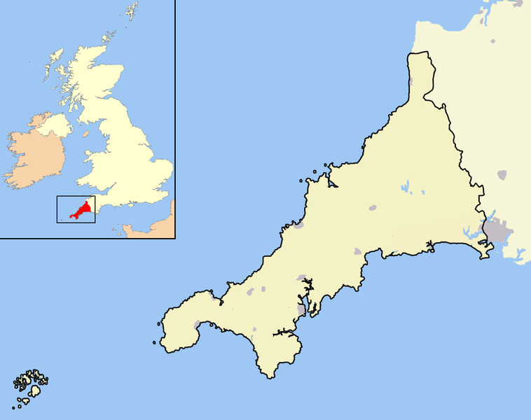
| T'iktuna | A map of the county of Cornwall, England, United Kingdom, showing the post-2009 district boundaries. |
| P'unchaw | |
| Pukyu | Kikinpa rurasqan |
| Ruraq | Jhamez84 |
Saqillaspa[llamk'apuy]
.png&action=edit§ion=2)
| Ñuqaqa, kay rurasqaypa iskaychay hayñiyuq kaqnin, rurasqayta Sapsi Chaskinancha nisqamanmi kacharichkani. Kayqa tukuy Tiksimuyuntinpim chanin. Huk mama llaqtakunap kamachiyninkunaqa manachá saqillankuchu; hinaptinqa: Ñuqaqa pitapas saqillani kay rurasqayta llamk'achiyta imapaqpas, mana phatawanchu, chay hina phatakuna mana kamachiypa kamachiptinkama. |
Willañiqip wiñay kawsaynin
P'unchaw/pacha nisqapi ñit'iy chaypacha willañiqi kachkasqata qhawanaykipaq.
| P'unchaw/Pacha | Uchuylla rikchacha | Chhikanyachikuqkuna | Ruraq | Willapuy | |
|---|---|---|---|---|---|
| kunan | 14:13 18 mar 2010 | | 1351 × 1069 (80 kB) | Mahahahaneapneap (rimanakuy | llamk'apusqakuna) | Compressed |
| 20:15 19 dis 2008 |  | 1351 × 1069 (121 kB) | Jza84 (rimanakuy | llamk'apusqakuna) | == Summary == {{Information |Description=A map of the county of Cornwall, England, United Kingdom, showing the post-2009 district boundaries. |Source=self-made |Date=December 2008 |Author= Jhamez84 |Permission=See below |other_versions=N |
Manam atinkichu kay willañiqita huknachayta.
Maypim willañiqita llamk'achinku
Kay rikchamanqa manam ima p'anqakunachu t'inkimun.
Mayqin wikikunapi willañiqita llamk'achinku
Kay wakin wikikunam willañiqitaqa llamk'achinku:
- cy.wikipedia.org-pi kaykunapi llamk'achinku
- en.wikipedia.org-pi kaykunapi llamk'achinku
- Crewe and Nantwich
- South Shropshire
- Ellesmere Port and Neston
- Shrewsbury and Atcham
- Castle Morpeth
- Vale Royal
- Blyth Valley
- Wansbeck District
- Tynedale
- Mid Bedfordshire District
- South Bedfordshire
- Penwith
- Kerrier
- Carrick, Cornwall
- Restormel
- Caradon
- North Cornwall
- Teesdale (district)
- Wear Valley
- Derwentside
- North Shropshire
- Kennet District
- West Wiltshire
- North Wiltshire
- Borough of Berwick-upon-Tweed
- Alnwick District
- Bridgnorth District
- Sedgefield (borough)
- Easington District
- Macclesfield (borough)
- Congleton (borough)
- Chester (district)
- Salisbury District
- Borough of Oswestry
- City of Durham (district)
- Chester-le-Street (district)
- Cornwall Council
- Northumberland County Council
- Wiltshire Council
- 2009 structural changes to local government in England
- Shropshire Council
- Wikipedia:WikiProject UK geography/2009 local government structural changes task force
- Wikipedia talk:WikiProject UK geography/2009 local government structural changes task force
- User:Coldmachine/Sandbox/Template:2009EnglandNavbox
- Template:Local government districts of England abolished in 2009
- User:Squitipedia
- kw.wikipedia.org-pi kaykunapi llamk'achinku
- qu.wikipedia.org-pi kaykunapi llamk'achinku
- tr.wikipedia.org-pi kaykunapi llamk'achinku
.png&oldid=868505250)