File:Cylindrical Map of Venus.jpg
ナビゲーションに移動
検索に移動

このプレビューのサイズ: 800 × 400 ピクセル。 その他の解像度: 320 × 160 ピクセル | 640 × 320 ピクセル | 1,024 × 512 ピクセル | 1,280 × 640 ピクセル | 2,560 × 1,280 ピクセル | 5,120 × 2,560 ピクセル。
元のファイル (5,120 × 2,560 ピクセル、ファイルサイズ: 2.42メガバイト、MIME タイプ: image/jpeg)
キャプション
キャプション
このファイルの内容を1行で記述してください
概要
[編集]
| 解説 |
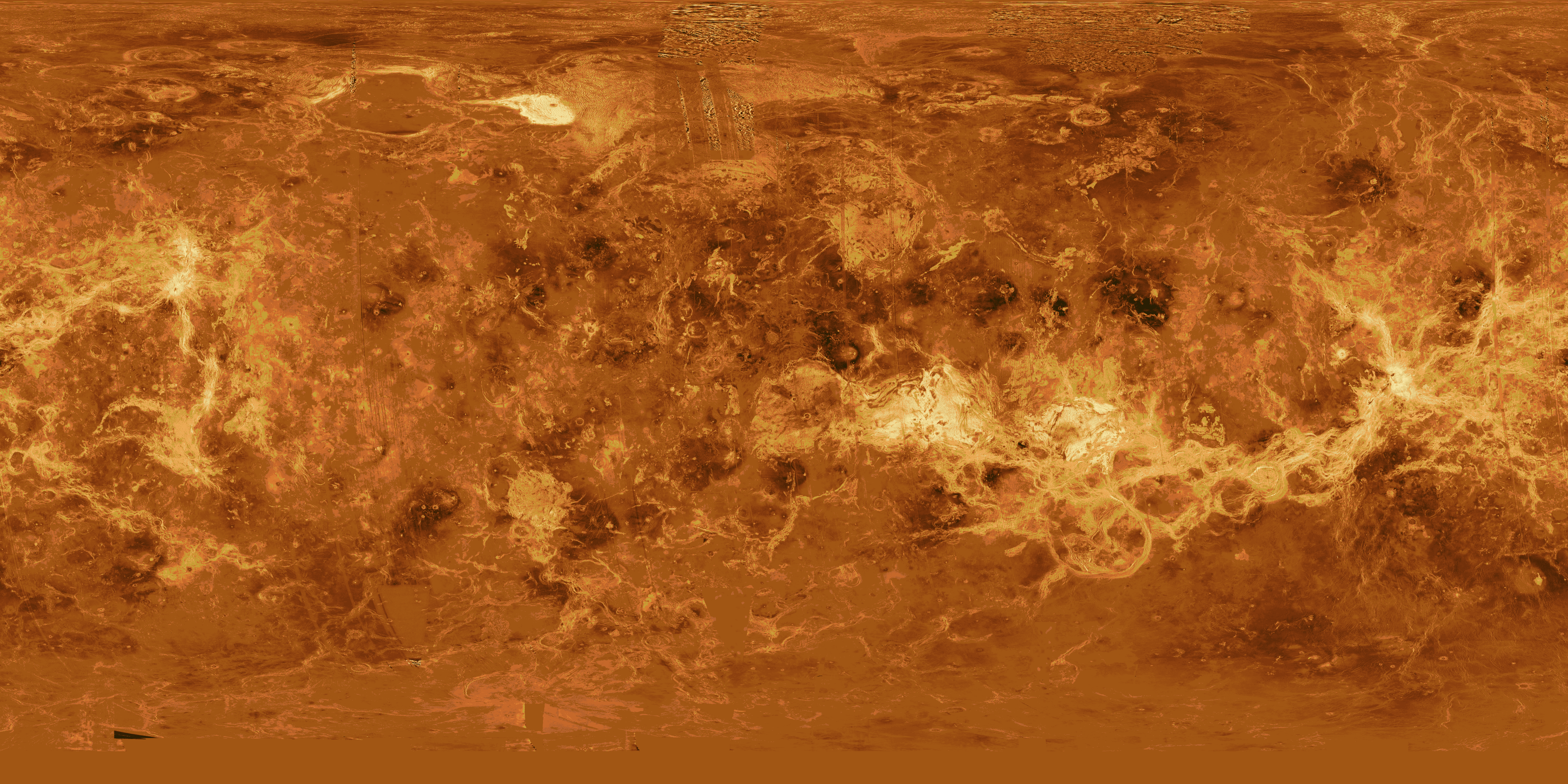
English: This image is a composite of the complete radar image collection obtained by the Magellan mission. The Magellan spacecraft was launched aboard space shuttle Atlantis in May 1989 and began mapping the surface of Venus in September 1990. The spacecraft continued to orbit Venus for four years, returning high- resolution images, altimetry, thermal emissions and gravity maps of 98 percent of the surface. Magellan spacecraft operations ended on October 12, 1994, when the radio contact was lost with the spacecraft during its controlled descent into the deeper portions of the Venusian atmosphere. Venus is displayed in this simple cylindrical map of the planet's surface. The right and left edges of the image are at 240 degrees east longitude. The top and bottom of the image are at 90 degrees north latitude and 90 degrees south latitude, respectively. Magellan synthetic aperture radar mosaics are mapped onto a rectangular latitude- longitude grid to create this image. Data gaps are filled with Pioneer-Venus Orbiter altimetric data, or a constant mid-range value. Simulated color is used to enhance small-scale structure. The simulated hues are based on color images recorded by the Soviet Venera 13 and 14 spacecraft. At the top, left of center, the bright region is Maxwell Montes, the highest mountain range on Venus. Extending along the equator to the right of center is Aphrodite Terra, a large highland region on Venus. The scattered dark patches in this image are halos surrounding some of the younger impact craters. This global data set reveals a number of craters consistent with an average Venus surface age of 300 million to 500 million years. |
| 日付 | |
| 原典 | http://solarviews.com/cap/venus/venmap.htm (image link) |
| 作者 | NASA / Jet Propulsion Laboratory |
| 許可 (ファイルの再利用) |
NASA - Permission |
ライセンス
[編集]
| このファイルはアメリカ航空宇宙局(NASA)によって作成されたものです。NASAの著作権の方針では、特記事項が無い場合、NASAの資料はパブリックドメインとなります。 (詳しくはTemplate:PD-USGov、NASAの著作権の方針について(英語)又はジェット推進研究所(JPL)の画像使用に関するガイドライン(英語)をご覧ください。) |
||
 |
注意事項:
|
ファイルの履歴
過去の版のファイルを表示するには、その版の日時をクリックしてください。
| 日付と時刻 | サムネイル | 寸法 | 利用者 | コメント | |
|---|---|---|---|---|---|
| 現在の版 | 2015年8月24日 (月) 10:08 | | 5,120 × 2,560 (2.42メガバイト) | Jcpag2012 (トーク | 投稿記録) | User created page with UploadWizard |
このファイルは上書きできません。
ファイルの使用状況
以下のページがこのファイルを使用しています:
グローバルなファイル使用状況
以下に挙げる他のウィキがこの画像を使っています:
- ja.wikipedia.org での使用状況