File:Daedongyeojijeondo small.jpg

Pradinė rinkmena (700 × 1 165 taškų, rinkmenos dydis: 340 KiB, MIME tipas: image/jpeg)
Captions
Captions
- Description:
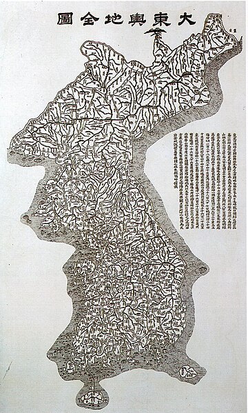
- A map of Korea "大東與地全圖""대동여지전도", painted by Korean geograph 김정호(Kim Jeongho), dating from 1860, showing the "스시마 섬"(Tsushima Islands) as part of Korea.
|
Šis failas yra viešo naudojimo tose šalyse, kuriose autorių teisės galiojimo netenka po 70 metų nuo autoriaus mirties.
| |
| This file has been identified as being free of known restrictions under copyright law, including all related and neighboring rights. | |
Rinkmenos istorija
Paspauskite ant datos/laiko, kad pamatytumėte rinkmeną tokią, kokia ji buvo tuo metu.
| Data/Laikas | Miniatiūra | Matmenys | Naudotojas | Paaiškinimas | |
|---|---|---|---|---|---|
| dabartinis | 07:22, 14 gegužės 2005 | | 700 × 1 165 (340 KiB) | Carnildo (aptarimas | indėlis) | '''Description:''' A map of Korea dating from 1860, showing the Tsushima Islands as part of Korea. {{PD}} Category:Maps of Korea |
Jūs negalite perrašyti šios rinkmenos.
Rinkmenos naudojimas
Šie puslapiai naudoja šią rinkmeną:
- Atlas of North Korea
- Atlas of South Korea
- Old maps of Korea
- File:Daedongyeojido 1860.jpg (failo peradresavimas)
Visuotinis rinkmenos naudojimas
Ši rinkmena naudojama šiose viki svetainėse:
- Naudojama bo.wikipedia.org
- Naudojama ca.wikipedia.org
- Naudojama en.wikipedia.org
- Korea
- History of South Korea
- Jiandao
- Gim Jeong-ho
- Coup d'état of December Twelfth
- Provisional Government of the Republic of Korea
- Geography of Korea
- First Republic of Korea
- United States Army Military Government in Korea
- April Revolution
- Supreme Council for National Reconstruction
- Second Republic of Korea
- Third Republic of Korea
- Fourth Republic of Korea
- Template:History of South Korea
- Fifth Republic of Korea
- Coup d'état of May Seventeenth
- Naudojama es.wikipedia.org
- Naudojama hi.wikipedia.org
- Naudojama id.wikipedia.org
- Naudojama it.wikiquote.org
- Naudojama ko.wikipedia.org
- Naudojama ms.wikipedia.org
- Sejarah Korea Selatan
- Templat:Sejarah Korea Selatan
- Pemerintahan Tentera Darat Amerika Syarikat di Korea
- Republik Pertama Korea Selatan
- Pengguna:Polar/Templat kembangan menegak
- Perjuangan Demokratik Jun
- Republik Kedua Korea Selatan
- Revolusi April
- Majlis Tertinggi Pembinaan Semula Negara
- Republik Ketiga Korea Selatan
- Republik Keempat Korea Selatan
- Republik Kelima Korea Selatan
- Rampasan kuasa 12 Disember
- Rampasan kuasa 17 Mei
- Naudojama my.wikipedia.org
- Naudojama sq.wikipedia.org
- Naudojama sv.wikipedia.org
- Naudojama ta.wikipedia.org
- Naudojama vi.wikipedia.org