File:Daita bypass.jpg
跳至導覽
跳至搜尋
預覽大小:800 × 478 像素。 其他解析度:320 × 191 像素 | 640 × 382 像素 | 1,024 × 612 像素 | 1,280 × 764 像素 | 1,733 × 1,035 像素。
原始檔案 (1,733 × 1,035 像素,檔案大小:1.54 MB,MIME 類型:image/jpeg)
說明
說明
添加單行說明來描述出檔案所代表的內容
| 描述 |
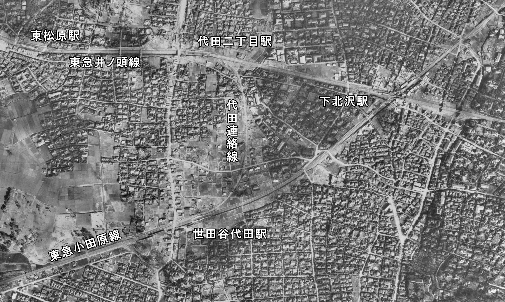
English: Daita Bypass. 日本語: 代田連絡線。 |
| 日期 | |
| 來源 |
|
| 作者 |
日本語: 国土地理院
|

|
本檔案的著作權持有者,Ministry of Land, Infrastructure, Transport and Tourism,在註明所有人姓名的前提下,允許任何人使用本檔案於任何用途。包含再散布、衍生作品、商業用途及其他用途。 |
姓名標示:
National Land Image Information (Color Aerial Photographs), created by Ministry of Land, Infrastructure, Transport and Tourism, distributed by Geospatial Information Authority of Japan
|

檔案歷史
點選日期/時間以檢視該時間的檔案版本。
| 日期/時間 | 縮圖 | 尺寸 | 用戶 | 備註 | |
|---|---|---|---|---|---|
| 目前 | 2017年12月31日 (日) 09:27 | | 1,733 × 1,035(1.54 MB) | ButuCC(對話 | 貢獻) | {{Information |description={{en|1=Daita Bypass.}}{{ja|1=代田連絡線。}} |date=1948-03-29 |source= *国土交通省「国土画像情報(カラー空中写真)」(配布元:国土地理院地図・空中写真閲覧サービス) **[http:/... |
無法覆蓋此檔案。
檔案用途
下列3個頁面有用到此檔案: