File:Damascus Eyalet, Ottoman Empire (1795).png
Перейти к навигации
Перейти к поиску
Размер этого предпросмотра: 716 × 599 пкс. Другие разрешения: 287 × 240 пкс | 574 × 480 пкс | 918 × 768 пкс | 1224 × 1024 пкс | 2434 × 2037 пкс.
Исходный файл (2434 × 2037 пкс, размер файла: 591 КБ, MIME-тип: image/png)
Краткие подписи
Краткие подписи
Добавьте однострочное описание того, что собой представляет этот файл
Краткое описание[править]
.png&action=edit§ion=1)
| Описание |
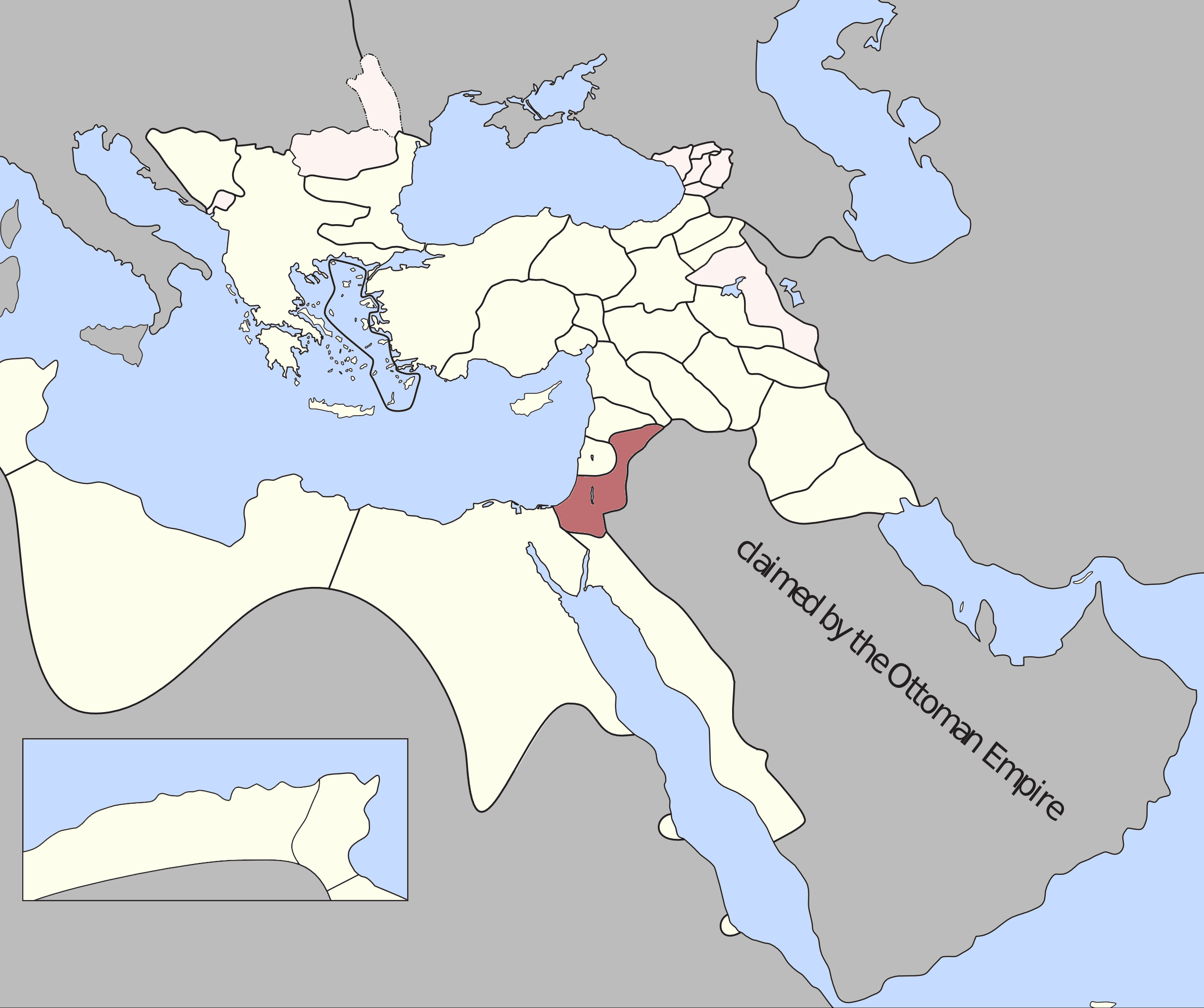
Damascus Eyalet — Ottoman Empire (1795). Source: A Brief History of the Late Ottoman Empire at Google Books By M. Sukru Hanioglu, Figure 1 |
| Дата | |
| Источник | Собственная работа |
| Автор | Underlying lk |
Лицензирование[править]
.png&action=edit§ion=2)
Я, владелец авторских прав на это произведение, добровольно публикую его на условиях следующей лицензии:
Этот файл доступен по лицензии Creative Commons Attribution-Share Alike 3.0 Unported.
- Вы можете свободно:
- делиться произведением – копировать, распространять и передавать данное произведение
- создавать производные – переделывать данное произведение
- При соблюдении следующих условий:
- атрибуция – Вы должны указать авторство, предоставить ссылку на лицензию и указать, внёс ли автор какие-либо изменения. Это можно сделать любым разумным способом, но не создавая впечатление, что лицензиат поддерживает вас или использование вами данного произведения.
- распространение на тех же условиях – Если вы изменяете, преобразуете или создаёте иное произведение на основе данного, то обязаны использовать лицензию исходного произведения или лицензию, совместимую с исходной.
История файла
Нажмите на дату/время, чтобы увидеть версию файла от того времени.
| Дата/время | Миниатюра | Размеры | Участник | Примечание | |
|---|---|---|---|---|---|
| текущий | 00:15, 21 декабря 2012 | | 2434 × 2037 (591 КБ) | Underlying lk (обсуждение | вклад) |
Вы не можете перезаписать этот файл.
Использование файла
Нет страниц, использующих этот файл.
Глобальное использование файла
Данный файл используется в следующих вики:
- Использование в az.wikipedia.org
- Использование в en.wikipedia.org
- Использование в es.wikipedia.org
- Использование в fr.wikipedia.org
- Использование в he.wikipedia.org
- Использование в id.wikipedia.org
- Использование в it.wikipedia.org
- Использование в ko.wikipedia.org
- Использование в pt.wikipedia.org
- Использование в ru.wikipedia.org
- Использование в tr.wikipedia.org
- Использование в uk.wikipedia.org
- Использование в www.wikidata.org
- Использование в zh.wikipedia.org
Метаданные
.png&oldid=706136607)
Категории:
- Locator maps of eyalets of the Ottoman Empire
- Maps of the Ottoman Empire in the 18th century
- Maps of Ottoman Syria
- Maps of the history of Syria
- Maps of the history of Israel
- Maps of the history of Jordan
- Maps of the history of Lebanon
- Maps of the history of Palestine
- Ottoman Syria in the 18th century
- Ottoman Empire in the 1790s
- Maps of 18th-century Arabia