File:Deux-Sèvres department location map.svg
跳至導覽
跳至搜尋

此 SVG 檔案的 PNG 預覽的大小:429 × 599 像素。 其他解析度:172 × 240 像素 | 344 × 480 像素 | 550 × 768 像素 | 733 × 1,024 像素 | 1,467 × 2,048 像素 | 813 × 1,135 像素。
原始檔案 (SVG 檔案,表面大小:813 × 1,135 像素,檔案大小:224 KB)
說明
說明
添加單行說明來描述出檔案所代表的內容
摘要
[編輯]| 拍攝地點 | | 位於此地的本圖片與其他圖片: OpenStreetMap |
|---|
| 描述 |
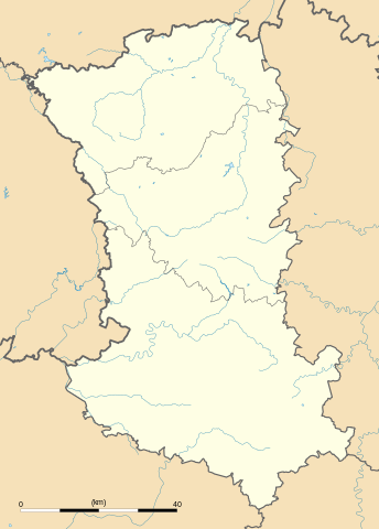
English: Blank administrative map of the department of Deux-Sèvres, France, for geo-location purpose, with distinct boundaries for regions, departments and arrondissements.
Français : Carte administrative vierge du département des Deux-Sèvres, France, destinée à la géolocalisation, avec limite distincte des régions, départements et arrondissements. Approximate scale: 1:480,000 (precision: 120 m)
Geographic limits of the map:
|
||
| 日期 | |||
| 來源 |
自己的作品
|
||
| 作者 | Eric Gaba (Sting - fr:Sting) | ||
| 授權許可 (重用此檔案) |
|
||
| 其他版本 |
|

授權條款
[編輯]
我,本作品的著作權持有者,決定用以下授權條款發佈本作品:
此檔案採用共享創意 姓名標示-相同方式分享 3.0 未在地化版本授權條款。
- 您可以自由:
- 分享 – 複製、發佈和傳播本作品
- 重新修改 – 創作演繹作品
- 惟需遵照下列條件:
- 姓名標示 – 您必須指名出正確的製作者,和提供授權條款的連結,以及表示是否有對內容上做出變更。您可以用任何合理的方式來行動,但不得以任何方式表明授權條款是對您許可或是由您所使用。
- 相同方式分享 – 如果您利用本素材進行再混合、轉換或創作,您必須基於如同原先的相同或兼容的條款,來分布您的貢獻成品。

|
已授權您依據自由軟體基金會發行的無固定段落、封面文字和封底文字GNU自由文件授權條款1.2版或任意後續版本,對本檔進行複製、傳播和/或修改。該協議的副本列在GNU自由文件授權條款中。 |
您可以選擇您需要的授權條款。
檔案歷史
點選日期/時間以檢視該時間的檔案版本。
| 日期/時間 | 縮圖 | 尺寸 | 用戶 | 備註 | |
|---|---|---|---|---|---|
| 目前 | 2008年10月17日 (五) 14:47 | | 813 × 1,135(224 KB) | Sting(對話 | 貢獻) | New version |
| 2008年10月15日 (三) 23:34 |  | 813 × 1,135(219 KB) | Sting(對話 | 貢獻) | Again... | |
| 2008年10月15日 (三) 21:04 |  | 813 × 1,135(217 KB) | Sting(對話 | 貢獻) | Again... | |
| 2008年10月15日 (三) 20:51 |  | 813 × 1,135(214 KB) | Sting(對話 | 貢獻) | Again... | |
| 2008年10月15日 (三) 20:44 |  | 813 × 1,135(218 KB) | Sting(對話 | 貢獻) | Display pb (again) | |
| 2008年10月15日 (三) 20:41 |  | 813 × 1,135(214 KB) | Sting(對話 | 貢獻) | Display pb | |
| 2008年10月15日 (三) 20:32 |  | 813 × 1,135(214 KB) | Sting(對話 | 貢獻) | == Summary == {{Location|46|32|15|N|00|20|15|W|scale:1000000}} <br/> {{Information |Description={{en|Blank administrative map of the department of Deux-Sèvres, France, for geo-location purpose, with distinct boundaries for regions, d |
無法覆蓋此檔案。
檔案用途
下列3個頁面有用到此檔案:
全域檔案使用狀況
以下其他 wiki 使用了這個檔案:
- als.wikipedia.org 的使用狀況
- cs.wikipedia.org 的使用狀況
- de.wikipedia.org 的使用狀況
- eo.wikipedia.org 的使用狀況
- Ŝablono:Situo sur mapo Francio Deux-Sèvres
- Melle (Deux-Sèvres)
- Niort (stacidomo)
- Thouars (stacidomo)
- Saint-Maixent-l'École (stacidomo)
- Saint-Maixent-l'École
- Beauvoir-sur-Niort (stacidomo)
- Beauvoir-sur-Niort
- La Crèche (stacidomo)
- La Crèche
- Marigny (stacidomo)
- Marigny (Deux-Sèvres)
- Épannes (stacidomo)
- Frontenay-Rohan-Rohan
- Amuré
- Fors (stacidomo)
- Fors (Deux-Sèvres)
- Mauzé (stacidomo)
- Mauzé-sur-le-Mignon
- La Mothe-Saint-Héray (stacidomo)
- La Mothe-Saint-Héray
- Sainte-Eanne
- Pamproux (stacidomo)
- Pamproux
- Prin-Deyrançon (stacidomo)
- Prin-Deyrançon
- Prissé-la-Charrière (stacidomo)
- Prissé-la-Charrière
- Plaine-d'Argenson
- Parthenay (stacidomo)
- Cerizay (stacidomo)
- Cerizay
- Saint-Varent (stacidomo)
- Saint-Varent
- Mazières - Verruyes (stacidomo)
- Mazières-en-Gâtine
- Verruyes
- Bressuire (stacidomo)
- Aiffres (stacidomo)
- Aiffres
- Airvault-Gare (stacidomo)
- Brion-près-Thouet (stacidomo)
- Brion-près-Thouet
- Luché (stacidomo)
檢視此檔案的更多全域使用狀況。