File:E40 route.svg
Salta a la navegació
Salta a la cerca

Mida d'aquesta previsualització PNG del fitxer SVG: 800 × 506 píxels. Altres resolucions: 320 × 202 píxels | 640 × 405 píxels | 1.024 × 648 píxels | 1.280 × 810 píxels | 2.560 × 1.620 píxels | 1.819 × 1.151 píxels.
Fitxer original (fitxer SVG, nominalment 1.819 × 1.151 píxels, mida del fitxer: 636 Ko)
Llegendes
Llegendes
Afegeix una explicació d'una línia del que representa aquest fitxer
Resum[modifica]
| Descripció |
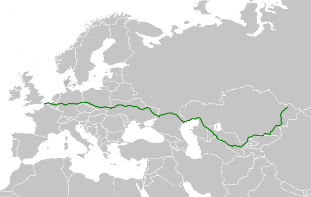
English: Map of the european road E40.
Italiano: Mappa della strada europea E40. |
||||||||
| Data | |||||||||
| Font |
This file was derived from: World map (Miller cylindrical projection, blank).svg |
||||||||
| Autor | Arbalete | ||||||||
| Permís (Com reutilitzar aquest fitxer) |
|

.svg)
Historial del fitxer
Cliqueu una data/hora per veure el fitxer tal com era aleshores.
| Data/hora | Miniatura | Dimensions | Usuari/a | Comentari | |
|---|---|---|---|---|---|
| actual | 22:27, 3 oct 2018 | | 1.819 × 1.151 (636 Ko) | Arbalete (discussió | contribucions) | Dimensioni maggiori |
| 21:50, 3 oct 2018 |  | 183 × 116 (637 Ko) | Arbalete (discussió | contribucions) | Complete road | |
| 17:29, 18 gen 2008 |  | 401 × 420 (101 Ko) | Macia11 (discussió | contribucions) | == Opis == {{Information |Description=E40_route.svg |Source=self made |Date=2008.01.18 |Author=Macia11 |Permission=Released under the GNU Free Documentation License |other_versions=ground map "BlankMap-Europe.svg" }} == Licensing == {{GFDL}} [[Category: |
No podeu sobreescriure aquest fitxer.
Ús del fitxer
Les 5 pàgines següents utilitzen aquest fitxer:
Ús global del fitxer
Utilització d'aquest fitxer en altres wikis:
- Utilització a ar.wikipedia.org
- Utilització a bg.wikipedia.org
- Utilització a ca.wikipedia.org
- Utilització a cs.wikipedia.org
- Utilització a da.wikipedia.org
- Utilització a de.wikipedia.org
- Utilització a en.wikipedia.org
- Utilització a eo.wikipedia.org
- Utilització a es.wikipedia.org
- Utilització a et.wikipedia.org
- Utilització a fa.wikipedia.org
- Utilització a fi.wikipedia.org
- Utilització a fr.wikipedia.org
- Utilització a hr.wikipedia.org
- Utilització a it.wikipedia.org
- Utilització a ka.wikipedia.org
- Utilització a kk.wikipedia.org
- Utilització a ko.wikipedia.org
- Utilització a lmo.wikipedia.org
- Utilització a lt.wikipedia.org
- Utilització a lv.wikipedia.org
- Utilització a nl.wikipedia.org
- Utilització a no.wikipedia.org
- Utilització a pl.wikipedia.org
- Utilització a pt.wikipedia.org
- Utilització a ru.wikipedia.org
- Utilització a sco.wikipedia.org
- Utilització a sk.wikipedia.org
- Utilització a sv.wikipedia.org
- Utilització a tr.wikipedia.org
- Utilització a uk.wikipedia.org
- Utilització a vi.wikipedia.org
- Utilització a vls.wikipedia.org
- Utilització a www.wikidata.org
- Utilització a zh-min-nan.wikipedia.org
- Utilització a zh.wikipedia.org