File:Electoral districts of Finland.svg
跳至導覽
跳至搜尋

此 SVG 檔案的 PNG 預覽的大小:346 × 600 像素。 其他解析度:138 × 240 像素 | 277 × 480 像素 | 443 × 768 像素 | 591 × 1,024 像素 | 1,182 × 2,048 像素 | 610 × 1,057 像素。
原始檔案 (SVG 檔案,表面大小:610 × 1,057 像素,檔案大小:653 KB)
說明
說明
添加單行說明來描述出檔案所代表的內容
摘要
[編輯]
| 描述 |
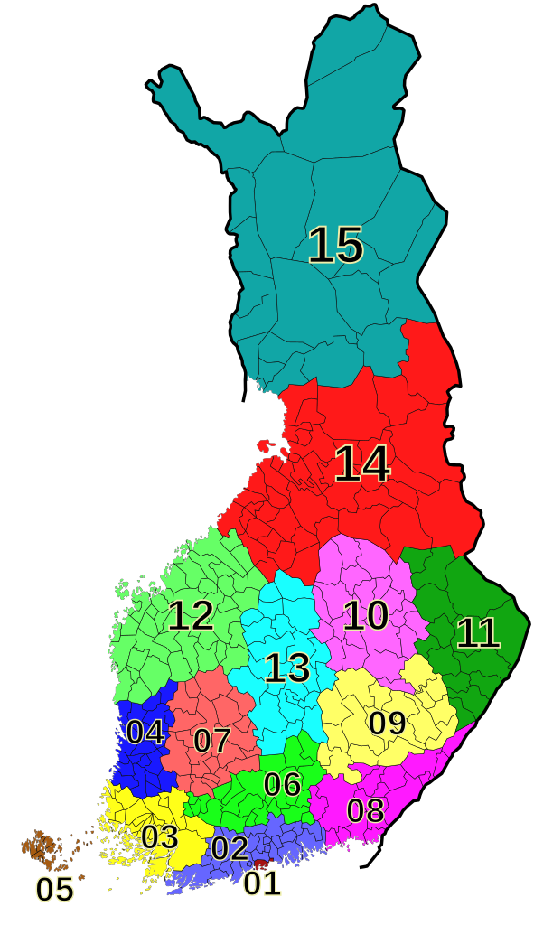
English: Electoral districts of Finland (2011)
Suomi: Suomen vaalipiirit (2011)
Svenska: Valkretsarna i Finland (2011) |
| 日期 | |
| 來源 | 自己的作品 |
| 作者 | hydrox |
授權條款
[編輯]

|
Contains data from the NLS Yleiskartta 1:4 500 000, 2010 |
| This file incorporates data from the National Land Survey of Finland Yleiskartta 1:4 500 000, 2010. Reuse of this file is bound by a license.
Generally, you are free:
Under the following conditions:
Specific license details and terms of use are available at the NLS website. You must observe the terms of the license when reusing this file. |
檔案歷史
點選日期/時間以檢視該時間的檔案版本。
| 日期/時間 | 縮圖 | 尺寸 | 使用者 | 備註 | |
|---|---|---|---|---|---|
| 目前 | 2011年4月4日 (一) 21:21 | | 610 × 1,057(653 KB) | Hydrox(留言 | 貢獻) | try fixing the issue of Helsinki being uncolored |
| 2011年3月28日 (一) 00:35 |  | 610 × 1,057(823 KB) | Hydrox(留言 | 貢獻) | fix fonts | |
| 2011年3月28日 (一) 00:11 |  | 610 × 1,057(823 KB) | Hydrox(留言 | 貢獻) | == {{int:filedesc}} == {{Information |Description= {{en|Electoral districts of Finland (2011)}} {{fi|Suomen vaalipiirit (2011)}} {{sv|Valkretsarna i Finland (2011)}} |Source={{own}} |Date=2011-03-28 |Author=hydrox |Permission= |other_versi |
無法覆蓋此檔案。
檔案用途
下列頁面有用到此檔案:
全域檔案使用狀況
以下其他 wiki 使用了這個檔案:
- de.wikipedia.org 的使用狀況
- pl.wikipedia.org 的使用狀況
- ru.wikipedia.org 的使用狀況
- zh.wikipedia.org 的使用狀況