File:Erebus Ice Tongue - Antarctica.jpg
跳至導覽
跳至搜尋

預覽大小:800 × 599 像素。 其他解析度:320 × 240 像素 | 640 × 479 像素 | 1,024 × 767 像素 | 1,280 × 959 像素 | 1,800 × 1,348 像素。
原始檔案 (1,800 × 1,348 像素,檔案大小:660 KB,MIME 類型:image/jpeg)
說明
說明
添加單行說明來描述出檔案所代表的內容
摘要
[編輯]
| 描述 |
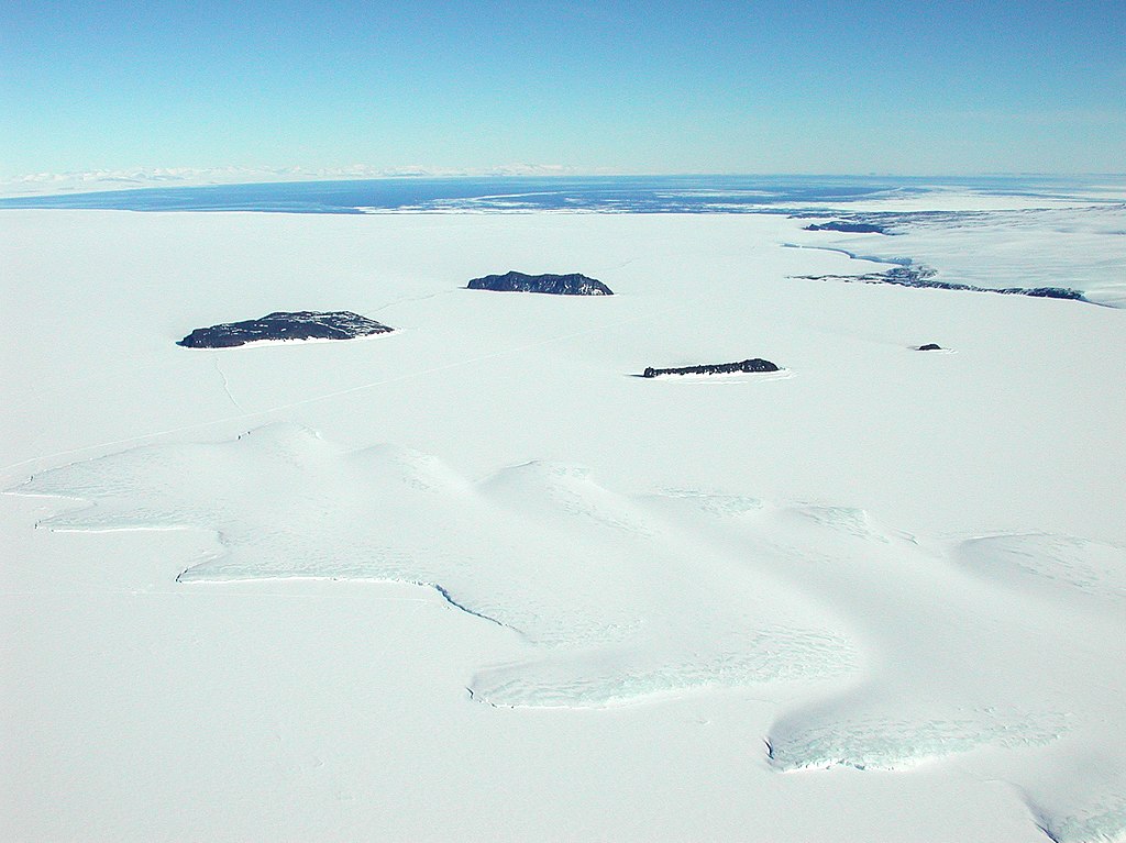
English: Aerial view of McMurdo Sound with Erebus Ice Tongue in the foreground and Ross Sea in the background, Antarctica. Français : Vue aérienne du détroit de Mc Murdo avec la glacier Erebus au premier plan et la mer de Ross au dernier plan, Antarctique. English: Original description: "An aerial view of the Erebus Ice Tongue in front of (left to right) Tent, Inaccessible, Big Razorback and Little Razorback islands. Cape Evans, a small rocky outcropping, can also be seen on the right. The white ice and snow surrounding the islands will thaw into open ocean water by late December. The ice edge and open water can be seen in the distance." |
| 日期 | |
| 來源 | Antarctic Photo Library, U.S. Antarctic Program |
| 作者 | NSF/Josh Landis, employee 1999-2001 |
授權條款
[編輯]
| This image is a work of a National Science Foundation employee, taken or made as part of that person's official duties. As a work of the U.S. federal government, the image is in the public domain. |  |
檔案歷史
點選日期/時間以檢視該時間的檔案版本。
| 日期/時間 | 縮圖 | 尺寸 | 用戶 | 備註 | |
|---|---|---|---|---|---|
| 目前 | 2007年3月13日 (二) 19:13 | | 1,800 × 1,348(660 KB) | Eugene van der Pijll(對話 | 貢獻) | Erebus Ice Tongue - Antarctica Source: Antarctic Photo Library, U.S. Antarctic Program [http://photolibrary.usap.gov/Portscripts/PortWeb.dll?query&field1=Filename&op1=matches&value=islandstongue.jpg&catalog=Antarctica&template=USAPgovMidThumbs] Photogra |
無法覆蓋此檔案。
檔案用途
下列2個頁面有用到此檔案:
全域檔案使用狀況
以下其他 wiki 使用了這個檔案:
- ceb.wikipedia.org 的使用狀況
- de.wikipedia.org 的使用狀況
- en.wikipedia.org 的使用狀況
- es.wikipedia.org 的使用狀況
- fr.wikipedia.org 的使用狀況
- he.wikipedia.org 的使用狀況
- lt.wikipedia.org 的使用狀況
- nl.wikipedia.org 的使用狀況
- nn.wikipedia.org 的使用狀況
- uk.wikipedia.org 的使用狀況
- www.wikidata.org 的使用狀況
- zh.wikipedia.org 的使用狀況