File:Eurasian Plate map-fr.png
跳至導覽
跳至搜尋

預覽大小:800 × 302 像素。 其他解析度:320 × 121 像素 | 640 × 242 像素 | 1,024 × 387 像素 | 1,280 × 483 像素 | 3,325 × 1,255 像素。
原始檔案 (3,325 × 1,255 像素,檔案大小:209 KB,MIME 類型:image/png)
說明
說明
添加單行說明來描述出檔案所代表的內容
| 描述 |
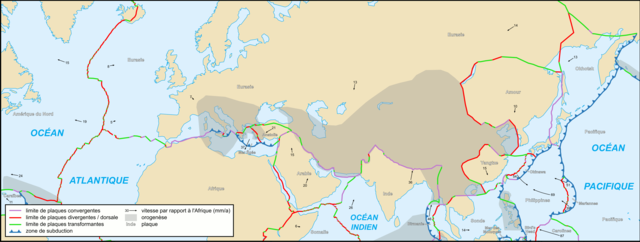
Français : Carte de la plaque eurasienne English: Map of the Eurasian Plate 中文:欧亚大陆板块地图 |
| 日期 | |
| 來源 | Cropped version by myself of Image:Tectonic_plates_boundaries_detailed-fr.svg created by Sting under CC-BY-SA |
| 作者 | Sting and Rémih |
| 授權許可 (重用此檔案) |
此檔案採用創用CC 姓名標示-相同方式分享 2.5 通用版授權條款。
|
| 其他版本 |
File:Eurasian Plate map-sr.png; Scaled version of  |
檔案歷史
點選日期/時間以檢視該時間的檔案版本。
| 日期/時間 | 縮圖 | 尺寸 | 用戶 | 備註 | |
|---|---|---|---|---|---|
| 目前 | 2006年11月20日 (一) 13:19 | 3,325 × 1,255(209 KB) | Sting(對話 | 貢獻) | Still bug | |
| 2006年11月20日 (一) 13:12 | 3,325 × 1,255(314 KB) | Sting(對話 | 貢獻) | Display bug ? | ||
| 2006年11月20日 (一) 12:58 | 3,325 × 1,255(314 KB) | Sting(對話 | 貢獻) | smaller key; reduced weight of file | ||
| 2006年11月18日 (六) 22:58 | 3,310 × 1,233(1.87 MB) | Rémih(對話 | 貢獻) | {{Information |Description={{fr|Carte de la plaque eurasienne}}{{en|Map of the Eurasian Plate}} |Source=Cropped version by myself of Image:Tectonic_plates_boundaries_detailed-fr.svg created by Sting under CC-BY-SA |Date=18/11/2006 |Aut |
無法覆蓋此檔案。
檔案用途
沒有使用此檔案的頁面。
全域檔案使用狀況
以下其他 wiki 使用了這個檔案:
- ca.wikipedia.org 的使用狀況
- en.wikipedia.org 的使用狀況
- fr.wikipedia.org 的使用狀況
- pl.wikipedia.org 的使用狀況
- uk.wikipedia.org 的使用狀況
- www.wikidata.org 的使用狀況
- zh.wikipedia.org 的使用狀況