File:Eure department location map.svg
跳至導覽
跳至搜尋

此 SVG 檔案的 PNG 預覽的大小:699 × 600 像素。 其他解析度:280 × 240 像素 | 559 × 480 像素 | 895 × 768 像素 | 1,193 × 1,024 像素 | 2,386 × 2,048 像素 | 1,165 × 1,000 像素。
原始檔案 (SVG 檔案,表面大小:1,165 × 1,000 像素,檔案大小:431 KB)
說明
說明
添加單行說明來描述出檔案所代表的內容
摘要
[編輯]| 拍攝地點 | | 位於此地的本圖片與其他圖片: OpenStreetMap |
|---|
| 描述 |
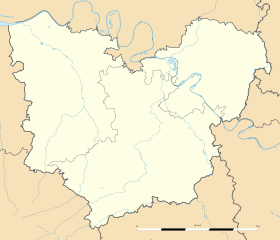
Français : Carte administrative vierge du département de l'Eure, France, destinée à la géolocalisation. Estimated scale: 1:400,000 (precision: 100 m)
Geographic limits of the map:
|
||
| 日期 | |||
| 來源 |
自己的作品
|
||
| 作者 | Eric Gaba (Sting - fr:Sting) | ||
| 授權許可 (重用此檔案) |
|
||
| 其他版本 |
|

授權條款
[編輯]
Eric Gaba, Wikimedia Commons user Sting,此作品的版權所有人,決定用以下授權條款發佈本作品:
此檔案採用共享創意 姓名標示-相同方式分享 3.0 未在地化版本授權條款。
姓名標示: Eric Gaba, Wikimedia Commons user Sting
- 您可以自由:
- 分享 – 複製、發佈和傳播本作品
- 重新修改 – 創作演繹作品
- 惟需遵照下列條件:
- 姓名標示 – 您必須指名出正確的製作者,和提供授權條款的連結,以及表示是否有對內容上做出變更。您可以用任何合理的方式來行動,但不得以任何方式表明授權條款是對您許可或是由您所使用。
- 相同方式分享 – 如果您利用本素材進行再混合、轉換或創作,您必須基於如同原先的相同或兼容的條款,來分布您的貢獻成品。
檔案歷史
點選日期/時間以檢視該時間的檔案版本。
| 日期/時間 | 縮圖 | 尺寸 | 用戶 | 備註 | |
|---|---|---|---|---|---|
| 目前 | 2010年3月12日 (五) 01:38 | | 1,165 × 1,000(431 KB) | Sting(對話 | 貢獻) | == {{int:filedesc}} == {{Location|49|04|30|N|01|03|00|E|scale:500000}} <br/> {{Information |Description={{en|Blank administrative map of the department of Eure, France, for geo-location purpose.}} |
無法覆蓋此檔案。
檔案用途
下列3個頁面有用到此檔案:
全域檔案使用狀況
以下其他 wiki 使用了這個檔案:
- als.wikipedia.org 的使用狀況
- de.wikipedia.org 的使用狀況
- eo.wikipedia.org 的使用狀況
- Gisors
- Ŝablono:Situo sur mapo Francio Eure
- Les Andelys
- Bernay (Eure)
- Conches-en-Ouche
- Giverny
- Évreux-Normandie (stacidomo)
- Verneuil-sur-Avre
- Bernay (stacidomo)
- Serquigny (stacidomo)
- Val-de-Reuil (stacidomo)
- Beaumont-le-Roger
- Pont-Audemer
- Verneuil-sur-Avre (stacidomo)
- Brionne (stacidomo)
- Bourgtheroulde-Infreville
- Thuit-Hébert
- Bueil (stacidomo)
- Glos - Montfort (stacidomo)
- Bourgtheroulde - Thuit-Hébert (stacidomo)
- Bourth
- Bourth (stacidomo)
- Nonancourt
- Tillières-sur-Avre
- Saint-Germain-sur-Avre
- Tillières (stacidomo)
- Nonancourt (stacidomo)
- Saint-Germain - Saint-Rémy (stacidomo)
- Acquigny
- Aigleville
- Amfreville-sur-Iton
- Angerville-la-Campagne
- Arnières-sur-Iton
- Aviron (Eure)
- Les Baux-Sainte-Croix
- Boisset-les-Prévanches
- La Boissière (Eure)
- Le Boulay-Morin
- Breuilpont
- Caillouet-Orgeville
- Caugé
- Chaignes
- Chambray
- Louviers
- Boncourt (Eure)
- La Chapelle-du-Bois-des-Faulx
檢視此檔案的更多全域使用狀況。