File:Europe 912 en.jpg
跳转到导航
跳转到搜索

本预览的尺寸:584 × 599像素。 其他分辨率:234 × 240像素 | 468 × 480像素 | 748 × 768像素 | 1,206 × 1,238像素。
原始文件 (1,206 × 1,238像素,文件大小:529 KB,MIME类型:image/jpeg)
说明
说明
添加一行文字以描述该文件所表现的内容
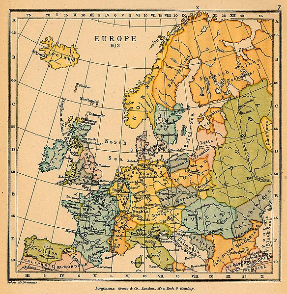
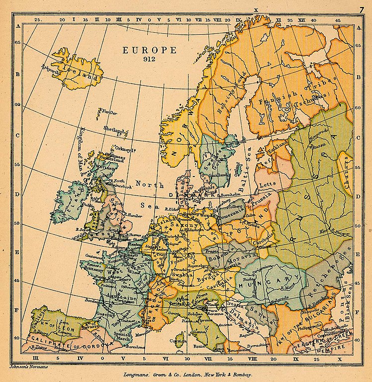
Political map of Europe in 912 CE
_en.png)
.png)
.jpg)
摘要
[编辑]
| 描述 |
English: A political map of most of Europe in 912 CE |
| 日期 | |
| 来源 | The map is taken from "The Public Schools Historical Atlas" by Charles Colbeck. Longmans, Green; New York; London; Bombay. 1905. It was accessed through the University of Texas at Austin's Perry-Castañeda Library Map Collection. |
| 作者 | Charles Colbeck |
许可协议
[编辑]
|
公有领域作品必须在美国以及来源国没有版权问题,才能上传至维基共享资源。如果此作品不是美国作品,这个文件必须要有一个额外的版权标记显示此文件在来源国的版权状态。
注意:此标签不应用于录音作品。 |
文件历史
点击某个日期/时间查看对应时刻的文件。
| 日期/时间 | 缩略图 | 大小 | 用户 | 备注 | |
|---|---|---|---|---|---|
| 当前 | 2019年1月11日 (五) 18:28 | | 1,206 × 1,238(529 KB) | Bryanrutherford0(留言 | 贡献) | User created page with UploadWizard |
您不可以覆盖此文件。
文件用途
没有页面使用本文件。
全域文件用途
以下其他wiki使用此文件:
- en.wikipedia.org上的用途
- no.wikipedia.org上的用途