File:European Greens - countries with member and candidate parties.svg
跳至導覽
跳至搜尋

此 SVG 檔案的 PNG 預覽的大小:732 × 599 像素。 其他解析度:293 × 240 像素 | 586 × 480 像素 | 938 × 768 像素 | 1,251 × 1,024 像素 | 2,501 × 2,048 像素 | 740 × 606 像素。
原始檔案 (SVG 檔案,表面大小:740 × 606 像素,檔案大小:703 KB)
說明
說明
添加單行說明來描述出檔案所代表的內容
摘要
[編輯]
| 描述 |
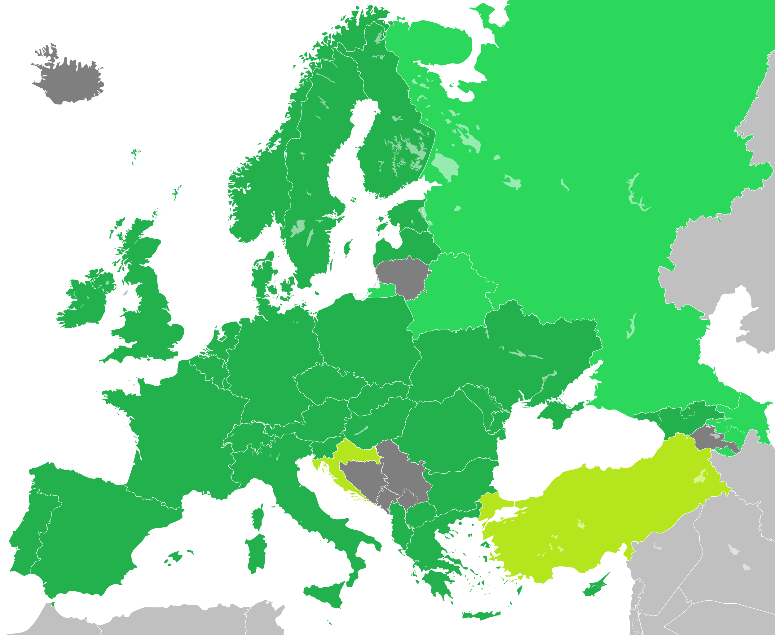
English: A map showing all states in which member, associate and candidate parties of the European Green Party exist.
States in which member (and possibly candidate) parties exist.
States in which associate parties exist.
States in which candidate parties exist.
Sources des données : Français : Carte des États européens où existent un parti membre, associé ou candidat au Parti vert européen.
États où existe un parti membre.
États où existe un parti associé.
États où existe un parti candidat.
Sources of data: Hrvatski: Karta koja prikazuje zemlje u kojima postoje stranke članice, kandidatkinje ili savezničke stranke Europske zelene stranke.
Države u kojima postoje stranke članice. Moguće je i postojanje stranki kandidatkinja.
Države u kojima postoje savezničke stranke.
Države u kojima postoje stranke kandidatkinje.
Izvori podataka: |
| 日期 | |
| 來源 | Map by user Hmxhmx. Based on this file on Wikimedia Commons by user Maix. |
| 作者 | Hmxhmx |
| 其他版本 | File:Blank map of Europe cropped.svg File:European Greens - countries with member and observer parties - 2011.svg |
| 這是一張修飾過的圖片,即本圖片是用軟體修改過後的版本,修改的方式或內容有:Colored countries in the appropriate colors。
|
授權條款
[編輯]
我,本作品的著作權持有者,決定用以下授權條款發佈本作品:
此檔案採用共享創意 姓名標示-相同方式分享 4.0 國際授權條款。
- 您可以自由:
- 分享 – 複製、發佈和傳播本作品
- 重新修改 – 創作演繹作品
- 惟需遵照下列條件:
- 姓名標示 – 您必須指名出正確的製作者,和提供授權條款的連結,以及表示是否有對內容上做出變更。您可以用任何合理的方式來行動,但不得以任何方式表明授權條款是對您許可或是由您所使用。
- 相同方式分享 – 如果您利用本素材進行再混合、轉換或創作,您必須基於如同原先的相同或兼容的條款,來分布您的貢獻成品。

|
已授權您依據自由軟體基金會發行的無固定段落、封面文字和封底文字GNU自由文件授權條款1.2版或任意後續版本,對本檔進行複製、傳播和/或修改。該協議的副本列在GNU自由文件授權條款中。 |
您可以選擇您需要的授權條款。
檔案歷史
點選日期/時間以檢視該時間的檔案版本。
| 日期/時間 | 縮圖 | 尺寸 | 用戶 | 備註 | |
|---|---|---|---|---|---|
| 目前 | 2019年6月1日 (六) 12:34 | | 740 × 606(703 KB) | Hmxhmx(對話 | 貢獻) | updated map (https://www.globalgreens.org/federations#europe) |
| 2016年10月15日 (六) 17:29 |  | 740 × 606(703 KB) | Hmxhmx(對話 | 貢獻) | Fixed Russia and Kazahstan | |
| 2016年10月15日 (六) 16:39 |  | 740 × 606(719 KB) | Hmxhmx(對話 | 貢獻) | {{Information |Description ={{en|1=A map showing all states in which member, associate and candidate parties of the European Green Party exist. {{legend|#22b14c|States in which member (and possibly candidate) parties exist.}} {{legend|#2BD85C|States... |
無法覆蓋此檔案。
檔案用途
全域檔案使用狀況
以下其他 wiki 使用了這個檔案:
- ast.wikipedia.org 的使用狀況
- ca.wikipedia.org 的使用狀況
- cs.wikipedia.org 的使用狀況
- de.wikipedia.org 的使用狀況
- en.wikipedia.org 的使用狀況
- eo.wikipedia.org 的使用狀況
- es.wikipedia.org 的使用狀況
- fi.wikipedia.org 的使用狀況
- hu.wikipedia.org 的使用狀況
- it.wikipedia.org 的使用狀況
- ja.wikipedia.org 的使用狀況
- ko.wikipedia.org 的使用狀況
- lv.wikipedia.org 的使用狀況
- mk.wikipedia.org 的使用狀況
- nl.wikipedia.org 的使用狀況
- no.wikipedia.org 的使用狀況
- pt.wikipedia.org 的使用狀況
- ro.wikipedia.org 的使用狀況
- ru.wikipedia.org 的使用狀況
- sr.wikipedia.org 的使用狀況
- sv.wikipedia.org 的使用狀況
- tr.wikipedia.org 的使用狀況
- uk.wikipedia.org 的使用狀況
- zh.wikipedia.org 的使用狀況