File:Falcon 9 Flight 20 OG2 first stage post-landing (23273082823) cropped.jpg
跳至導覽
跳至搜尋
預覽大小:450 × 600 像素。 其他解析度:180 × 240 像素 | 360 × 480 像素 | 576 × 768 像素 | 1,104 × 1,472 像素。
原始檔案 (1,104 × 1,472 像素,檔案大小:303 KB,MIME 類型:image/jpeg)
說明
說明
添加單行說明來描述出檔案所代表的內容
| 描述 |
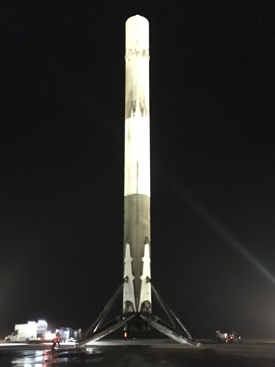
English: The first stage of a Falcon 9 rocket, which launched 11 Orbcomm OG2 satellites, sits on the pad after successfully returning to Cape Canaveral under powered flight and landing vertically. This marks the first time an orbital spaceflight has landed a rocket stage. |
|||||||||
| 日期 | 2015年十二月21日, 22:28:20 | |||||||||
| 來源 | https://www.flickr.com/photos/spacexphotos/23273082823/ | |||||||||
| 作者 | SpaceX | |||||||||
| 授權許可 (重用此檔案) |
|
|||||||||
| 其他版本 |

.jpg)
| 拍攝地點 | | 位於此地的本圖片與其他圖片: OpenStreetMap |
|---|
_cropped.jpg¶ms=028.485781_N_-080.543617_E_globe:Earth_type:camera_heading:94.34&language=zh-hk)
檔案歷史
點選日期/時間以檢視該時間的檔案版本。
| 日期/時間 | 縮圖 | 尺寸 | 用戶 | 備註 | |
|---|---|---|---|---|---|
| 目前 | 2015年12月23日 (三) 00:00 | | 1,104 × 1,472(303 KB) | David Levy(對話 | 貢獻) | {{Information |description={{en|The first stage of a Falcon 9 rocket, which launched 11 Orbcomm OG2 satellites, sits on the pad after successfully returning to Cape Canaveral under powered flight and landing vertically. This marks the first time an orb... |
無法覆蓋此檔案。
檔案用途
下列2個頁面有用到此檔案:
全域檔案使用狀況
以下其他 wiki 使用了這個檔案:
- ar.wikipedia.org 的使用狀況
- en.wikipedia.org 的使用狀況
- Falcon 9 first-stage landing tests
- Wikipedia:Main Page history/2015 December 23
- Wikipedia:Main Page history/2015 December 24
- Wikipedia:Main Page history/2015 December 25
- Wikipedia:Main Page history/2015 December 26
- Wikipedia:Main Page history/2015 December 27
- Wikipedia:Main Page history/2015 December 28
- Wikipedia:Main Page history/2015 December 29
- Wikipedia:Main Page history/2015 December 30
- Wikipedia:Main Page history/2015 December 31
- Wikipedia:Main Page history/2016 January 1
- Wikipedia:Main Page history/2016 January 2
- Wikipedia:Main Page history/2016 January 3
- History of SpaceX
- fr.wikipedia.org 的使用狀況
- id.wikipedia.org 的使用狀況
- jv.wikipedia.org 的使用狀況
- ko.wikipedia.org 的使用狀況
- ko.wikinews.org 的使用狀況
- pt.wikipedia.org 的使用狀況
- simple.wikipedia.org 的使用狀況
- uk.wikipedia.org 的使用狀況
- zh.wikipedia.org 的使用狀況
_cropped.jpg&oldid=689258274)