File:Former Yugoslavia Map.png
元のファイル (3,280 × 2,398 ピクセル、ファイルサイズ: 2.55メガバイト、MIME タイプ: image/png)
キャプション
キャプション
Kosovo is Serbia
I saw michel morpisdkjnfalsdkjvcasd.Ken.
概要
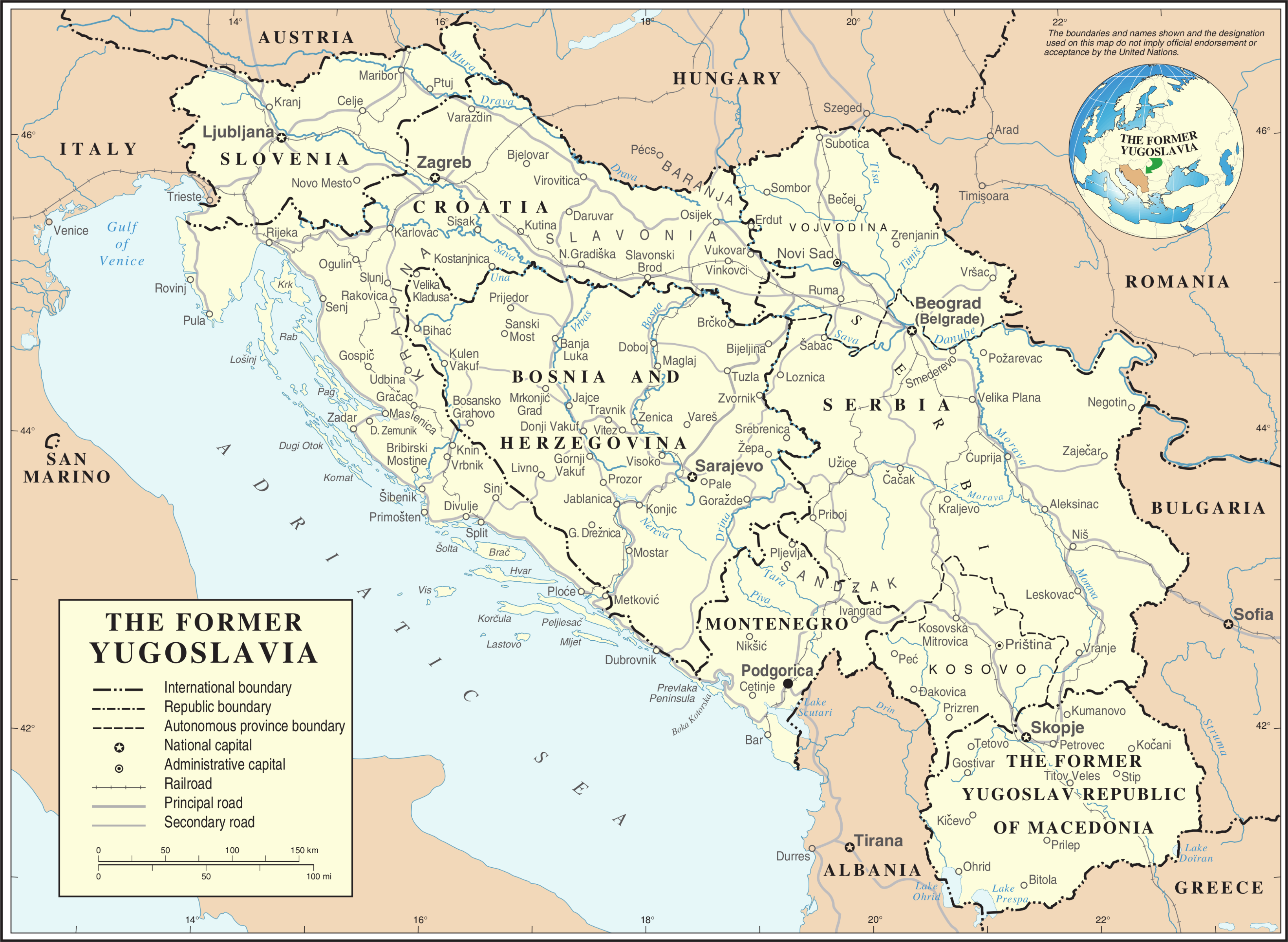
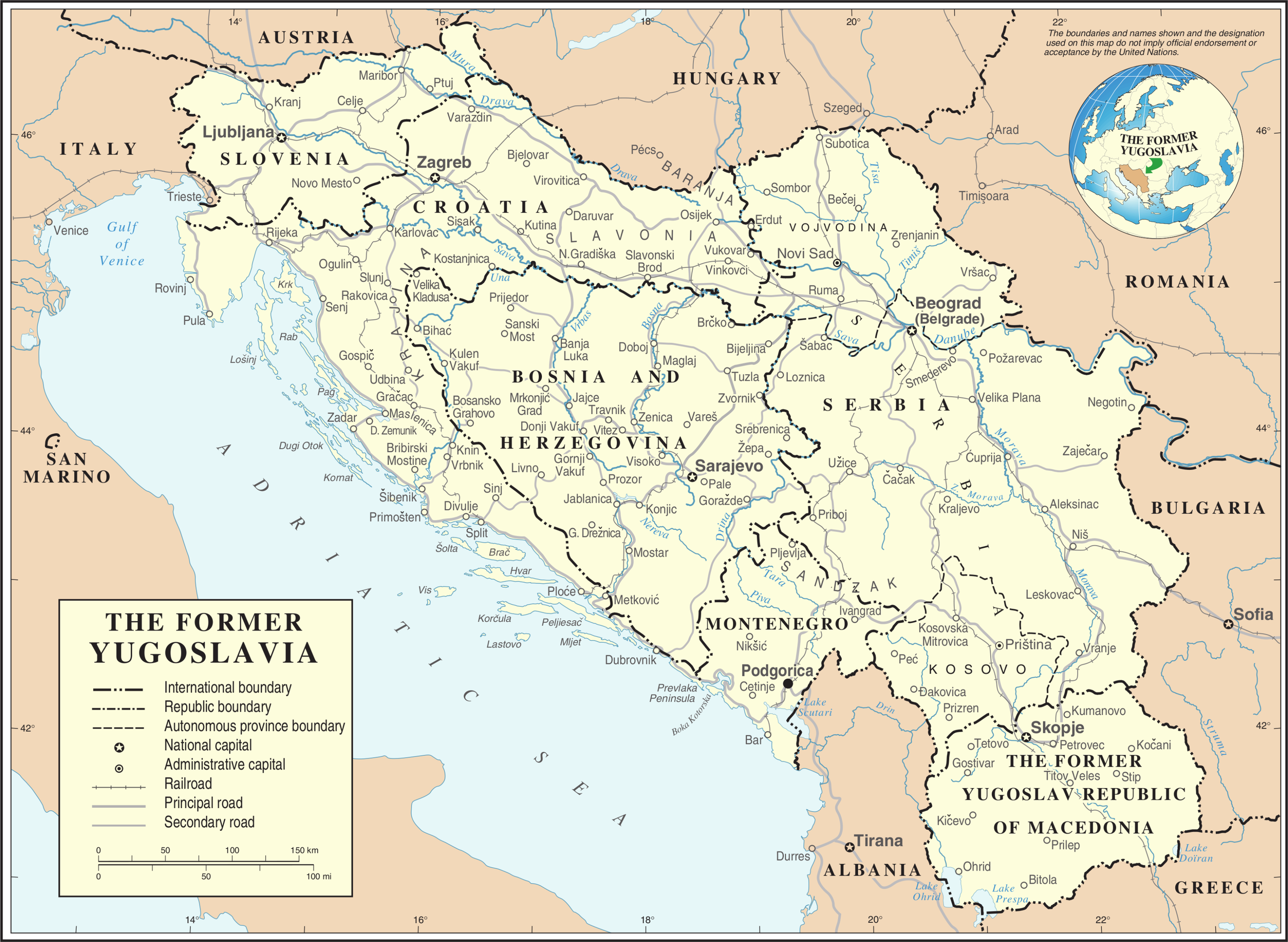
[編集]| 解説 | Map of former Yugoslavia. | |||
| 日付 | ||||
| 原典 | The Cartographic Section of the United Nations (CSUN) | |||
| 作者 | Cartographer of the United Nations | |||
| 許可 (ファイルの再利用) |
|
|||
| その他のバージョン |
|


ファイルの履歴
過去の版のファイルを表示するには、その版の日時をクリックしてください。
| 日付と時刻 | サムネイル | 寸法 | 利用者 | コメント | |
|---|---|---|---|---|---|
| 現在の版 | 2007年10月21日 (日) 20:39 | | 3,280 × 2,398 (2.55メガバイト) | Jeroen (トーク | 投稿記録) | Recreated an updated map from the same source, but now incl. Montenegro and Serbia as independent nations. |
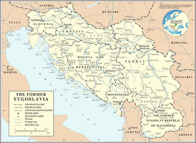
| 2007年3月10日 (土) 17:02 |  | 3,231 × 2,367 (1.6メガバイト) | Minestrone (トーク | 投稿記録) | Former Yugoslavia Map {{Information |Description=Former Yugoslavia Map |Source=The Cartographic Section of the United Nations (CSUN) |Date=2007-03-10 |Author=Cartographer of the United Nations |Permission={{Template:UN map}} and the cartographer of |
このファイルは上書きできません。
ファイルの使用状況
以下の 7 ページがこのファイルを使用しています:
グローバルなファイル使用状況
以下に挙げる他のウィキがこの画像を使っています:
- ar.wikipedia.org での使用状況
- az.wikipedia.org での使用状況
- bs.wikipedia.org での使用状況
- ca.wikipedia.org での使用状況
- ckb.wikipedia.org での使用状況
- cs.wikipedia.org での使用状況
- de.wikipedia.org での使用状況
- el.wiktionary.org での使用状況
- en.wikipedia.org での使用状況
- es.wikipedia.org での使用状況
- fa.wikipedia.org での使用状況
- fr.wikipedia.org での使用状況
- fr.wiktionary.org での使用状況
- id.wikipedia.org での使用状況
- ja.wikipedia.org での使用状況
- ka.wikipedia.org での使用状況
- ko.wikipedia.org での使用状況
- mzn.wikipedia.org での使用状況
このファイルのグローバル使用状況を表示する。