File:GPS Satellite NASA art-iif.jpg
跳去導覽
跳去搵嘢

預覽大細:748 × 599 像素。 第啲解像度:300 × 240 像素 | 599 × 480 像素 | 1,006 × 806 像素。
原本檔案 (1,006 × 806 像素,檔案大細:111 KB ,MIME類型:image/jpeg)
Captions
Captions
Add a one-line explanation of what this file represents
GPS determines the position of a vessel by comparing signals from several transmitting satellites in medium earth orbit (MEO). Differential GPS (DGPS) provides error correction to the GPS signals in order to increase location fix accuracy.
摘要[編輯]
| 描述 |
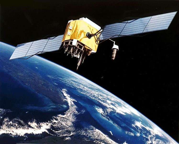
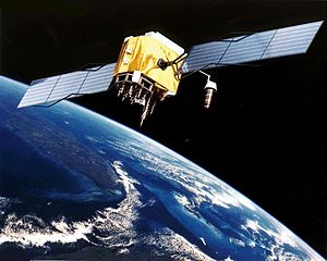
English: Artist's conception of GPS Block II-F satellite in Earth orbit.
Français : Vue d'artiste d'un satellite GPS Block II-F sur orbite terrestre. |
| 日期 | 未知日期 |
| 來源 | https://www.egraphicbd.com [dead link] (Wayback Machine) |
| 作者 | NASA |
| Other versions |

協議[編輯]
| This file is in the public domain in the United States because it was solely created by NASA. NASA copyright policy states that "NASA material is not protected by copyright unless noted". (See Template:PD-USGov, NASA copyright policy page or JPL Image Use Policy.) | ||
 |
Warnings:
|
檔案歷史
撳個日期/時間去睇響嗰個時間出現過嘅檔案。
| 日期/時間 | 縮圖 | 尺寸 | 用戶 | 註解 | |
|---|---|---|---|---|---|
| 現時 | 2006年2月9號 (四) 20:20 | | 1,006 × 806(111 KB) | Michaelfavor~commonswiki(傾偈 | 貢獻) | Artist Interpretation of GPS satellite, image courtesy of NASA http://www.navcen.uscg.gov/ftp/gps/ggeninfo/gps-iif.tif |
你無得衾咗個檔案。
檔案用途
以下嘅3版用到呢個檔:
全域檔案使用情況
下面嘅維基都用緊呢個檔案:
- af.wikipedia.org嘅使用情況
- ar.wikipedia.org嘅使用情況
- ba.wikipedia.org嘅使用情況
- be.wikipedia.org嘅使用情況
- bn.wikipedia.org嘅使用情況
- cs.wikipedia.org嘅使用情況
- cv.wikipedia.org嘅使用情況
- da.wikipedia.org嘅使用情況
- de.wikinews.org嘅使用情況
- el.wikipedia.org嘅使用情況
- en.wikipedia.org嘅使用情況
- Navigation
- Dynamic positioning
- Geoinformatics
- Militarisation of space
- GPS signals
- Wikipedia:WikiProject Systems/List of images of systems
- Talk:USA-193
- Help talk:Table/Archive 3
- List of equipment of the United States Armed Forces
- Error analysis for the Global Positioning System
- User:Doggitydogs/GPS
- User:HelpingWorld/sandbox2
- User:Wikiworkr/sandbox
- User:MYBOIIII/sandbox
- Portal:Geodesy
- en.wikibooks.org嘅使用情況
- en.wikiversity.org嘅使用情況
- es.wikipedia.org嘅使用情況
- es.wikinews.org嘅使用情況
- et.wikipedia.org嘅使用情況
- fa.wikipedia.org嘅使用情況
- fi.wikipedia.org嘅使用情況
- fr.wikipedia.org嘅使用情況
睇呢個檔案嘅更多全域使用情況。