File:GPS Satellite NASA art-iif.jpg
跳至導覽
跳至搜尋

預覽大小:748 × 599 像素。 其他解析度:300 × 240 像素 | 599 × 480 像素 | 1,006 × 806 像素。
原始檔案 (1,006 × 806 像素,檔案大小:111 KB,MIME 類型:image/jpeg)
說明
說明
添加單行說明來描述出檔案所代表的內容
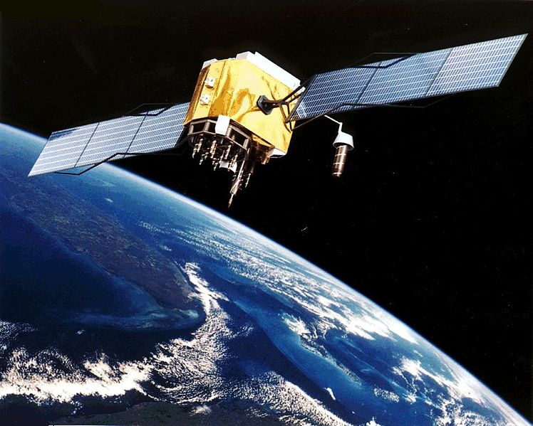
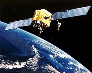
GPS determines the position of a vessel by comparing signals from several transmitting satellites in medium earth orbit (MEO). Differential GPS (DGPS) provides error correction to the GPS signals in order to increase location fix accuracy.
摘要
[編輯]| 描述 |
English: Artist's conception of GPS Block II-F satellite in Earth orbit.
Français : Vue d'artiste d'un satellite GPS Block II-F sur orbite terrestre. |
| 日期 | 日期不明 |
| 來源 | https://www.egraphicbd.com [失效連結] (Wayback Machine) |
| 作者 | NASA |
| 其他版本 |

授權條款
[編輯]
| 本作品由NASA創作,屬於公有領域。根據NASA的版權政策:“NASA的創作除非另有聲明否則不受版權保護。”(參見:Template:PD-USGov/zh,NASA版權政策或JPL圖像使用政策) | ||
 |
警告:
|
檔案歷史
點選日期/時間以檢視該時間的檔案版本。
| 日期/時間 | 縮圖 | 尺寸 | 使用者 | 備註 | |
|---|---|---|---|---|---|
| 目前 | 2006年2月9日 (四) 20:20 | | 1,006 × 806(111 KB) | Michaelfavor~commonswiki(留言 | 貢獻) | Artist Interpretation of GPS satellite, image courtesy of NASA http://www.navcen.uscg.gov/ftp/gps/ggeninfo/gps-iif.tif |
無法覆蓋此檔案。
檔案用途
下列3個頁面有用到此檔案:
全域檔案使用狀況
以下其他 wiki 使用了這個檔案:
- af.wikipedia.org 的使用狀況
- ar.wikipedia.org 的使用狀況
- ba.wikipedia.org 的使用狀況
- be.wikipedia.org 的使用狀況
- bn.wikipedia.org 的使用狀況
- cs.wikipedia.org 的使用狀況
- cv.wikipedia.org 的使用狀況
- da.wikipedia.org 的使用狀況
- de.wikinews.org 的使用狀況
- el.wikipedia.org 的使用狀況
- en.wikipedia.org 的使用狀況
- Navigation
- Dynamic positioning
- Geoinformatics
- Militarisation of space
- GPS signals
- Wikipedia:WikiProject Systems/List of images of systems
- Talk:USA-193
- Help talk:Table/Archive 3
- List of equipment of the United States Armed Forces
- Error analysis for the Global Positioning System
- User:Doggitydogs/GPS
- User:HelpingWorld/sandbox2
- User:Wikiworkr/sandbox
- User:MYBOIIII/sandbox
- Portal:Geodesy
- en.wikibooks.org 的使用狀況
- en.wikiversity.org 的使用狀況
- es.wikipedia.org 的使用狀況
- es.wikinews.org 的使用狀況
- et.wikipedia.org 的使用狀況
- fa.wikipedia.org 的使用狀況
- fi.wikipedia.org 的使用狀況
- fr.wikipedia.org 的使用狀況
檢視此檔案的更多全域使用狀況。