File:Galapagos-satellite-2002.jpg
跳转到导航
跳转到搜索
本预览的尺寸:800 × 600像素。 其他分辨率:320 × 240像素 | 640 × 480像素 | 1,024 × 768像素 | 1,280 × 960像素 | 1,600 × 1,200像素。
原始文件 (1,600 × 1,200像素,文件大小:387 KB,MIME类型:image/jpeg)
说明
说明
添加一行文字以描述该文件所表现的内容
The Galapagos islands
摘要
[编辑]
| 描述 |
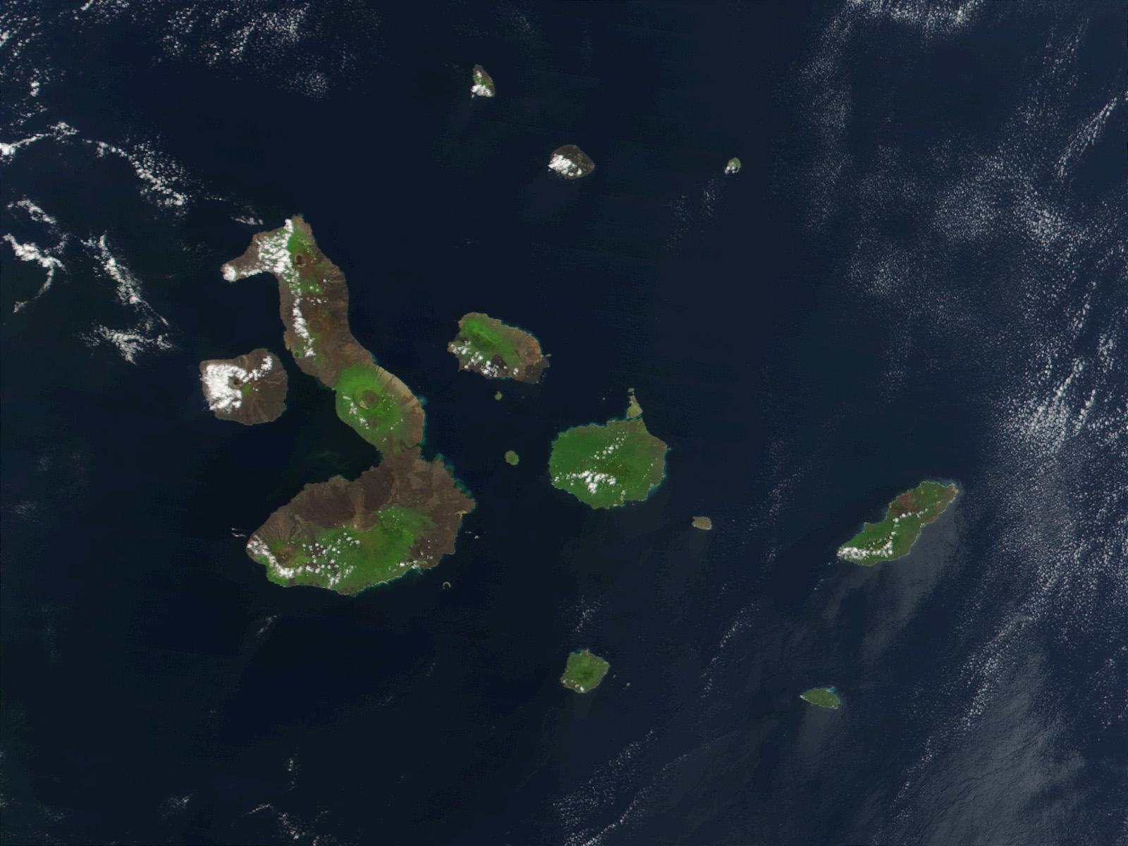
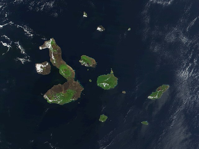
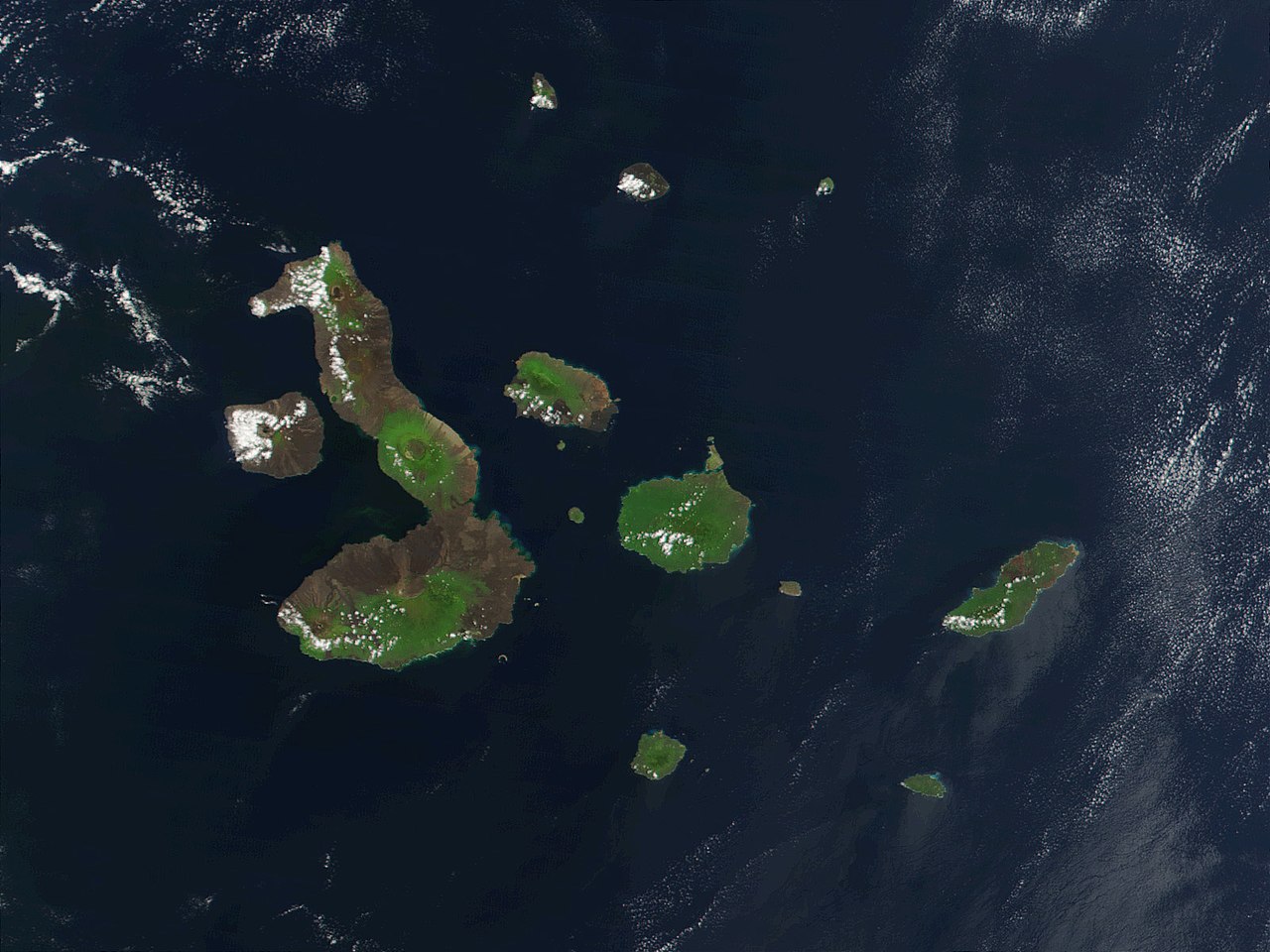
English: This true-color image of the Galapagos Islands was acquired on March 12, 2002, by the Moderate-resolution Imaging Spectroradiometer (MODIS), flying aboard NASA's Terra satellite. The Galapagos Islands, which are part of Ecuador, sit in the Pacific Ocean about 1000 km (620 miles) west of South America. As the three craters on the largest island (Isabela Island) suggest, the archipelago was created by volcanic eruptions, which took place millions of years ago. |
| 日期 | |
| 来源 | Earth Observatory 8270 and NASA GSFC |
| 作者 | Jacques Descloitres, MODIS Rapid Response Project at NASA/GSFC |
许可协议
[编辑]
| 本文件完全由NASA创作,在美国属于公有领域。根据NASA的版权方针,NASA的材料除非另有声明否则不受版权保护。(参见Template:PD-USGov/zh、NASA版权方针页面或JPL图片使用方针。) | ||
 |
警告:
|
| 註解 | 該圖片含有註解:在維基媒體共享資源上查看註解 |
文件历史
点击某个日期/时间查看对应时刻的文件。
| 日期/时间 | 缩略图 | 大小 | 用户 | 备注 | |
|---|---|---|---|---|---|
| 当前 | 2007年11月25日 (日) 21:13 | | 1,600 × 1,200(387 KB) | CarolSpears(留言 | 贡献) | {{Information |Description= This true-color image of the Galapagos Islands was acquired on March 12, 2002, by the Moderate-resolution Imaging Spectroradiometer (MODIS), flying aboard NASA's Terra satellite. The Galapagos Islands, which are part of Ecuador |
您不可以覆盖此文件。
文件用途
以下6个页面使用本文件:
全域文件用途
以下其他wiki使用此文件:
- af.wikipedia.org上的用途
- als.wikipedia.org上的用途
- an.wikipedia.org上的用途
- ast.wikipedia.org上的用途
- azb.wikipedia.org上的用途
- bg.wikipedia.org上的用途
- bn.wikipedia.org上的用途
- br.wikipedia.org上的用途
- ca.wikipedia.org上的用途
- cs.wikipedia.org上的用途
- de.wikipedia.org上的用途
- de.wikinews.org上的用途
- en.wikipedia.org上的用途
- en.wikivoyage.org上的用途
- en.wiktionary.org上的用途
- eo.wikipedia.org上的用途
- es.wikipedia.org上的用途
- frr.wikipedia.org上的用途
- fr.wikipedia.org上的用途
- hu.wikipedia.org上的用途
- hy.wikipedia.org上的用途
- incubator.wikimedia.org上的用途
- it.wikipedia.org上的用途
查看此文件的更多全域用途。