File:Geothermal springs map US.png
跳转到导航
跳转到搜索
本预览的尺寸:800 × 349像素。 其他分辨率:320 × 140像素 | 887 × 387像素。
原始文件 (887 × 387像素,文件大小:78 KB,MIME类型:image/png)
说明
说明
添加一行文字以描述该文件所表现的内容
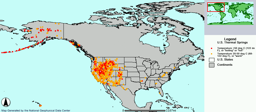
Distribution of geothermal springs in the United States.
文件历史
点击某个日期/时间查看对应时刻的文件。
| 日期/时间 | 缩略图 | 大小 | 用户 | 备注 | |
|---|---|---|---|---|---|
| 当前 | 2006年2月15日 (三) 08:20 | | 887 × 387(78 KB) | Napa(留言 | 贡献) | Geothermal hot springs in the United States. {{PD-USGov-DOC-NOAA}} http://map.ngdc.noaa.gov/website/seg/hot_springs/viewer.htm Category:Maps of North America |
您不可以覆盖此文件。
文件用途
没有页面使用本文件。
全域文件用途
以下其他wiki使用此文件:
- bn.wikipedia.org上的用途
- de.wikipedia.org上的用途
- de.wikivoyage.org上的用途
- en.wikipedia.org上的用途
- eo.wikipedia.org上的用途
- fr.wikipedia.org上的用途
- it.wikipedia.org上的用途
- ja.wikipedia.org上的用途
- pt.wikipedia.org上的用途
- zh.wikipedia.org上的用途