File:Gila County Incorporated and Unincorporated areas Young highlighted.svg
跳至導覽
跳至搜尋

此 SVG 檔案的 PNG 預覽的大小:564 × 599 像素。 其他解析度:226 × 240 像素 | 452 × 480 像素 | 723 × 768 像素 | 964 × 1,024 像素 | 1,927 × 2,048 像素。
原始檔案 (SVG 檔案,表面大小:800 × 850 像素,檔案大小:96 KB)
說明
說明
添加單行說明來描述出檔案所代表的內容
摘要
[編輯]
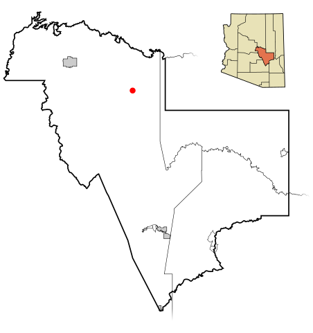
| 描述 | This map shows the incorporated areas and unincorporated areas in Gila County, Arizona. Young is highlighted in red. Incorporated cities are shown in gray and unincorporated communities or CDPs are shown in white. Data for the borders and locations are based on maps from the US Census Bureau TIGER Map Server. I created this map in Inkscape. |
| 日期 | |
| 來源 | My own work, based on public domain information |
| 作者 | Ixnayonthetimmay |
| SVG開發 |
授權條款
[編輯]
| 我,此作品的版權所有人,釋出此作品至公共領域。此授權條款在全世界均適用。 這可能在某些國家不合法,如果是的話: 我授予任何人有權利使用此作品於任何用途,除受法律約束外,不受任何限制。 |
檔案歷史
點選日期/時間以檢視該時間的檔案版本。
| 日期/時間 | 縮圖 | 尺寸 | 用戶 | 備註 | |
|---|---|---|---|---|---|
| 目前 | 2007年3月16日 (五) 19:19 | | 800 × 850(96 KB) | Ixnayonthetimmay(對話 | 貢獻) | {{Information |Description=This map shows the incorporated areas and unincorporated areas in Gila County, Arizona. Young is highlighted in |
無法覆蓋此檔案。
檔案用途
下列頁面有用到此檔案:
全域檔案使用狀況
以下其他 wiki 使用了這個檔案:
- ar.wikipedia.org 的使用狀況
- arz.wikipedia.org 的使用狀況
- azb.wikipedia.org 的使用狀況
- ca.wikipedia.org 的使用狀況
- de.wikipedia.org 的使用狀況
- en.wikipedia.org 的使用狀況
- eu.wikipedia.org 的使用狀況
- fa.wikipedia.org 的使用狀況
- fr.wikipedia.org 的使用狀況
- ht.wikipedia.org 的使用狀況
- it.wikipedia.org 的使用狀況
- sr.wikipedia.org 的使用狀況
- tt.wikipedia.org 的使用狀況
- ur.wikipedia.org 的使用狀況
- www.wikidata.org 的使用狀況
- zh.wikipedia.org 的使用狀況