File:Golan heights border.jpg
Salta a la navegació
Salta a la cerca

Mida d'aquesta previsualització: 800 × 600 píxels. Altres resolucions: 320 × 240 píxels | 640 × 480 píxels | 1.024 × 768 píxels | 1.280 × 960 píxels | 2.304 × 1.728 píxels.
Fitxer original (2.304 × 1.728 píxels, mida del fitxer: 625 Ko, tipus MIME: image/jpeg)
Llegendes
Llegendes
Afegeix una explicació d'una línia del que representa aquest fitxer
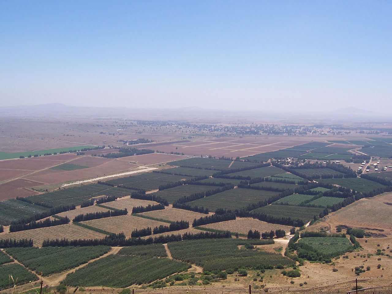
View of Quneitra from Bental mountain
Resum
[modifica]
| Descripció |
Čeština: hranice mezi izraelem a sýrií v golanských výšinách
English: The Golan Heights' border with Syria proper. The Golan Heights end (and Syria begins) where the farmland ends. In the background is the deserted city of Quneitra in Syria. The white buildings on the right are mostly UN buildings.
Русский: Сирийско-израильская граница в Голанских высотах
Français : Vue sur la frontière syro-israélienne à la lisière des hauteurs du Golan. On distingue au loin la ville syrienne de Quneitra désertée. Les bâtiments de couleur claire à droite appartiennent pour la plupart à l'ONU. |
| Data | Taken in 2004 |
| Font | Fotografia pròpia (Original text: I took this picture.) |
| Autor | Masterpjz9 at en.wikipedia |
Llicència
[modifica]
Aquest fitxer està publicat sota la llicència de Creative Commons Reconeixement i Compartir Igual 2.5 Genèrica.
- Sou lliure de:
- compartir – copiar, distribuir i comunicar públicament l'obra
- adaptar – fer-ne obres derivades
- Amb les condicions següents:
- reconeixement – Heu de donar la informació adequada sobre l'autor, proporcionar un enllaç a la llicència i indicar si s'han realitzat canvis. Podeu fer-ho amb qualsevol mitjà raonable, però de cap manera no suggereixi que l'autor us dóna suport o aprova l'ús que en feu.
- compartir igual – Si modifiqueu, transformeu, o generareu amb el material, haureu de distribuir les vostres contribucions sota una llicència similar o una de compatible com l'original
Registre original de càrregues
[modifica]
La pàgina de descripció original era aquí. Els noms d'usuari a continuació es refereixen a en.wikipedia.
- 2006-04-08 03:29 Masterpjz9 2304×1728× (639949 bytes) This is a photo of the Israeli Golan Heights border with Syria. The Golan Heights end (and Syria begins) where the farmland ends. In the background there is an deserted city of Syria, and the white buildings in the right are mostly UN buildings. I took t
Historial del fitxer
Cliqueu una data/hora per veure el fitxer tal com era aleshores.
| Data/hora | Miniatura | Dimensions | Usuari/a | Comentari | |
|---|---|---|---|---|---|
| actual | 02:45, 10 abr 2012 | | 2.304 × 1.728 (625 Ko) | OgreBot (discussió | contribucions) | (BOT): Uploading old version of file from en.wikipedia; originally uploaded on 2006-04-08 03:29:30 by Masterpjz9 |
| 21:09, 31 jul 2006 |  | 800 × 600 (69 Ko) | Becherka (discussió | contribucions) | Israeli golan heights border with syria hranice mezi izraelem a sýrií v golanských výšinách |
No podeu sobreescriure aquest fitxer.
Ús del fitxer
No hi ha pàgines que utilitzin aquest fitxer.
Ús global del fitxer
Utilització d'aquest fitxer en altres wikis:
- Utilització a ar.wikipedia.org
- Utilització a be-tarask.wikipedia.org
- Utilització a ca.wikipedia.org
- Utilització a ckb.wikipedia.org
- Utilització a en.wikipedia.org
- Utilització a fa.wikipedia.org
- Utilització a fr.wikipedia.org
- Utilització a he.wikipedia.org
- Utilització a hu.wikipedia.org
- Utilització a id.wikipedia.org
- Utilització a ja.wikipedia.org
- Utilització a ko.wikipedia.org
- Utilització a ms.wikipedia.org
- Utilització a mzn.wikipedia.org
- Utilització a nl.wikipedia.org
- Utilització a pt.wikipedia.org
- Utilització a ru.wikipedia.org
- Utilització a tg.wikipedia.org
- Utilització a tr.wikipedia.org
- Utilització a vi.wikipedia.org
- Utilització a www.wikidata.org
- Utilització a zh.wikipedia.org