File:Golfe Saint-Laurent en.png
跳去導覽
跳去搵嘢
冇更高解像度嘅圖像。
Golfe_Saint-Laurent_en.png (600 × 555 像素,檔案大細:101 KB ,MIME類型:image/png)
Captions
Captions
Add a one-line explanation of what this file represents
| 描述 | |||||||||
| 日期 | |||||||||
| 來源 | Image:Canada (geolocalisation).svg | ||||||||
| 作者 | Benoit Rochon | ||||||||
| 許可 (重用呢個檔案) |
|
||||||||
| Other versions |
|

.svg)
檔案歷史
撳個日期/時間去睇響嗰個時間出現過嘅檔案。
| 日期/時間 | 縮圖 | 尺寸 | 用戶 | 註解 | |
|---|---|---|---|---|---|
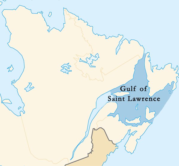
| 現時 | 2015年3月11號 (三) 21:35 | | 600 × 555(101 KB) | Palaeozoic99(傾偈 | 貢獻) | Changed outline of the Gulf of St. Lawrence to confirm with the International Hydrographic Organization, which defines the limits of the Gulf of Saint Lawrence as follows: On the Northeast. A line running from Cape Bauld (North point of Kirpon Island,... |
| 2008年3月15號 (六) 02:43 |  | 600 × 555(102 KB) | Brochon99(傾偈 | 貢獻) | == Description == {{Information |Description= *{{de|Karte {{wde|Sankt-Lorenz-Golf}}, {{wde|Québec}} }} *{{en|Map {{wen|Gulf of Saint Lawrence}}, {{wen|Quebec}} }} *{{fr|Carte {{wfr|Golfe du Saint-Laurent}}, {{wfr|Québec}} }} *{{ja|地図 {{wja|セント |
你無得衾咗個檔案。
檔案用途
以下嘅5版用到呢個檔:
全域檔案使用情況
下面嘅維基都用緊呢個檔案:
- af.wikipedia.org嘅使用情況
- ang.wikipedia.org嘅使用情況
- ar.wikipedia.org嘅使用情況
- bg.wikipedia.org嘅使用情況
- bn.wikipedia.org嘅使用情況
- cy.wikipedia.org嘅使用情況
- de.wikipedia.org嘅使用情況
- en.wikipedia.org嘅使用情況
- et.wikipedia.org嘅使用情況
- fi.wikipedia.org嘅使用情況
- fr.wikipedia.org嘅使用情況
- hu.wikipedia.org嘅使用情況
- ilo.wikipedia.org嘅使用情況
- is.wikipedia.org嘅使用情況
- ka.wikipedia.org嘅使用情況
- la.wikipedia.org嘅使用情況
- mk.wikipedia.org嘅使用情況
- ml.wikipedia.org嘅使用情況
- pa.wikipedia.org嘅使用情況
- pl.wiktionary.org嘅使用情況
- pnb.wikipedia.org嘅使用情況
- simple.wikipedia.org嘅使用情況
- sv.wikipedia.org嘅使用情況
- sw.wikipedia.org嘅使用情況
- ta.wikipedia.org嘅使用情況
- uk.wikipedia.org嘅使用情況
- ur.wikipedia.org嘅使用情況
- vi.wikipedia.org嘅使用情況
- war.wikipedia.org嘅使用情況
- xmf.wikipedia.org嘅使用情況
- zh-min-nan.wikipedia.org嘅使用情況
- zh-yue.wikipedia.org嘅使用情況