File:Gulf Intracoastal Waterway Galveston Bay.jpg
Zur Navigation springen
Zur Suche springen
Größe dieser Vorschau: 800 × 534 Pixel. Weitere Auflösungen: 320 × 214 Pixel | 640 × 427 Pixel | 1.024 × 683 Pixel | 1.500 × 1.001 Pixel.
Originaldatei (1.500 × 1.001 Pixel, Dateigröße: 838 KB, MIME-Typ: image/jpeg)
Bildtexte
Kurzbeschreibungen
Ergänze eine einzeilige Erklärung, was diese Datei darstellt.
Beschreibung[Bearbeiten]
| Beschreibung |
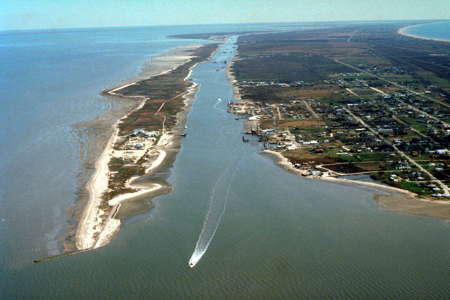
English: The Gulf Intracoastal Waterway enters Galveston Bay from the southwest end of the Bolivar Peninsula at the town of Port Bolivar, Galveston County, Texas, USA. The community of Port Bolivar lies at right at the end of the peninsula. Galveston Bay is the great body of water at left. A small piece of the Gulf of Mexico can be seen at upper right. The U.S. Army Corps of Engineers maintains and dredges the waterway for commercial barge navigation. |
| Datum | (Caveat: Dates provided by U.S. Army Corps of Engineers Digital Visual Library are not reliable and may be wrong.) |
| Quelle |
U.S. Army Corps of Engineers Digital Visual Library Image page Image description page Digital Visual Library home page |
| Urheber | U.S. Army Corps of Engineers, photographer not specified or unknown |
| Kameraposition | | Dieses und weitere Bilder auf OpenStreetMap |
|---|
Lizenz[Bearbeiten]
This image or file is a work of a U.S. Army Corps of Engineers soldier or employee, taken or made as part of that person's official duties. As a work of the U.S. federal government, the image is in the public domain.
|
Dateiversionen
Klicke auf einen Zeitpunkt, um diese Version zu laden.
| Version vom | Vorschaubild | Maße | Benutzer | Kommentar | |
|---|---|---|---|---|---|
| aktuell | 03:39, 10. Mai 2007 | | 1.500 × 1.001 (838 KB) | DanMS (Diskussion | Beiträge) | {{Information | Description = {{en|The Gulf Intracoastal Waterway enters Galveston Bay from the southwest end of the Bolivar Peninsula at the town of Port Bolivar, Galveston County, Texas, USA. The community of Port Bolivar lies at right at the end of |
Du kannst diese Datei nicht überschreiben.
Dateiverwendung
Die folgende Seite verwendet diese Datei:
- File:Bolivar Peninsula, Texas.jpg (Dateiweiterleitung)
Globale Dateiverwendung
Die nachfolgenden anderen Wikis verwenden diese Datei:
- Verwendung auf ceb.wikipedia.org
- Verwendung auf de.wikipedia.org
- Verwendung auf en.wikipedia.org
- Verwendung auf et.wikipedia.org
- Verwendung auf it.wikipedia.org
- Verwendung auf ja.wikipedia.org
- Verwendung auf sl.wikipedia.org
- Verwendung auf www.wikidata.org