File:Haut-Rhin department location map.svg
跳至導覽
跳至搜尋

此 SVG 檔案的 PNG 預覽的大小:391 × 599 像素。 其他解析度:157 × 240 像素 | 313 × 480 像素 | 501 × 768 像素 | 669 × 1,024 像素 | 1,337 × 2,048 像素 | 708 × 1,084 像素。
原始檔案 (SVG 檔案,表面大小:708 × 1,084 像素,檔案大小:286 KB)
說明
說明
添加單行說明來描述出檔案所代表的內容
摘要
[編輯]W3C-validity not checked.
| 拍攝地點 | | 位於此地的本圖片與其他圖片: OpenStreetMap |
|---|
| 描述 |
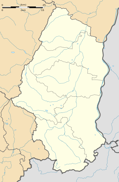
Français : Carte administrative vierge du département du Haut-Rhin, France, destinée à la géolocalisation. Equirectangular projection, WGS84 datum
Geographic limits of the map:
|
||
| 日期 | |||
| 來源 |
自己的作品
|
||
| 作者 | Eric Gaba (Sting - fr:Sting) | ||
| 授權許可 (重用此檔案) |
|
||
| 其他版本 |
|

授權條款
[編輯]
我,本作品的著作權持有者,決定用以下授權條款發佈本作品:
此檔案採用共享創意 姓名標示-相同方式分享 3.0 未在地化版本授權條款。
- 您可以自由:
- 分享 – 複製、發佈和傳播本作品
- 重新修改 – 創作演繹作品
- 惟需遵照下列條件:
- 姓名標示 – 您必須指名出正確的製作者,和提供授權條款的連結,以及表示是否有對內容上做出變更。您可以用任何合理的方式來行動,但不得以任何方式表明授權條款是對您許可或是由您所使用。
- 相同方式分享 – 如果您利用本素材進行再混合、轉換或創作,您必須基於如同原先的相同或兼容的條款,來分布您的貢獻成品。

|
已授權您依據自由軟體基金會發行的無固定段落、封面文字和封底文字GNU自由文件授權條款1.2版或任意後續版本,對本檔進行複製、傳播和/或修改。該協議的副本列在GNU自由文件授權條款中。 |
您可以選擇您需要的授權條款。
檔案歷史
點選日期/時間以檢視該時間的檔案版本。
| 日期/時間 | 縮圖 | 尺寸 | 用戶 | 備註 | |
|---|---|---|---|---|---|
| 目前 | 2009年4月28日 (二) 01:40 | | 708 × 1,084(286 KB) | Sting(對話 | 貢獻) | == Summary == {{Location|47|51|45|N|07|13|30|E|scale:500000}} <br/> {{Information |Description={{en|Blank administrative map of the department of Haut-Rhin, France, for geo-location purpose.}} |
無法覆蓋此檔案。
檔案用途
下列3個頁面有用到此檔案:
全域檔案使用狀況
以下其他 wiki 使用了這個檔案:
- als.wikipedia.org 的使用狀況
- cs.wikipedia.org 的使用狀況
- de.wikipedia.org 的使用狀況
- Flughafen Basel-Mülhausen
- Wikipedia:Kartenwerkstatt/Positionskarten/Europa
- Vorlage:Positionskarte Frankreich Haut-Rhin
- Stade de l’Ill
- Colmar Stadium
- Militärflugplatz Colmar-Meyenheim
- Benutzer:Valo139/Vorlage:Infobox Grenzübergang
- Benutzer:Valo139/Vorlage:Infobox Grenzübergang/Doku
- Bahnhof Pfetterhouse
- eo.wikipedia.org 的使用狀況
- Mulhouse
- Ŝablono:Geokesto lokumilo Haut-Rhin
- Ŝablono:Geokesto lokumilo Bas-Rhin
- Ŝablono:Situo sur mapo Francio Haut-Rhin
- Riquewihr
- Saint-Louis (Haut-Rhin)
- Mulhouse-Ville (stacidomo)
- Colmar (stacidomo)
- Cernay (Haut-Rhin) (stacidomo)
- Lutterbach (stacidomo)
- Rixheim (stacidomo)
- Mulhouse-Dornach (stacidomo)
- Kruth
- Kruth (stacidomo)
- Saint-Louis (stacidomo)
- Altkirch (stacidomo)
- Ingersheim-Cité-Scolaire (stacidomo)
- Ingersheim (Haut-Rhin)
- Turckheim (stacidomo)
- Metzeral (stacidomo)
- Munster (stacidomo)
- Munster-Badischhof (stacidomo)
- Mulhouse-Nord (stacidomo)
- Colmar-Mésanges (stacidomo)
- Colmar-Saint-Joseph (stacidomo)
- Thann (stacidomo)
- Thann-Centre (stacidomo)
- Thann-Saint-Jacques (stacidomo)
- Vieux-Thann
- Vieux-Thann (stacidomo)
- Vieux-Thann-ZI (stacidomo)
- Graffenwald (stacidomo)
- Saint-Louis-la-Chaussée (stacidomo)
- Saint-Amarin (stacidomo)
- Walheim (stacidomo)
- Bantzenheim (stacidomo)
- Bantzenheim
- Hasenrain (stacidomo)
- Bartenheim (stacidomo)
檢視此檔案的更多全域使用狀況。