File:High Island, Michigan, USGS Topo Map 1 24000 1986.tif
Aller à la navigation
Aller à la recherche

Taille de cet aperçu PNG pour ce fichier TIF : 418 × 599 pixels. Autres résolutions : 167 × 240 pixels | 335 × 480 pixels | 536 × 768 pixels | 714 × 1 024 pixels | 1 429 × 2 048 pixels | 4 725 × 6 772 pixels.
Fichier d’origine (4 725 × 6 772 pixels, taille du fichier : 9,14 Mio, type MIME : image/tiff)
Légendes
Légendes
Ajoutez en une ligne la description de ce que représente ce fichier
Description
[modifier]| Description |
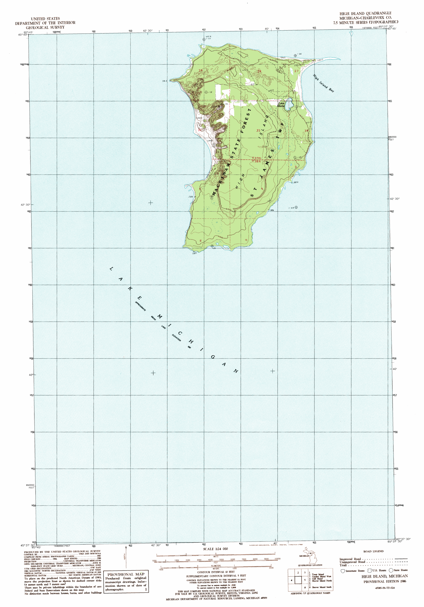
English: map of High Island, Beaver Islands, Lake Michigan, Michigan, USA |
| Date | |
| Source | https://www.topoquest.com/map-detail.php?usgs_cell_id=20361 |
| Auteur | USGS |
Conditions d’utilisation
[modifier]| Cette œuvre est issue de la Bibliothèque du Congrès. Selon la bibliothèque, il n'existe aucune restriction connue en matière de droits d'auteur pour l'utilisation de cette œuvre. |  |
Historique du fichier
Cliquer sur une date et heure pour voir le fichier tel qu'il était à ce moment-là.
| Date et heure | Vignette | Dimensions | Utilisateur | Commentaire | |
|---|---|---|---|---|---|
| actuel | 24 octobre 2016 à 13:11 |  | 4 725 × 6 772 (9,14 Mio) | Ratzer (d | contributions) | User created page with UploadWizard |
Vous ne pouvez pas remplacer ce fichier.
Utilisations locales du fichier
Aucune page n’utilise ce fichier.
Utilisations du fichier sur d’autres wikis
Les autres wikis suivants utilisent ce fichier :
- Utilisation sur en.wikipedia.org
- Utilisation sur fr.wikipedia.org