File:Hobucken Bridge North Carolina.jpg
ナビゲーションに移動
検索に移動

このプレビューのサイズ: 800 × 534 ピクセル。 その他の解像度: 320 × 214 ピクセル | 640 × 427 ピクセル | 1,024 × 683 ピクセル | 1,500 × 1,001 ピクセル。
元のファイル (1,500 × 1,001 ピクセル、ファイルサイズ: 795キロバイト、MIME タイプ: image/jpeg)
キャプション
キャプション
このファイルの内容を1行で記述してください
| 解説 |
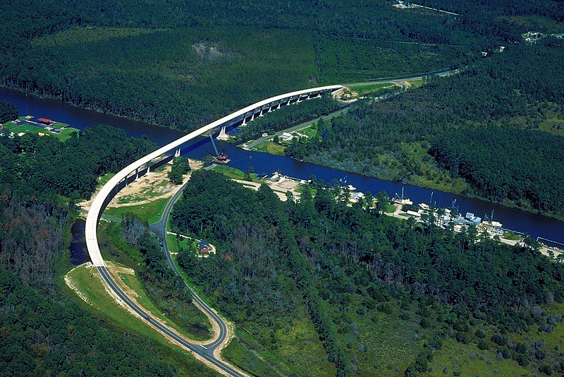
English: Aerial view of a stretch of the Intracoastal Waterway in Pamlico County, North Carolina, USA. The U.S. Army Corps of Engineers constructed the Hobucken Bridge over the waterway to replace an old swing-style drawbridge. The bridge carries NC state routes 33 and 304 over the waterway.
Coordinates: 35°14′46.37″N 76°35′29.74″W / 35.2462139°N 76.5915944°W |
|||
| 場所 | Pamlico County, North Carolina, USA | |||
| 日付 | (Caveat: Dates provided by U.S. Army Corps of Engineers Digital Visual Library are not reliable and are often wrong.) | |||
| 原典 |
U.S. Army Corps of Engineers Digital Visual Library Image page Image description page Digital Visual Library home page |
|||
| 作者 | Bud Davis, U.S. Army Corps of Engineers | |||
| 許可 (ファイルの再利用) |
|
ファイルの履歴
過去の版のファイルを表示するには、その版の日時をクリックしてください。
| 日付と時刻 | サムネイル | 寸法 | 利用者 | コメント | |
|---|---|---|---|---|---|
| 現在の版 | 2007年4月26日 (木) 04:26 | | 1,500 × 1,001 (795キロバイト) | DanMS (トーク | 投稿記録) | {{Information | Description = {{en|Aerial view of a stretch of the Intracoastal Waterway in Pamlico County, North Carolina, USA. The U.S. Army Corps of Engineers constructed the Hobucken Bridge over the waterway to replace an old swing-style drawbridge |
このファイルは上書きできません。
ファイルの使用状況
以下の 5 ページがこのファイルを使用しています:
グローバルなファイル使用状況
以下に挙げる他のウィキがこの画像を使っています:
- af.wikipedia.org での使用状況
- ar.wikipedia.org での使用状況
- arz.wikipedia.org での使用状況
- ceb.wikipedia.org での使用状況
- ce.wikipedia.org での使用状況
- cy.wikipedia.org での使用状況
- de.wikipedia.org での使用状況
- en.wikipedia.org での使用状況
- eo.wikipedia.org での使用状況
- es.wikipedia.org での使用状況
- fa.wikipedia.org での使用状況
- fi.wikipedia.org での使用状況
- fr.wikipedia.org での使用状況
- ga.wikipedia.org での使用状況
- glk.wikipedia.org での使用状況
- he.wikipedia.org での使用状況
- hu.wikipedia.org での使用状況
- it.wikipedia.org での使用状況
- ja.wikipedia.org での使用状況
- ko.wikipedia.org での使用状況
- mzn.wikipedia.org での使用状況
- nl.wikipedia.org での使用状況
- no.wikipedia.org での使用状況
- pl.wikipedia.org での使用状況
- pt.wikipedia.org での使用状況
- ru.wikipedia.org での使用状況
- simple.wikipedia.org での使用状況
- sr.wikipedia.org での使用状況
- tt.wikipedia.org での使用状況
- ur.wikipedia.org での使用状況
- www.wikidata.org での使用状況